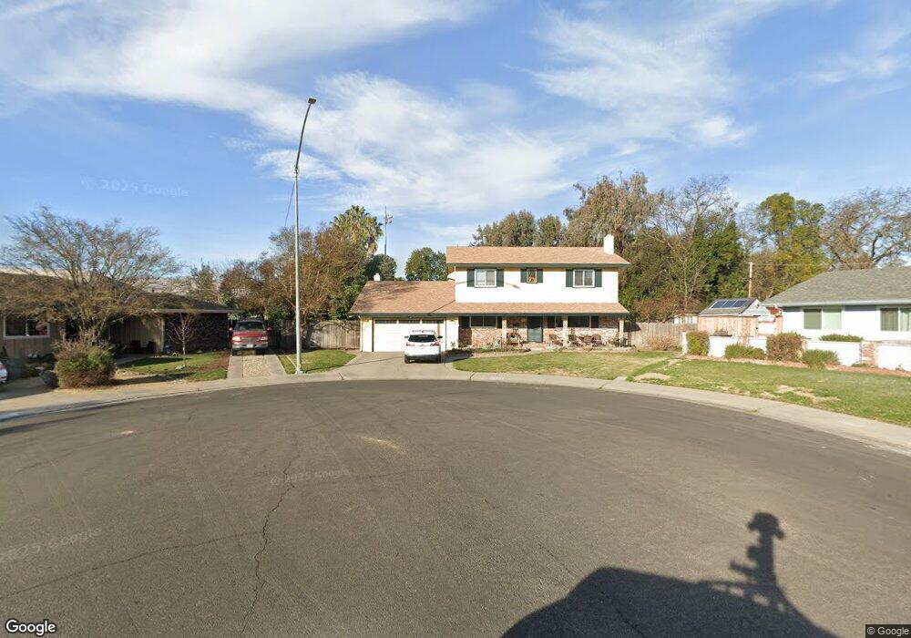
1819 Burnside Way Stockton, CA 95207
Parkwoods NeighborhoodEstimated Value: $570,000 - $645,000
4
Beds
3
Baths
2,306
Sq Ft
$261/Sq Ft
Est. Value
About This Home
This home is located at 1819 Burnside Way, Stockton, CA 95207 and is currently estimated at $601,475, approximately $260 per square foot. 1819 Burnside Way is a home located in San Joaquin County with nearby schools including Lincoln Elementary School, Sierra Middle School, and Lincoln High School.
Ownership History
Date
Name
Owned For
Owner Type
Purchase Details
Closed on
Jun 6, 2008
Sold by
Skaggs Ronald L and Skaggs Karen L
Bought by
Skaggs Ronald L and Skaggs Karen L
Current Estimated Value
Purchase Details
Closed on
Aug 13, 1999
Sold by
St Clair Stephen L & Barbara
Bought by
Skaggs Ronald L and Skaggs Karen L
Home Financials for this Owner
Home Financials are based on the most recent Mortgage that was taken out on this home.
Original Mortgage
$178,804
Outstanding Balance
$51,302
Interest Rate
7.63%
Mortgage Type
FHA
Estimated Equity
$550,173
Purchase Details
Closed on
May 20, 1996
Sold by
Stclair Stephen Laurence and Clement Stephen Laurence
Bought by
Stclair Stephen Laurence and Stclair Barbara
Create a Home Valuation Report for This Property
The Home Valuation Report is an in-depth analysis detailing your home's value as well as a comparison with similar homes in the area
Home Values in the Area
Average Home Value in this Area
Purchase History
| Date | Buyer | Sale Price | Title Company |
|---|---|---|---|
| Skaggs Ronald L | -- | None Available | |
| Skaggs Ronald L | $180,000 | First American Title Co | |
| Stclair Stephen Laurence | -- | -- |
Source: Public Records
Mortgage History
| Date | Status | Borrower | Loan Amount |
|---|---|---|---|
| Open | Skaggs Ronald L | $178,804 |
Source: Public Records
Tax History Compared to Growth
Tax History
| Year | Tax Paid | Tax Assessment Tax Assessment Total Assessment is a certain percentage of the fair market value that is determined by local assessors to be the total taxable value of land and additions on the property. | Land | Improvement |
|---|---|---|---|---|
| 2025 | $3,309 | $276,638 | $76,842 | $199,796 |
| 2024 | $3,240 | $271,215 | $75,336 | $195,879 |
| 2023 | $3,215 | $265,898 | $73,859 | $192,039 |
| 2022 | $3,083 | $260,685 | $72,411 | $188,274 |
| 2021 | $3,042 | $255,575 | $70,992 | $184,583 |
| 2020 | $3,040 | $252,956 | $70,265 | $182,691 |
| 2019 | $2,992 | $247,997 | $68,888 | $179,109 |
| 2018 | $2,937 | $243,136 | $67,538 | $175,598 |
| 2017 | $2,877 | $238,369 | $66,214 | $172,155 |
| 2016 | $2,847 | $233,696 | $64,916 | $168,780 |
| 2014 | $2,779 | $225,677 | $62,688 | $162,989 |
Source: Public Records
Map
Nearby Homes
- 2025 W Lincoln Rd
- 1607 Stanton Way
- 1906 Meadow Ave
- 2140 Pennington Ct
- 1720 Mcclellan Way
- 7307 Woodside Dr
- 7516 Brentwood Dr
- 2039 W Benjamin Holt Dr
- 1152 Stanton Way
- 7512 Heather Dr
- 1214 Mcclellan Way
- 2252 W Benjamin Holt Dr
- 1703 Polk Way
- 7622 Oakcreek Dr
- 7523 Oakcreek Dr
- 7709 Heather Dr
- 2513 Hazelwood Ave
- 1864 Polk Way
- 1005 W Benjamin Holt Dr
- 1633 Porter Way
- 1811 Burnside Way
- 1820 Burnside Way
- 1826 Mcdowell Way
- 1818 Mcdowell Way
- 7013 Richmond Place
- 1812 Burnside Way
- 1804 Burnside Way
- 1751 Greeley Way
- 1759 Greeley Way
- 1827 Mcdowell Way
- 1743 Greeley Way
- 7012 Richmond Place
- 1750 Burnside Way
- 1819 Mcdowell Way
- 1735 Greeley Way
- 7055 Richmond Place
- 7028 Richmond Place
- 1764 Greeley Way
- 1735 Burnside Way
- 1727 Greeley Way