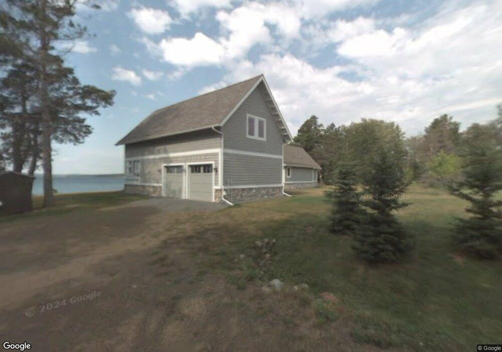
1819 Cliff Point Rd Two Harbors, MN 55616
Estimated Value: $744,000 - $1,889,624
3
Beds
3
Baths
1,936
Sq Ft
$680/Sq Ft
Est. Value
About This Home
This home is located at 1819 Cliff Point Rd, Two Harbors, MN 55616 and is currently estimated at $1,316,812, approximately $680 per square foot. 1819 Cliff Point Rd is a home with nearby schools including Minnehaha Elementary School, Two Harbors Secondary, and Northwoods Christian Academy.
Ownership History
Date
Name
Owned For
Owner Type
Purchase Details
Closed on
Apr 15, 2005
Sold by
Burgeson Delores J
Bought by
Braun Michael R and Braun Julie K
Current Estimated Value
Purchase Details
Closed on
Aug 9, 1999
Sold by
Austin Florence M
Bought by
Braun Michael R and Braun Julie K
Create a Home Valuation Report for This Property
The Home Valuation Report is an in-depth analysis detailing your home's value as well as a comparison with similar homes in the area
Home Values in the Area
Average Home Value in this Area
Purchase History
| Date | Buyer | Sale Price | Title Company |
|---|---|---|---|
| Braun Michael R | $200,000 | None Available | |
| Braun Michael R | -- | None Available |
Source: Public Records
Tax History Compared to Growth
Tax History
| Year | Tax Paid | Tax Assessment Tax Assessment Total Assessment is a certain percentage of the fair market value that is determined by local assessors to be the total taxable value of land and additions on the property. | Land | Improvement |
|---|---|---|---|---|
| 2025 | $12,264 | $1,414,600 | $527,400 | $887,200 |
| 2024 | $6,762 | $1,558,700 | $436,000 | $1,122,700 |
| 2023 | $6,091 | $1,421,300 | $314,500 | $1,106,800 |
| 2022 | $8,209 | $1,177,700 | $290,200 | $887,500 |
| 2021 | $7,946 | $775,700 | $290,200 | $485,500 |
| 2020 | $8,323 | $298,800 | $290,200 | $8,600 |
| 2019 | $7,210 | $429,800 | $421,200 | $8,600 |
| 2018 | $7,417 | $713,100 | $421,200 | $291,900 |
| 2017 | $7,000 | $716,200 | $421,200 | $295,000 |
| 2016 | $6,359 | $719,400 | $421,200 | $298,200 |
| 2015 | $66 | $659,000 | $385,000 | $274,000 |
| 2014 | $66 | $0 | $0 | $0 |
| 2013 | $5,377 | $0 | $0 | $0 |
| 2012 | $6,891 | $0 | $0 | $0 |
Source: Public Records
Map
Nearby Homes
- 1928 Loop Rd
- 1690 Highway 61
- 1768 Stewart River Rd
- 2202 Fors Rd
- 1563 Highway 61
- 1621 #71 Superior Shores Unit 1/8 fractional owner
- 1624 #85 Superior Shores Unit 1/8 fractional owner
- 1611 #57B Superior Shores Unit 1/8 Interval Ownersh
- 1603 Superior Shores Dr Unit 49
- 1594 Superior Shores Dr Unit 111
- 1621 Superior Shores Dr Unit 71
- 1567 Superior Shores Dr Unit 27
- 1555 Superior Shores Dr Unit 15
- 1611 Superior Shores Dr Unit 57B
- 1611 Superior Shores Dr Unit 57A
- 2036 Highway 2
- 1412 #5-302a Burlington Rd
- 1412 #5-202a Burlington Rd
- 1412 #5-404a Burlington Rd
- 1412 #5-207a Burlington Rd
- 1811 Cliff Point Rd
- 1821 Cliff Point Rd
- 1800 Silver Cliff Rd
- 1825 Cliff Point Rd
- 1810 Silver Cliff Rd
- 1812 Silver Cliff Rd
- 1806 Silver Cliff Rd Unit 11
- 1808 Silver Cliff Rd
- 1802 Silver Cliff Rd
- 1906 Minnesota 61
- 1906 Highway 61
- 1906 Highway 61
- 1906 Highway 61
- 1906 Highway 61
- 1906 Highway 61
- 1906 Highway 61
- 1906 Highway 61
- 1814 Silver Cliff Rd Unit 7
- 1814 Silver Cliff Rd
- 1816 Silver Cliff Rd Unit 6