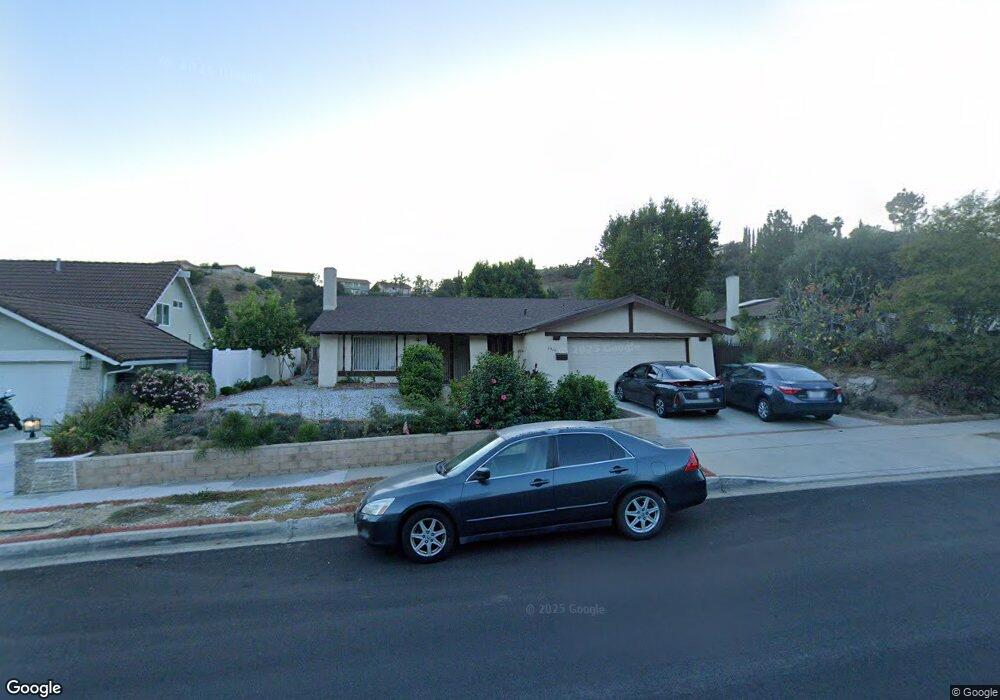
1819 Kiowa Crest Dr Diamond Bar, CA 91765
Estimated Value: $889,653 - $1,034,000
4
Beds
2
Baths
1,498
Sq Ft
$636/Sq Ft
Est. Value
About This Home
This home is located at 1819 Kiowa Crest Dr, Diamond Bar, CA 91765 and is currently estimated at $953,413, approximately $636 per square foot. 1819 Kiowa Crest Dr is a home located in Los Angeles County with nearby schools including Maple Hill Elementary School, Chaparral Middle School, and Diamond Bar High School.
Ownership History
Date
Name
Owned For
Owner Type
Purchase Details
Closed on
Nov 23, 1993
Sold by
Tam Gary Wei Hsung and Tam Josephine Jing Fang
Bought by
Tsou Kuei Man
Current Estimated Value
Home Financials for this Owner
Home Financials are based on the most recent Mortgage that was taken out on this home.
Original Mortgage
$150,000
Interest Rate
6.74%
Create a Home Valuation Report for This Property
The Home Valuation Report is an in-depth analysis detailing your home's value as well as a comparison with similar homes in the area
Home Values in the Area
Average Home Value in this Area
Purchase History
| Date | Buyer | Sale Price | Title Company |
|---|---|---|---|
| Tsou Kuei Man | $188,000 | Chicago Title Insurance Co |
Source: Public Records
Mortgage History
| Date | Status | Borrower | Loan Amount |
|---|---|---|---|
| Closed | Tsou Kuei Man | $150,000 |
Source: Public Records
Tax History Compared to Growth
Tax History
| Year | Tax Paid | Tax Assessment Tax Assessment Total Assessment is a certain percentage of the fair market value that is determined by local assessors to be the total taxable value of land and additions on the property. | Land | Improvement |
|---|---|---|---|---|
| 2025 | $4,274 | $319,507 | $132,388 | $187,119 |
| 2024 | $4,274 | $313,243 | $129,793 | $183,450 |
| 2023 | $4,178 | $307,102 | $127,249 | $179,853 |
| 2022 | $4,090 | $301,081 | $124,754 | $176,327 |
| 2021 | $4,012 | $295,178 | $122,308 | $172,870 |
| 2019 | $3,890 | $286,425 | $118,681 | $167,744 |
| 2018 | $3,684 | $280,809 | $116,354 | $164,455 |
| 2016 | $3,416 | $269,907 | $111,837 | $158,070 |
| 2015 | $3,434 | $265,854 | $110,158 | $155,696 |
| 2014 | $3,442 | $260,648 | $108,001 | $152,647 |
Source: Public Records
Map
Nearby Homes
- 1522 Deerfoot Dr
- 2256 Shady Hills Dr
- 2119 Dublin Ln Unit 3
- 1739 Shadehill Place
- 2282 Shady Hills Dr
- 1806 Morning Canyon Rd
- 2221 Dublin Ln Unit 2
- 22455 Ridge Line Rd
- 1826 Wellspring Dr
- 22586 Pacific Ln
- 22536 Ridge Line Rd
- 2118 Tierra Loma Dr
- 1714 Roundtree Cir
- 21600 Laurelrim Dr Unit B
- 1721 Cliffbranch Dr
- 22939 Ridge Line Rd
- 22407 Birds Eye Dr
- 22517 Lazy Meadow Dr
- 22528 Lazy Meadow Dr
- 22532 Lazy Meadow Dr
- 1811 Kiowa Crest Dr
- 1825 Kiowa Crest Dr
- 1836 Tintah Dr
- 1830 Tintah Dr
- 1844 Tintah Dr
- 1833 Kiowa Crest Dr
- 1822 Tintah Dr
- 1854 Tintah Dr
- 1731 Kiowa Crest Dr
- 1738 Mensha Ct
- 1814 Kiowa Crest Dr
- 1822 Kiowa Crest Dr
- 1816 Tintah Dr
- 1828 Kiowa Crest Dr
- 1845 Kiowa Crest Dr
- 1836 Kiowa Crest Dr
- 1839 Tintah Dr
- 1860 Tintah Dr
- 1833 Tintah Dr
- 1725 Kiowa Crest Dr