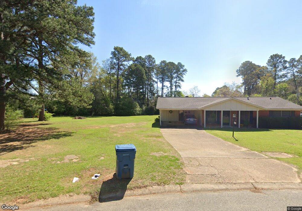
182 Bruce Dr Vivian, LA 71082
Estimated Value: $163,000 - $301,000
3
Beds
3
Baths
2,100
Sq Ft
$118/Sq Ft
Est. Value
About This Home
This home is located at 182 Bruce Dr, Vivian, LA 71082 and is currently estimated at $248,548, approximately $118 per square foot. 182 Bruce Dr is a home located in Caddo Parish with nearby schools including South Highlands Elementary, Judson Fundamental Elementary School, and Fairfield Magnet School.
Ownership History
Date
Name
Owned For
Owner Type
Purchase Details
Closed on
Oct 21, 2019
Sold by
Va
Bought by
Burks Willie Style and Davis Dorothy Ann
Current Estimated Value
Purchase Details
Closed on
Dec 6, 2018
Sold by
Wells Fargo Bank
Bought by
Va
Purchase Details
Closed on
Jan 22, 2010
Sold by
Wormington Ricky Lynn and Gould Jacquline Wormington
Bought by
West Don Alan and West Pamela Activille
Home Financials for this Owner
Home Financials are based on the most recent Mortgage that was taken out on this home.
Original Mortgage
$185,000
Interest Rate
5.08%
Mortgage Type
VA
Create a Home Valuation Report for This Property
The Home Valuation Report is an in-depth analysis detailing your home's value as well as a comparison with similar homes in the area
Home Values in the Area
Average Home Value in this Area
Purchase History
| Date | Buyer | Sale Price | Title Company |
|---|---|---|---|
| Burks Willie Style | $47,500 | None Available | |
| Va | -- | None Available | |
| West Don Alan | $185,000 | None Available |
Source: Public Records
Mortgage History
| Date | Status | Borrower | Loan Amount |
|---|---|---|---|
| Previous Owner | West Don Alan | $185,000 |
Source: Public Records
Tax History Compared to Growth
Tax History
| Year | Tax Paid | Tax Assessment Tax Assessment Total Assessment is a certain percentage of the fair market value that is determined by local assessors to be the total taxable value of land and additions on the property. | Land | Improvement |
|---|---|---|---|---|
| 2024 | $3,762 | $21,614 | $1,429 | $20,185 |
| 2023 | $3,559 | $20,023 | $1,361 | $18,662 |
| 2022 | $3,559 | $20,023 | $1,361 | $18,662 |
| 2021 | $3,561 | $20,023 | $1,361 | $18,662 |
| 2020 | $3,540 | $20,023 | $1,361 | $18,662 |
| 2019 | $3,446 | $19,692 | $1,361 | $18,331 |
| 2018 | $3,022 | $19,692 | $1,361 | $18,331 |
| 2017 | $3,436 | $19,692 | $1,361 | $18,331 |
| 2015 | $3,033 | $19,692 | $1,361 | $18,331 |
| 2014 | $2,729 | $17,550 | $1,360 | $16,190 |
| 2013 | -- | $17,550 | $1,360 | $16,190 |
Source: Public Records
Map
Nearby Homes
- 62011 Rebel Heights Rd
- 325 E Oklahoma Ave
- 9420 Hosston Rd
- 122 S Bird St
- 109 N Huckaby St
- 310 W Tennessee Ave
- 210 W Mississippi Ave
- 9794 Upper State Line Rd
- 9008 Hosston Vivian Rd
- 0 Camelia St
- Lot 14 Peaceful Pines Ln
- Lot 4 Peaceful Pines Ln
- Lot 2 Peaceful Pines Ln
- Lot 6 Peaceful Pines Ln
- Lot 5 Peaceful Pines Ln
- Lot 12 Peaceful Pines Ln
- 1220 N Carson St
- 2040 Ma County Road 3509
- 2040 McR 3509
- 10651 Murry Ln
- 129 General Lee Dr
- 131 General Lee Dr
- 125 General Lee Dr
- 318 Rebel Rd
- 133 General Lee Dr
- 123 General Lee Dr
- 128 General Lee Dr
- 121 General Lee Dr
- 126 General Lee Dr
- 207 Randy Ln
- 134 General Beauregard Dr
- 119 General Lee Dr
- 129 General Beauregard Dr
- 124 General Lee Dr
- 117 General Lee Dr
- 122 General Lee Dr
- 120 General Lee Dr
- 115 General Lee Dr
- 130 General Beauregard Dr
- 126 General Beauregard Dr