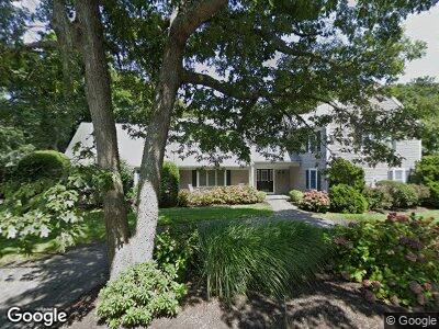
182 Foster Rd Unit 1 Brewster, MA 02631
Estimated Value: $1,923,000 - $2,674,000
3
Beds
2
Baths
1,201
Sq Ft
$1,987/Sq Ft
Est. Value
About This Home
This home is located at 182 Foster Rd Unit 1, Brewster, MA 02631 and is currently estimated at $2,386,286, approximately $1,986 per square foot. 182 Foster Rd Unit 1 is a home located in Barnstable County with nearby schools including Stony Brook Elementary School, Eddy Elementary School, and Nauset Regional Middle School.
Ownership History
Date
Name
Owned For
Owner Type
Purchase Details
Closed on
Nov 3, 2019
Sold by
Mcgrath Richard A
Bought by
Richard A Mcgrath Ret
Current Estimated Value
Purchase Details
Closed on
Oct 10, 2008
Sold by
Vasta Deborah I
Bought by
Mcgrath Joan M and Mcgrath Richard
Home Financials for this Owner
Home Financials are based on the most recent Mortgage that was taken out on this home.
Original Mortgage
$760,000
Interest Rate
6.43%
Mortgage Type
Purchase Money Mortgage
Purchase Details
Closed on
Aug 18, 2000
Sold by
Est Bradley Mary A
Bought by
Vasta Salvorte and Vasta Deborah I
Home Financials for this Owner
Home Financials are based on the most recent Mortgage that was taken out on this home.
Original Mortgage
$200,000
Interest Rate
8.13%
Mortgage Type
Purchase Money Mortgage
Create a Home Valuation Report for This Property
The Home Valuation Report is an in-depth analysis detailing your home's value as well as a comparison with similar homes in the area
Home Values in the Area
Average Home Value in this Area
Purchase History
| Date | Buyer | Sale Price | Title Company |
|---|---|---|---|
| Richard A Mcgrath Ret | -- | -- | |
| Mcgrath Joan M | $1,200,000 | -- | |
| Vasta Salvorte | $297,000 | -- |
Source: Public Records
Mortgage History
| Date | Status | Borrower | Loan Amount |
|---|---|---|---|
| Previous Owner | Vasta Salvorte | $746,000 | |
| Previous Owner | Mcgrath Joan M | $760,000 | |
| Previous Owner | Vasta Salvorte | $325,000 | |
| Previous Owner | Vasta Salvorte | $200,000 |
Source: Public Records
Tax History Compared to Growth
Tax History
| Year | Tax Paid | Tax Assessment Tax Assessment Total Assessment is a certain percentage of the fair market value that is determined by local assessors to be the total taxable value of land and additions on the property. | Land | Improvement |
|---|---|---|---|---|
| 2025 | $14,004 | $2,035,500 | $803,900 | $1,231,600 |
| 2024 | $12,144 | $1,783,300 | $606,700 | $1,176,600 |
| 2023 | $10,873 | $1,555,500 | $502,900 | $1,052,600 |
| 2022 | $11,103 | $1,414,400 | $523,700 | $890,700 |
| 2021 | $10,696 | $1,246,600 | $455,300 | $791,300 |
| 2020 | $10,501 | $1,218,200 | $455,300 | $762,900 |
| 2019 | $10,069 | $1,173,500 | $437,900 | $735,600 |
| 2018 | $9,531 | $1,153,900 | $437,900 | $716,000 |
| 2017 | $9,464 | $1,128,000 | $437,900 | $690,100 |
| 2016 | $9,140 | $1,084,200 | $429,400 | $654,800 |
| 2015 | $8,817 | $1,067,400 | $420,900 | $646,500 |
Source: Public Records
Map
Nearby Homes
- 5 Jakes Ln
- 48 Landing Ln Unit 48
- 48 Landing Ln
- 2241 Main St
- 2750 Main St
- 80 Clipper Way
- 120 Stonehenge Dr
- 42 Ocean Edge Dr Unit 42
- 107 Court Way
- 168 Yankee Dr
- 146 Crescent Ln
- 79 Chilton Ln
- 93 Chilton Ln
- 114 Chestnut Cir
- 137 Crescent Ln Unit 137
- 137 Crescent Ln
- 53 Chilton Ln Unit 53
- 53 Chilton Ln
- 398 Lund Farm Way
- 64 Chestnut Cir