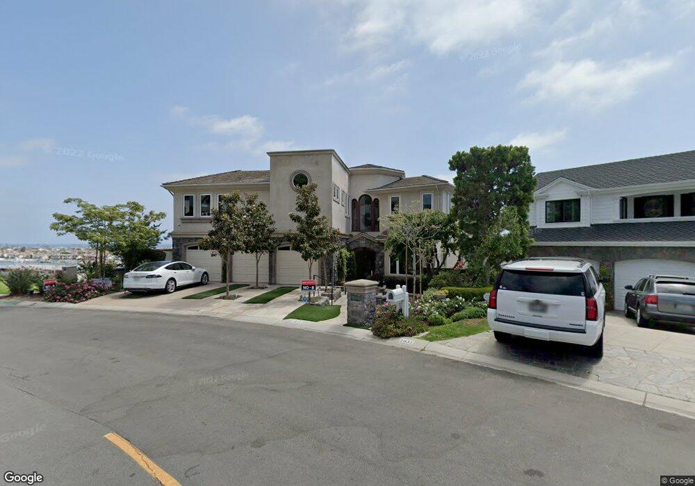
1821 Kings Rd Newport Beach, CA 92663
Cliff Haven NeighborhoodEstimated Value: $5,811,000 - $8,744,393
5
Beds
9
Baths
8,801
Sq Ft
$819/Sq Ft
Est. Value
About This Home
This home is located at 1821 Kings Rd, Newport Beach, CA 92663 and is currently estimated at $7,208,598, approximately $819 per square foot. 1821 Kings Rd is a home located in Orange County with nearby schools including Newport Heights Elementary, Horace Ensign Intermediate School, and Newport Harbor High School.
Ownership History
Date
Name
Owned For
Owner Type
Purchase Details
Closed on
Mar 6, 2002
Sold by
Hill Rush N and Hill Linda Bourns
Bought by
Hill Ii Rush N and Hill Linda B
Current Estimated Value
Purchase Details
Closed on
Feb 10, 1995
Sold by
Kitchens William L and Kitchens Joan B
Bought by
Davidsson Ii Sture and Davidsson Sture
Home Financials for this Owner
Home Financials are based on the most recent Mortgage that was taken out on this home.
Original Mortgage
$240,000
Outstanding Balance
$141,705
Interest Rate
9.21%
Estimated Equity
$7,066,893
Create a Home Valuation Report for This Property
The Home Valuation Report is an in-depth analysis detailing your home's value as well as a comparison with similar homes in the area
Home Values in the Area
Average Home Value in this Area
Purchase History
| Date | Buyer | Sale Price | Title Company |
|---|---|---|---|
| Hill Ii Rush N | -- | -- | |
| Davidsson Ii Sture | -- | Fidelity National Title Ins |
Source: Public Records
Mortgage History
| Date | Status | Borrower | Loan Amount |
|---|---|---|---|
| Open | Davidsson Ii Sture | $240,000 |
Source: Public Records
Tax History Compared to Growth
Tax History
| Year | Tax Paid | Tax Assessment Tax Assessment Total Assessment is a certain percentage of the fair market value that is determined by local assessors to be the total taxable value of land and additions on the property. | Land | Improvement |
|---|---|---|---|---|
| 2025 | $42,035 | $4,043,801 | $1,442,524 | $2,601,277 |
| 2024 | $42,035 | $3,964,511 | $1,414,239 | $2,550,272 |
| 2023 | $41,052 | $3,886,776 | $1,386,509 | $2,500,267 |
| 2022 | $40,373 | $3,810,565 | $1,359,322 | $2,451,243 |
| 2021 | $39,597 | $3,735,849 | $1,332,669 | $2,403,180 |
| 2020 | $39,216 | $3,697,543 | $1,319,004 | $2,378,539 |
| 2019 | $38,397 | $3,625,043 | $1,293,142 | $2,331,901 |
| 2018 | $37,629 | $3,553,964 | $1,267,786 | $2,286,178 |
| 2017 | $36,961 | $3,484,279 | $1,242,928 | $2,241,351 |
| 2016 | $36,126 | $3,415,960 | $1,218,557 | $2,197,403 |
| 2015 | $35,787 | $3,364,650 | $1,200,254 | $2,164,396 |
| 2014 | $34,942 | $3,298,742 | $1,176,743 | $2,121,999 |
Source: Public Records
Map
Nearby Homes
- 321 Fullerton Ave
- 1805 Clay St
- 430 Aliso Ave
- 1705 Haven Place Unit 1
- 211 Via Dijon
- 118 Via Lido Nord
- 401 Snug Harbor Rd
- 411 Snug Harbor Rd
- 421 Tustin Ave
- 230 Ocean View Ave
- 2401 Bayshore Dr
- 401 Piazza Lido
- 600 Via Lido Nord
- 339 Via Lido Soud
- 600 Powell Place
- 2907 Cliff Dr
- 511 Cliff Dr
- 2300 Margaret Dr
- 2427 Margaret Dr
- 615 Lido Park Dr
- 1831 Kings Rd
- 1901 Kings Rd
- 1810 Kings Rd
- 1950 W Coast Hwy
- 1911 Kings Rd
- 1800 Kings Rd
- 1730 W Coast Hwy
- 1721 Kings Rd
- 2000 Kings Rd
- 1921 Kings Rd
- 1720 Kings Rd
- 2001 Kings Rd
- 2001 Cliff Dr Unit 2001 one half Cliff
- 2001 Cliff Dr
- 2001 Cliff Dr Unit 1/2
- 2001 Cliff Dr
- 1710 Kings Rd
- 1911 Cliff Dr
- 2011 Kings Rd
- 1621 Kings Rd