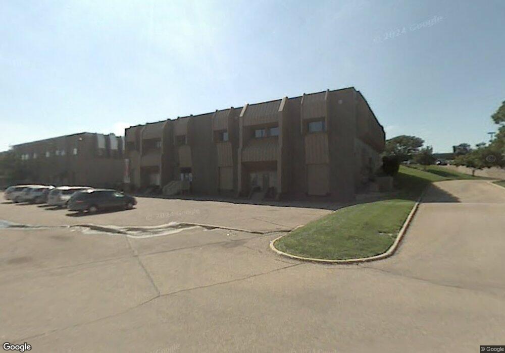
1821 Lefthand Cir Longmont, CO 80501
--
Bed
--
Bath
19,040
Sq Ft
2.18
Acres
About This Home
This home is located at 1821 Lefthand Cir, Longmont, CO 80501. 1821 Lefthand Cir is a home located in Boulder County with nearby schools including Indian Peaks Elementary School, Sunset Middle School, and Niwot High School.
Ownership History
Date
Name
Owned For
Owner Type
Purchase Details
Closed on
Oct 11, 2012
Sold by
Circle Capital Longmont Llc
Bought by
Longmont Diagonal Investments Lp
Home Financials for this Owner
Home Financials are based on the most recent Mortgage that was taken out on this home.
Original Mortgage
$61,000,000
Outstanding Balance
$42,439,009
Interest Rate
3.61%
Mortgage Type
Commercial
Purchase Details
Closed on
Dec 29, 1993
Sold by
Pratt Partnership
Bought by
Pratt Land Ltd Liability Company
Purchase Details
Closed on
Dec 18, 1980
Bought by
Longmont Diagonal Investments Lp
Purchase Details
Closed on
Sep 21, 1979
Bought by
Longmont Diagonal Investments Lp
Create a Home Valuation Report for This Property
The Home Valuation Report is an in-depth analysis detailing your home's value as well as a comparison with similar homes in the area
Home Values in the Area
Average Home Value in this Area
Purchase History
| Date | Buyer | Sale Price | Title Company |
|---|---|---|---|
| Longmont Diagonal Investments Lp | -- | None Available | |
| Pratt Land Ltd Liability Company | -- | -- | |
| Pratt Partnership | -- | -- | |
| Longmont Diagonal Investments Lp | -- | -- | |
| Longmont Diagonal Investments Lp | -- | -- |
Source: Public Records
Mortgage History
| Date | Status | Borrower | Loan Amount |
|---|---|---|---|
| Open | Longmont Diagonal Investments Lp | $61,000,000 |
Source: Public Records
Tax History Compared to Growth
Tax History
| Year | Tax Paid | Tax Assessment Tax Assessment Total Assessment is a certain percentage of the fair market value that is determined by local assessors to be the total taxable value of land and additions on the property. | Land | Improvement |
|---|---|---|---|---|
| 2025 | $77,394 | $843,993 | $190,782 | $653,211 |
| 2024 | $77,394 | $843,993 | $190,782 | $653,211 |
| 2023 | $76,339 | $809,100 | $194,100 | $615,000 |
| 2022 | $70,309 | $710,500 | $87,000 | $623,500 |
| 2021 | $69,227 | $710,500 | $87,000 | $623,500 |
| 2020 | $25,043 | $257,810 | $68,440 | $189,370 |
| 2019 | $24,649 | $257,810 | $68,440 | $189,370 |
| 2018 | $26,621 | $280,262 | $122,566 | $157,696 |
| 2017 | $26,259 | $280,262 | $122,566 | $157,696 |
| 2016 | $19,135 | $200,187 | $51,330 | $148,857 |
| 2015 | $18,234 | $171,100 | $44,892 | $126,208 |
| 2014 | $15,981 | $171,100 | $44,892 | $126,208 |
Source: Public Records
Map
Nearby Homes
- 1527 S Vivian St
- 1518 Sepia Ave
- 919 S Sherman St
- 1350 S Lincoln St
- 2020 Creekside Dr
- 1327 Brookfield Dr
- 2111 River Walk Ln
- 1801 S Pratt Pkwy
- 2215 Parkview Dr
- 832 S Bowen St
- 24 James Cir
- 2237 Eagleview Way
- 1321 Onyx Cir
- 2443 Mallard Cir
- 2284 Indian Peaks Cir
- 2240 Summitview Dr
- 1028 Katy Ln
- 2425 Water Cress Ct
- 1072 Kane Dr
- 421 Barnard Ct Unit 61
- 1831 Lefthand Cir Unit A
- 1511 Kempton Ct
- 1509 Kempton Ct
- 1508 Kempton Ct
- 1517 Kempton Ct
- 2011 Ken Pratt Blvd
- 2011 Ken Pratt Blvd Unit 200
- 1624 Redfern Place
- 1523 Kempton Ct
- 1813 Sunset Place
- 1512 Kempton Ct
- 1625 Redfern Place
- 1513 Foster Ct
- 1616 Redfern Place
- 1801 Sunset Place
- 1801 Sunset Place
- 1529 Kempton Ct
- 1516 Kempton Ct
- 1509 Foster Ct
- 1517 Foster Ct