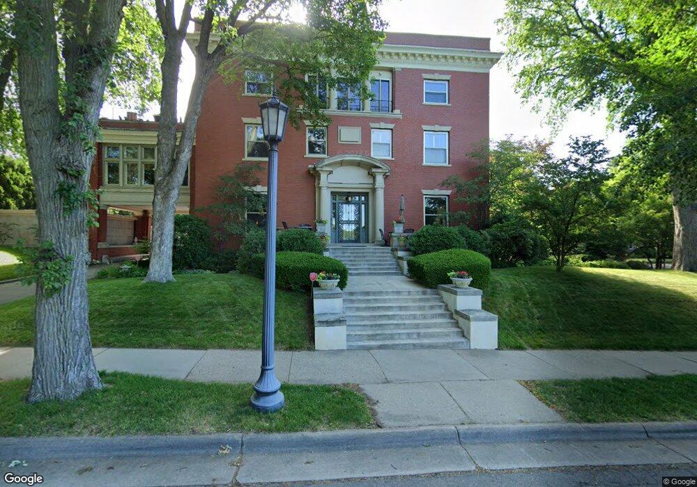
1821 Logan Ave S Unit 1 Minneapolis, MN 55403
Lowry Hill NeighborhoodEstimated Value: $1,042,000 - $1,797,051
2
Beds
4
Baths
5,561
Sq Ft
$257/Sq Ft
Est. Value
About This Home
This home is located at 1821 Logan Ave S Unit 1, Minneapolis, MN 55403 and is currently estimated at $1,429,350, approximately $257 per square foot. 1821 Logan Ave S Unit 1 is a home located in Hennepin County with nearby schools including Kenwood Elementary School, Anwatin Middle School, and North Community High School.
Ownership History
Date
Name
Owned For
Owner Type
Purchase Details
Closed on
Aug 28, 2013
Sold by
Carlson Terrance L and Carlson Jeanette M
Bought by
Ryan Thomas C and Ryan Jody
Current Estimated Value
Home Financials for this Owner
Home Financials are based on the most recent Mortgage that was taken out on this home.
Original Mortgage
$1,000,000
Outstanding Balance
$726,621
Interest Rate
3.75%
Mortgage Type
New Conventional
Estimated Equity
$702,729
Purchase Details
Closed on
Apr 28, 2005
Sold by
Baker Douglas and Baker Carole M
Bought by
Carlson Terrance L and Leehr Jeanette M
Create a Home Valuation Report for This Property
The Home Valuation Report is an in-depth analysis detailing your home's value as well as a comparison with similar homes in the area
Home Values in the Area
Average Home Value in this Area
Purchase History
| Date | Buyer | Sale Price | Title Company |
|---|---|---|---|
| Ryan Thomas C | $1,450,000 | Burnet Title | |
| Carlson Terrance L | $1,845,000 | -- |
Source: Public Records
Mortgage History
| Date | Status | Borrower | Loan Amount |
|---|---|---|---|
| Open | Ryan Thomas C | $1,000,000 |
Source: Public Records
Tax History Compared to Growth
Tax History
| Year | Tax Paid | Tax Assessment Tax Assessment Total Assessment is a certain percentage of the fair market value that is determined by local assessors to be the total taxable value of land and additions on the property. | Land | Improvement |
|---|---|---|---|---|
| 2024 | $27,752 | $1,619,000 | $182,000 | $1,437,000 |
| 2023 | $24,537 | $1,629,000 | $182,000 | $1,447,000 |
| 2022 | $24,660 | $1,590,000 | $182,000 | $1,408,000 |
| 2021 | $23,559 | $1,544,000 | $179,000 | $1,365,000 |
| 2020 | $25,486 | $1,531,000 | $159,100 | $1,371,900 |
| 2019 | $24,618 | $1,531,000 | $159,100 | $1,371,900 |
| 2018 | $23,103 | $1,444,500 | $159,100 | $1,285,400 |
| 2017 | $22,508 | $1,290,500 | $159,100 | $1,131,400 |
| 2016 | $25,495 | $1,409,000 | $159,100 | $1,249,900 |
| 2015 | $26,120 | $1,379,000 | $159,100 | $1,219,900 |
| 2014 | -- | $1,379,000 | $159,100 | $1,219,900 |
Source: Public Records
Map
Nearby Homes
- 1776 Knox Ave S
- 1770 Knox Ave S
- 1770 James Ave S Unit 1
- 1941 James Ave S
- 1721 Mount Curve Ave
- 2109 James Ave S
- 1013 Kenwood Pkwy
- 2100 W 21st St
- 1600 Kenwood Pkwy
- 1721 Humboldt Ave S Unit 1
- 1527 Waverly Place
- 1767 Girard Ave S
- 1925 Girard Ave S
- 2225 E Lake of the Isles Pkwy
- 2218 W Lake of the Isles Pkwy
- 2021 Girard Ave S
- 741 Kenwood Pkwy
- 1805 Fremont Ave S
- 1767 Fremont Ave S
- 2215 Penn Ave S
- 1814 Lincoln Ave Unit 3
- 1819 Logan Ave S Unit 2
- 1812 Lincoln Ave Unit 4
- 1814 1814 Lincoln Ave
- 1814 1814 Lincoln-Avenue-
- 1821 1821 Logan Ave S
- 1805 Logan Ave S
- 1814 Knox Ave S
- 1820 Knox Ave S
- 1808 Knox Ave S
- 1801 Logan Ave S
- 1901 Logan Ave S
- 1800 Knox Ave S
- 1900 Knox Ave S
- 1910 Knox Ave S
- 1817 Knox Ave S
- 1815 Knox Ave S
- 1819 Knox Ave S
- 1800 Summit Ave
- 1809 Knox Ave S