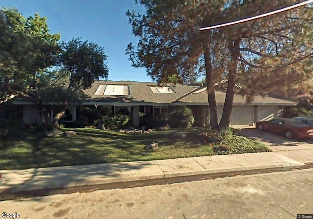
1822 San Gabriel Ave Clovis, CA 93611
Estimated Value: $515,556 - $558,000
5
Beds
2
Baths
2,210
Sq Ft
$245/Sq Ft
Est. Value
About This Home
This home is located at 1822 San Gabriel Ave, Clovis, CA 93611 and is currently estimated at $540,889, approximately $244 per square foot. 1822 San Gabriel Ave is a home located in Fresno County with nearby schools including Gettysburg Elementary School, Reyburn Intermediate School, and Clovis East High School.
Ownership History
Date
Name
Owned For
Owner Type
Purchase Details
Closed on
Jan 31, 2022
Sold by
Wiens Roger L
Bought by
Roger And Carmen Wiens Grantor Trust and Grantor Carmen
Current Estimated Value
Purchase Details
Closed on
May 21, 2007
Sold by
Wiens Roger and Wiens Carmen
Bought by
Wiens Rober and Wiens Carmen
Home Financials for this Owner
Home Financials are based on the most recent Mortgage that was taken out on this home.
Original Mortgage
$304,000
Interest Rate
6.18%
Mortgage Type
New Conventional
Create a Home Valuation Report for This Property
The Home Valuation Report is an in-depth analysis detailing your home's value as well as a comparison with similar homes in the area
Home Values in the Area
Average Home Value in this Area
Purchase History
| Date | Buyer | Sale Price | Title Company |
|---|---|---|---|
| Roger And Carmen Wiens Grantor Trust | -- | Jeffrey Wall Pc | |
| Wiens Rober | -- | Chicago Title Company |
Source: Public Records
Mortgage History
| Date | Status | Borrower | Loan Amount |
|---|---|---|---|
| Previous Owner | Wiens Rober | $304,000 |
Source: Public Records
Tax History Compared to Growth
Tax History
| Year | Tax Paid | Tax Assessment Tax Assessment Total Assessment is a certain percentage of the fair market value that is determined by local assessors to be the total taxable value of land and additions on the property. | Land | Improvement |
|---|---|---|---|---|
| 2025 | $2,585 | $218,175 | $45,267 | $172,908 |
| 2023 | $2,487 | $209,705 | $43,510 | $166,195 |
| 2022 | $2,372 | $205,594 | $42,657 | $162,937 |
| 2021 | $2,304 | $201,564 | $41,821 | $159,743 |
| 2020 | $2,294 | $199,499 | $41,393 | $158,106 |
| 2019 | $2,248 | $195,588 | $40,582 | $155,006 |
| 2018 | $2,198 | $191,754 | $39,787 | $151,967 |
| 2017 | $2,159 | $187,995 | $39,007 | $148,988 |
| 2016 | $2,084 | $184,310 | $38,243 | $146,067 |
| 2015 | $2,051 | $181,542 | $37,669 | $143,873 |
| 2014 | $2,012 | $177,987 | $36,932 | $141,055 |
Source: Public Records
Map
Nearby Homes
- 2645 Fowler Ave
- 1963 Rialto Ct
- 2612 Renn Ave
- 2468 Laverne Ave
- 1608 Gettysburg Ave
- 1488 Alamos Ave
- 1408 Alamos Ave
- 1438 Indianapolis Ave
- 2932 Claremont Ave
- 1916 Ashlan Ave
- 1515 Keats Ave
- 1607 Ashlan Ave
- 1504 Scott Ave
- 2211 Dawson Cove Ln
- 1721 Beverly Ave
- 2334 Sierra Madre Ave
- 2566 Mustang Dr
- 1722 Buckingham Ave
- 1895 Dennis Ave
- 2444 Ashcroft Ave
- 1802 San Gabriel Ave
- 1842 San Gabriel Ave
- 1823 Rialto Ct
- 1803 Rialto Ct
- 1843 Rialto Ct
- 1811 San Gabriel Ave
- 1831 San Gabriel Ave
- 1801 San Gabriel Ave
- 1863 Rialto Ct
- 1862 San Gabriel Ave
- 1814 Rialto Ct
- 1834 Rialto Ct
- 1851 San Gabriel Ave
- 1854 Rialto Ct
- 1804 Rialto Ct
- 1820 Rall Ave
- 1840 Rall Ave
- 1800 Rall Ave
- 1882 San Gabriel Ave
- 1864 Rialto Ct