Estimated Value: $264,000 - $304,000
4
Beds
1
Bath
1,776
Sq Ft
$158/Sq Ft
Est. Value
About This Home
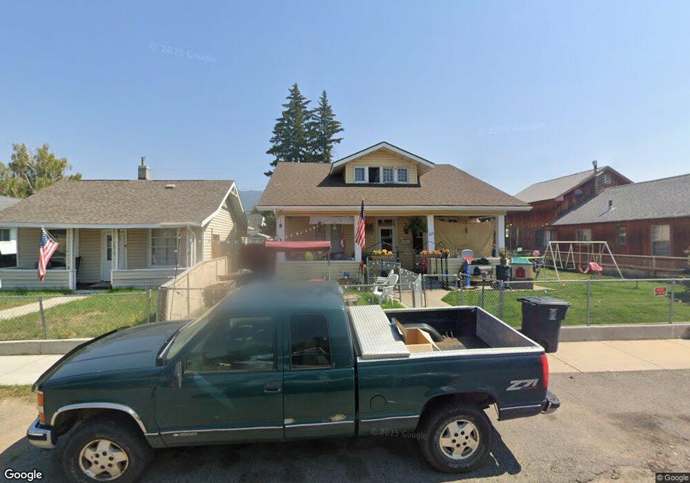
This home is located at 1822 Whitman Ave, Butte, MT 59701 and is currently estimated at $280,463, approximately $157 per square foot. 1822 Whitman Ave is a home located in Silver Bow County with nearby schools including Emerson School, East Middle School, and Butte High School.
Ownership History
Date
Name
Owned For
Owner Type
Purchase Details
Closed on
Jun 28, 2022
Sold by
Larry Holverson
Bought by
Wonnacott Gary J
Current Estimated Value
Home Financials for this Owner
Home Financials are based on the most recent Mortgage that was taken out on this home.
Original Mortgage
$240,404
Outstanding Balance
$228,155
Interest Rate
5.3%
Mortgage Type
New Conventional
Estimated Equity
$52,308
Purchase Details
Closed on
Feb 7, 2016
Sold by
Meader James W
Bought by
Holverson Larry
Purchase Details
Closed on
Mar 1, 2009
Sold by
Wine Shawn M and Wine Patricia L
Bought by
Meader James W
Create a Home Valuation Report for This Property
The Home Valuation Report is an in-depth analysis detailing your home's value as well as a comparison with similar homes in the area
Home Values in the Area
Average Home Value in this Area
Purchase History
| Date | Buyer | Sale Price | Title Company |
|---|---|---|---|
| Wonnacott Gary J | -- | None Listed On Document | |
| Holverson Larry | -- | None Available | |
| Meader James W | -- | -- |
Source: Public Records
Mortgage History
| Date | Status | Borrower | Loan Amount |
|---|---|---|---|
| Open | Wonnacott Gary J | $240,404 |
Source: Public Records
Tax History Compared to Growth
Tax History
| Year | Tax Paid | Tax Assessment Tax Assessment Total Assessment is a certain percentage of the fair market value that is determined by local assessors to be the total taxable value of land and additions on the property. | Land | Improvement |
|---|---|---|---|---|
| 2025 | $2,138 | $274,600 | $0 | $0 |
| 2024 | $2,794 | $262,300 | $0 | $0 |
| 2023 | $2,793 | $262,300 | $0 | $0 |
| 2022 | $2,083 | $140,400 | $0 | $0 |
| 2021 | $1,556 | $140,400 | $0 | $0 |
| 2020 | $2,025 | $126,607 | $0 | $0 |
| 2019 | $2,020 | $126,607 | $0 | $0 |
| 2018 | $1,873 | $117,900 | $0 | $0 |
| 2017 | $1,196 | $117,900 | $0 | $0 |
| 2016 | $1,729 | $117,700 | $0 | $0 |
| 2015 | $1,241 | $117,700 | $0 | $0 |
| 2014 | $1,541 | $55,385 | $0 | $0 |
Source: Public Records
Map
Nearby Homes
- 1734 Whitman Ave
- 1875 Harrison Ave
- 1618 Oregon Ave
- 1633 Harrison
- 1636 Harrison Ave
- 2011 S Arizona St
- 1322 Casey St
- 2125 Garrison Ave
- 1705 Wall St
- 1727 Wall St
- 1727 A St
- 2007 Florida Ave
- 2000 Florida Ave
- 1408 C St
- 1851 Massachusetts Ave
- 1806 C St
- 1824 Massachusetts Ave
- 2030 Argyle St
- 2212 Massachusetts Ave
- 2263 West Dr
- 1810 Whitman Ave
- 1828 Whitman Ave
- 1806 Whitman Ave
- 1815 Lowell Ave
- 1832 Whitman Ave
- 1811 Lowell Ave
- 1821 Lowell Ave
- 1815 Whitman Ave
- 1819 Whitman Ave
- 1811 Whitman Ave
- 1801 Lowell Ave
- 1800 Whitman Ave
- 1747 Whitman Ave
- 1835 Whitman Ave
- TBD Whitman Ave
- 1733 Lowell Ave
- 1817 Whitman Ave
- 1731 Whitman Ave
- 1900 Whitman Ave
- 1901 Lowell Ave