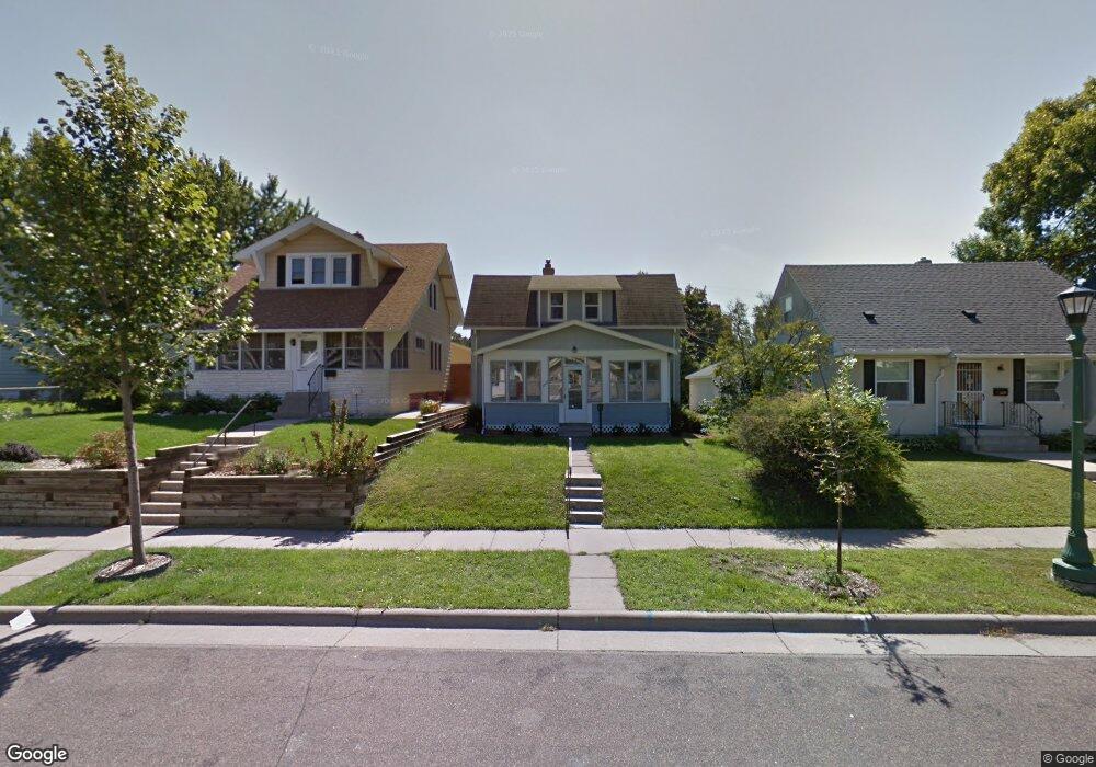
1826 1826 Case Ave E St. Paul, MN 55119
Hazel Park NeighborhoodEstimated Value: $215,000 - $240,000
3
Beds
1
Bath
730
Sq Ft
$312/Sq Ft
Est. Value
About This Home
This home is located at 1826 1826 Case Ave E, St. Paul, MN 55119 and is currently estimated at $227,802, approximately $312 per square foot. 1826 1826 Case Ave E is a home located in Ramsey County with nearby schools including Hazel Park Preparatory Academy, Battle Creek Middle School, and Johnson Senior High School.
Ownership History
Date
Name
Owned For
Owner Type
Purchase Details
Closed on
May 17, 2024
Sold by
Fyr Sfr Trs Llc
Bought by
Cag Minnesota Fund I Llc
Current Estimated Value
Home Financials for this Owner
Home Financials are based on the most recent Mortgage that was taken out on this home.
Original Mortgage
$7,495,750
Outstanding Balance
$7,376,590
Interest Rate
7.17%
Mortgage Type
New Conventional
Estimated Equity
-$7,148,788
Purchase Details
Closed on
Dec 19, 2023
Sold by
Fyr Sfr Borrower Llc
Bought by
Fyr Sfr Trs Llc
Purchase Details
Closed on
Nov 12, 2014
Sold by
Gardner Aaron W
Bought by
Rha 3 Llc
Purchase Details
Closed on
Mar 31, 1997
Sold by
Estate Of Mary Eileen Whalen
Bought by
Miller Gary A
Create a Home Valuation Report for This Property
The Home Valuation Report is an in-depth analysis detailing your home's value as well as a comparison with similar homes in the area
Home Values in the Area
Average Home Value in this Area
Purchase History
We collect this data history from publicly available records. To have your information removed, we recommend requesting removal directly through your county’s website.
| Date | Buyer | Sale Price | Title Company |
|---|---|---|---|
| Cag Minnesota Fund I Llc | $3,178,405 | Selene Title | |
| Fyr Sfr Trs Llc | $500 | None Listed On Document | |
| Rha 3 Llc | $91,696 | Titlesmart Inc | |
| -- | $89,000 | -- | |
| Miller Gary A | $61,200 | -- |
Source: Public Records
Mortgage History
We collect this data history from publicly available records. To have your information removed, we recommend requesting removal directly through your county’s website.
| Date | Status | Borrower | Loan Amount |
|---|---|---|---|
| Open | Cag Minnesota Fund I Llc | $7,495,750 |
Source: Public Records
Tax History
| Year | Tax Paid | Tax Assessment Tax Assessment Total Assessment is a certain percentage of the fair market value that is determined by local assessors to be the total taxable value of land and additions on the property. | Land | Improvement |
|---|---|---|---|---|
| 2025 | $2,828 | $180,700 | $30,000 | $150,700 |
| 2023 | $2,828 | $168,900 | $25,000 | $143,900 |
| 2022 | $2,742 | $202,100 | $25,000 | $177,100 |
| 2021 | $2,596 | $163,000 | $25,000 | $138,000 |
| 2020 | $2,112 | $149,600 | $12,900 | $136,700 |
| 2019 | $2,134 | $118,600 | $12,900 | $105,700 |
| 2018 | $2,184 | $121,500 | $12,900 | $108,600 |
| 2017 | $1,718 | $127,900 | $12,900 | $115,000 |
| 2016 | $1,492 | $0 | $0 | $0 |
| 2015 | $1,442 | $86,200 | $12,900 | $73,300 |
| 2014 | $1,492 | $0 | $0 | $0 |
Source: Public Records
Map
Nearby Homes
- 1805 Case Ave E
- 1809 Mechanic Ave
- TBD Lacrosse Ave
- Null Lacrosse Ave
- None Lacrosse Ave
- 1810 Ross Ave E
- 1659 Case Ave
- 935 Kennard St
- 1112 Breen St
- 1623 York Ave
- 1655 Ross Ave
- 2069 Manitou Ave
- 1660 Jessamine Ave E
- 2040 Stillwater Ave E
- 1119 Kingsford St
- 1131 Kingsford St
- 2047 Nokomis Ave
- 1647 Ames Ave
- 1776 Maryland Ave E Unit 201
- 1776 Maryland Ave E Unit 106
- 1828 Case Ave E
- 1828 1828 Case-Avenue-
- 1822 Case Ave E
- 1818 1818 Case Ave E
- 1818 Case Ave E
- 1838 Case Ave E
- 1825 Sims Ave
- 1825 1825 Sims Ave
- 1812 Case Ave E
- 1829 Sims Ave
- 1829 1829 Case-Avenue-e
- 1829 1829 Case Ave E
- 1815 Sims Ave
- 1833 Sims Ave
- 1825 Case Ave E
- 1829 Case Ave E
- 1821 1821 Case-Avenue-
- 1821 1821 Case Ave E
- 1811 Sims Ave
- 1811 1811 Sims Ave
Your Personal Tour Guide
Ask me questions while you tour the home.