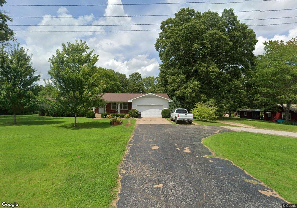
1826 Gibson Ave West Plains, MO 65775
Estimated Value: $149,000 - $342,000
--
Bed
--
Bath
1,678
Sq Ft
$136/Sq Ft
Est. Value
About This Home
This home is located at 1826 Gibson Ave, West Plains, MO 65775 and is currently estimated at $228,957, approximately $136 per square foot. 1826 Gibson Ave is a home with nearby schools including West Plains Senior High School and Faith Assembly Christian School.
Ownership History
Date
Name
Owned For
Owner Type
Purchase Details
Closed on
Jul 7, 2021
Sold by
Powell Carol J and Powell Joe
Bought by
Bentley James R
Current Estimated Value
Home Financials for this Owner
Home Financials are based on the most recent Mortgage that was taken out on this home.
Original Mortgage
$152,525
Interest Rate
2.8%
Mortgage Type
New Conventional
Purchase Details
Closed on
Sep 2, 2015
Sold by
Spence George B and Spence Wanda
Bought by
Spence Beverly and Powell Carol J
Create a Home Valuation Report for This Property
The Home Valuation Report is an in-depth analysis detailing your home's value as well as a comparison with similar homes in the area
Home Values in the Area
Average Home Value in this Area
Purchase History
| Date | Buyer | Sale Price | Title Company |
|---|---|---|---|
| Bentley James R | -- | Wiles Abstract & Title Co | |
| Bentley James R | -- | New Title Company Name | |
| Spence Beverly | -- | Brill Title Company |
Source: Public Records
Mortgage History
| Date | Status | Borrower | Loan Amount |
|---|---|---|---|
| Previous Owner | Bentley James R | $152,525 |
Source: Public Records
Tax History Compared to Growth
Tax History
| Year | Tax Paid | Tax Assessment Tax Assessment Total Assessment is a certain percentage of the fair market value that is determined by local assessors to be the total taxable value of land and additions on the property. | Land | Improvement |
|---|---|---|---|---|
| 2025 | $1,183 | $28,570 | $4,800 | $23,770 |
| 2024 | $1,176 | $25,510 | -- | -- |
| 2023 | $1,176 | $25,510 | $0 | $0 |
| 2022 | $1,116 | $24,230 | $0 | $0 |
| 2021 | $1,062 | $24,230 | $0 | $0 |
| 2020 | $1,062 | $22,520 | $0 | $0 |
| 2019 | $1,102 | $22,520 | $0 | $0 |
| 2018 | $1,102 | $22,520 | $0 | $0 |
| 2017 | $1,098 | $22,520 | $0 | $0 |
| 2015 | -- | $21,660 | $0 | $0 |
| 2014 | -- | $21,660 | $0 | $0 |
| 2013 | -- | $21,660 | $0 | $0 |
Source: Public Records
Map
Nearby Homes
- 1908 Timber Ln
- 1402 Stoney Dr
- 1931 Kay Dr
- 1805 Cole St
- 1933 Lynn Dr
- 1158 Chateau Dr
- 1157 Chateau Dr
- 1945 Debra Dr
- 000 Woodridge Subdivision
- 1611 9th St
- 2204 Gleghorn St
- 000 Lot 1 Block 13 Morrison Sub
- 000 Gleghorn St
- 000 Joann Dr
- Tbd N Kentucky Ave
- 000 Kentucky Ave
- 1938 Debra Dr
- 1816 Lasswell St
- 2416 Gleghorn St
- 1165 Susan Dr
- 1819 Gibson St
- 1819 Gibson Ave
- 1817 Gibson St
- 1605 Padgett St
- 1407 Country Club Dr
- 1303 Mo-Cc Unit Louis
- 1906 Gibson St
- 1906 Gibson Ave
- 1403 Country Club Dr
- 1406 Chateau Dr
- 1813 Gibson Ave
- 1404 Chateau Dr
- 1811 Gibson Ave
- 1811 Gibson St
- 1402 Chateau Dr
- 1918 Cole St
- 1914 Cole St
- 1405 Chateau Dr
- 1912 Cole St
- 1403 Chateau Dr