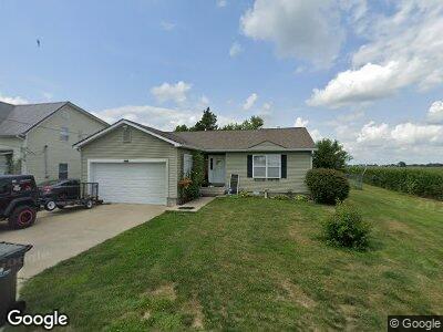
1826 W Lewis Creek Ln Flat Rock, IN 47234
Estimated Value: $183,000 - $216,000
1
Bed
1
Bath
900
Sq Ft
$223/Sq Ft
Est. Value
About This Home
This home is located at 1826 W Lewis Creek Ln, Flat Rock, IN 47234 and is currently estimated at $200,306, approximately $222 per square foot. 1826 W Lewis Creek Ln is a home located in Shelby County with nearby schools including Southwestern Elementary School and Southwestern High School.
Ownership History
Date
Name
Owned For
Owner Type
Purchase Details
Closed on
Jul 21, 2022
Sold by
Webster and Odessa
Bought by
Tong Liam Rai Alexande
Current Estimated Value
Home Financials for this Owner
Home Financials are based on the most recent Mortgage that was taken out on this home.
Original Mortgage
$145,500
Outstanding Balance
$140,811
Interest Rate
5.78%
Mortgage Type
New Conventional
Estimated Equity
$62,486
Purchase Details
Closed on
Jul 17, 2006
Sold by
Riley Lee Charles and Riley Ann Pauline
Bought by
Webster Ricky and Webster Odessa
Home Financials for this Owner
Home Financials are based on the most recent Mortgage that was taken out on this home.
Original Mortgage
$100,000
Interest Rate
6.73%
Mortgage Type
New Conventional
Create a Home Valuation Report for This Property
The Home Valuation Report is an in-depth analysis detailing your home's value as well as a comparison with similar homes in the area
Home Values in the Area
Average Home Value in this Area
Purchase History
| Date | Buyer | Sale Price | Title Company |
|---|---|---|---|
| Tong Liam Rai Alexande | $150,000 | Security Title | |
| Webster Ricky | -- | -- |
Source: Public Records
Mortgage History
| Date | Status | Borrower | Loan Amount |
|---|---|---|---|
| Open | Tong Liam Rai Alexande | $18,786 | |
| Open | Tong Liam Rai Alexande | $145,500 | |
| Previous Owner | Webster Rickey C | $123,900 | |
| Previous Owner | Webster Ricky | $100,000 |
Source: Public Records
Tax History Compared to Growth
Tax History
| Year | Tax Paid | Tax Assessment Tax Assessment Total Assessment is a certain percentage of the fair market value that is determined by local assessors to be the total taxable value of land and additions on the property. | Land | Improvement |
|---|---|---|---|---|
| 2024 | $804 | $157,200 | $10,100 | $147,100 |
| 2023 | $714 | $153,100 | $10,100 | $143,000 |
| 2022 | $180 | $110,900 | $8,900 | $102,000 |
| 2021 | $163 | $103,100 | $8,900 | $94,200 |
| 2020 | $141 | $100,500 | $8,900 | $91,600 |
| 2019 | $111 | $97,800 | $8,900 | $88,900 |
| 2018 | $113 | $98,900 | $8,900 | $90,000 |
| 2017 | $97 | $96,000 | $8,900 | $87,100 |
| 2016 | $103 | $96,800 | $7,900 | $88,900 |
| 2014 | $60 | $91,700 | $7,500 | $84,200 |
| 2013 | $60 | $93,600 | $7,500 | $86,100 |
Source: Public Records
Map
Nearby Homes
- 10776 S 250 W
- 2451 W Flat Rock Rd
- 2650 W State Road 252
- 5299 W Pr Black Hawk Hills
- 0 St 9 Rd Unit MBR21894364
- 7934 S 600 W
- 6086 W 850 S
- 6063 W Mount Auburn 2nd St
- 9278 S Geneva Rd
- 3149 E 900 S
- 1150 S Edinburgh Rd
- 0 Parkway Dr Unit MBR21991969
- 3163 S 25 E
- 7418 W Old State Road 252
- 3081 S Woodridge Rd
- 2867 S Oakland Dr
- 1330 Country Creek Cir
- 1302 Country Creek Cir
- 1026 Summer Way Dr
- 1061 Saint Paul St
- 1826 W Lewis Creek Ln
- 1830 W Lewis Creek Ln
- 1834 W Lewis Creek Ln
- 1829 W Lewis Creek Ln
- 1838 W Lewis Creek Ln
- 1840 W 850 S
- 1816 W 850 S
- 1830 W 850 S
- 1806 W 850 S
- 1864 W 850 S
- 1792 W 850 S
- 1896 W 850 S
- 1878 W 850 S
- 1782 W 850 S
- 1904 W 850 S
- 1899 W 850 S
- 1904 S West St
- 1756 W 850 S
- 1910 W 850 S
- 1829 W 850 S