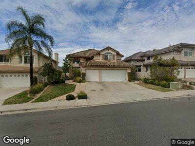
18268 Smokesignal Dr San Diego, CA 92127
Rancho Bernardo NeighborhoodEstimated Value: $1,465,726 - $1,649,000
4
Beds
3
Baths
2,170
Sq Ft
$725/Sq Ft
Est. Value
About This Home
This home is located at 18268 Smokesignal Dr, San Diego, CA 92127 and is currently estimated at $1,572,432, approximately $724 per square foot. 18268 Smokesignal Dr is a home located in San Diego County with nearby schools including Westwood Elementary School, Bernardo Heights Middle, and Rancho Bernardo High.
Ownership History
Date
Name
Owned For
Owner Type
Purchase Details
Closed on
May 26, 2000
Sold by
Ponceau Frederic and Ponceau Tomoyo
Bought by
Ponceau Frederic and Ponceau Tomoyo
Current Estimated Value
Purchase Details
Closed on
Aug 20, 1999
Sold by
Barnes Robert R and Barnes Lisa K
Bought by
Ponceau Frederic A and Takahashi Tomoyo
Purchase Details
Closed on
Apr 14, 1994
Sold by
Shea Homes Ltd Partnership
Bought by
Barnes Robert R and Barnes Lisa K
Home Financials for this Owner
Home Financials are based on the most recent Mortgage that was taken out on this home.
Original Mortgage
$258,750
Interest Rate
4.75%
Create a Home Valuation Report for This Property
The Home Valuation Report is an in-depth analysis detailing your home's value as well as a comparison with similar homes in the area
Home Values in the Area
Average Home Value in this Area
Purchase History
| Date | Buyer | Sale Price | Title Company |
|---|---|---|---|
| Ponceau Frederic | -- | -- | |
| Ponceau Frederic A | $386,000 | California Title Company | |
| Barnes Robert R | $287,500 | Continental Lawyers Title |
Source: Public Records
Mortgage History
| Date | Status | Borrower | Loan Amount |
|---|---|---|---|
| Previous Owner | Barnes Robert R | $244,000 | |
| Previous Owner | Barnes Robert R | $30,500 | |
| Previous Owner | Barnes Robert R | $258,750 |
Source: Public Records
Tax History Compared to Growth
Tax History
| Year | Tax Paid | Tax Assessment Tax Assessment Total Assessment is a certain percentage of the fair market value that is determined by local assessors to be the total taxable value of land and additions on the property. | Land | Improvement |
|---|---|---|---|---|
| 2024 | $6,156 | $581,622 | $188,344 | $393,278 |
| 2023 | $6,022 | $570,218 | $184,651 | $385,567 |
| 2022 | $5,932 | $559,038 | $181,031 | $378,007 |
| 2021 | $5,822 | $548,078 | $177,482 | $370,596 |
| 2020 | $5,760 | $542,459 | $175,663 | $366,796 |
| 2019 | $5,614 | $531,823 | $172,219 | $359,604 |
| 2018 | $5,458 | $521,396 | $168,843 | $352,553 |
| 2017 | $6,226 | $511,174 | $165,533 | $345,641 |
| 2016 | $6,116 | $501,152 | $162,288 | $338,864 |
| 2015 | $6,038 | $493,625 | $159,851 | $333,774 |
| 2014 | $5,972 | $483,956 | $156,720 | $327,236 |
Source: Public Records
Map
Nearby Homes
- 18295 High Mesa Ct
- 17837 Creciente Way
- 18037 Saponi Ct
- 11124 Papoose Ct
- 17648 Azucar Way
- 10717 Matinal Cir
- 10721 Matinal Cir
- 18197 Valladares Dr
- 11103 Matinal Cir
- 17551 Cabela Dr
- 18129 Chretien Ct
- 17417 Cabela Dr
- 17985 Caminito Pinero Unit 190
- 17935 Caminito Pinero Unit 273
- 11476 Matinal Cir Unit 31
- 18614 Caminito Cantilena Unit 324
- 18630 Caminito Cantilena Unit 304
- 17595 Fairlie Rd Unit 256
- 18638 Caminito Cantilena Unit 269
- 18660 Caminito Cantilena Unit 260
- 18268 Smokesignal Dr
- 18262 Smokesignal Dr
- 18272 Smokesignal Dr
- 18278 Smokesignal Dr
- 18258 Smokesignal Dr
- 11215 Monticook Ct
- 18282 Smokesignal Dr
- 18252 Smokesignal Dr
- 11205 Monticook Ct
- 18248 Smokesignal Dr
- 18296 Smokesignal Dr
- 11202 Monticook Ct
- 11378 Monticook Ct
- 11388 Monticook Ct
- 11216 Monticook Ct
- 11214 Monticook Ct Unit 7
- 18242 Smokesignal Dr
- 11206 Monticook Ct Unit 7
- 11224 Monticook Ct
- 11368 Monticook Ct