Estimated Value: $257,000 - $385,000
2
Beds
1
Bath
1,269
Sq Ft
$256/Sq Ft
Est. Value
About This Home
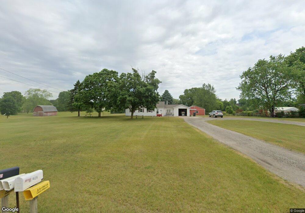
This home is located at 1827 144th Ave, Dorr, MI 49323 and is currently estimated at $325,293, approximately $256 per square foot. 1827 144th Ave is a home located in Allegan County with nearby schools including Wayland High School, Byron Center Charter School, and St. Stanislaus School.
Ownership History
Date
Name
Owned For
Owner Type
Purchase Details
Closed on
Oct 12, 2001
Sold by
Kurdelski Thomas J and Kurdelski Marie Ann
Bought by
Dever Daniel R
Current Estimated Value
Home Financials for this Owner
Home Financials are based on the most recent Mortgage that was taken out on this home.
Original Mortgage
$87,850
Outstanding Balance
$34,463
Interest Rate
6.92%
Estimated Equity
$290,830
Create a Home Valuation Report for This Property
The Home Valuation Report is an in-depth analysis detailing your home's value as well as a comparison with similar homes in the area
Home Values in the Area
Average Home Value in this Area
Purchase History
| Date | Buyer | Sale Price | Title Company |
|---|---|---|---|
| Dever Daniel R | $92,500 | Keystone Title Co |
Source: Public Records
Mortgage History
| Date | Status | Borrower | Loan Amount |
|---|---|---|---|
| Open | Dever Daniel R | $87,850 |
Source: Public Records
Tax History Compared to Growth
Tax History
| Year | Tax Paid | Tax Assessment Tax Assessment Total Assessment is a certain percentage of the fair market value that is determined by local assessors to be the total taxable value of land and additions on the property. | Land | Improvement |
|---|---|---|---|---|
| 2025 | $1,977 | $122,000 | $53,100 | $68,900 |
| 2024 | $1,813 | $106,600 | $41,500 | $65,100 |
| 2023 | $1,857 | $98,600 | $40,200 | $58,400 |
| 2022 | $1,813 | $79,700 | $31,000 | $48,700 |
| 2021 | $1,687 | $73,100 | $27,100 | $46,000 |
| 2020 | $1,603 | $67,000 | $25,800 | $41,200 |
| 2019 | $1,603 | $58,400 | $19,000 | $39,400 |
| 2018 | $1,570 | $51,300 | $19,000 | $32,300 |
| 2017 | $0 | $56,700 | $16,600 | $40,100 |
| 2016 | $0 | $56,000 | $17,800 | $38,200 |
| 2015 | -- | $56,000 | $17,800 | $38,200 |
| 2014 | -- | $51,400 | $17,800 | $33,600 |
| 2013 | -- | $47,500 | $15,900 | $31,600 |
Source: Public Records
Map
Nearby Homes
- 1722 144th Ave
- 1341 142nd Ave
- 4159 White Pine Dr
- 4312 Woodside Meadow Ct
- 2081 142nd Ave
- 4087 Ronalds Rd
- 4101 White Pine Dr Unit 4
- 10591 Byron Center Ave SW
- 1659 Creek Side Ct
- Lot 11 Walnut Dale Dr
- 10780 Windward Ave SW
- 10785 Windward Ave SW
- 1069 108th St SW
- 10725 Windward Ave SW
- 10711 Windward Ave SW
- 136 100th St SW
- 737 100th St SW
- 4351 Hickory View Ct
- V/L Ivanrest Ave SW
- 9705 Byron Center Ave SW
- 1821 144th Ave
- 1826 144th Ave Unit 7
- 1832 144th Ave
- 1822 144th Ave
- 1815 144th Ave
- 1814 144th Ave
- 1831 Quail Ridge Dr
- 1845 144th Ave
- 1808 144th Ave
- 1802 144th Ave
- 4404 18th St
- 4349 Quail Run Dr
- 1839 Quail Ridge Dr
- 1835 Quail Ridge Dr
- 1848 144th Ave
- 4345 Quail Run Dr
- 1836 Quail Ridge Dr
- 2670 144th Ave
- 4396 18th St
- 4390 18th St