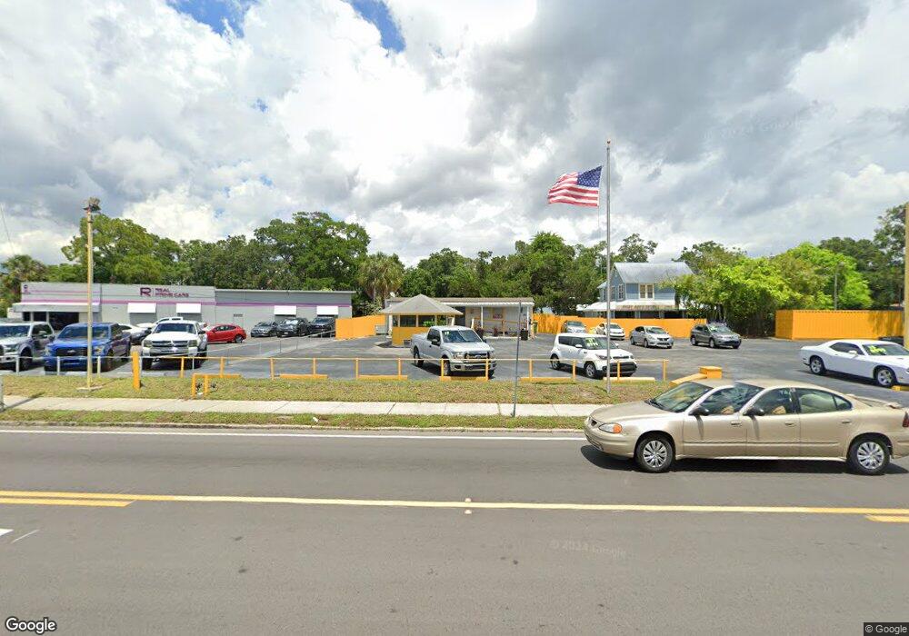
1827 9th St W Bradenton, FL 34205
Central Bradenton NeighborhoodEstimated Value: $431,000 - $764,000
3
Beds
2
Baths
1,000
Sq Ft
$601/Sq Ft
Est. Value
About This Home
This home is located at 1827 9th St W, Bradenton, FL 34205 and is currently estimated at $600,929, approximately $600 per square foot. 1827 9th St W is a home located in Manatee County with nearby schools including G.D. Rogers Garden - Bullock Elementary School, Manatee High School, and Martha B. King Middle School.
Ownership History
Date
Name
Owned For
Owner Type
Purchase Details
Closed on
Jul 29, 2022
Sold by
Stanley M Thompson Inter Vivos Trust
Bought by
L & M Properties Inc
Current Estimated Value
Purchase Details
Closed on
Jul 8, 2013
Sold by
Fritch Martha Ann
Bought by
Thompson Stanley M
Purchase Details
Closed on
Mar 16, 1999
Sold by
Samson Franklin J
Bought by
Fritch Martha Ann
Home Financials for this Owner
Home Financials are based on the most recent Mortgage that was taken out on this home.
Original Mortgage
$175,000
Interest Rate
6.74%
Create a Home Valuation Report for This Property
The Home Valuation Report is an in-depth analysis detailing your home's value as well as a comparison with similar homes in the area
Home Values in the Area
Average Home Value in this Area
Purchase History
| Date | Buyer | Sale Price | Title Company |
|---|---|---|---|
| L & M Properties Inc | $799,000 | None Listed On Document | |
| Thompson Stanley M | -- | Attorney | |
| Fritch Martha Ann | $195,000 | -- |
Source: Public Records
Mortgage History
| Date | Status | Borrower | Loan Amount |
|---|---|---|---|
| Previous Owner | Fritch Martha Ann | $175,000 |
Source: Public Records
Tax History Compared to Growth
Tax History
| Year | Tax Paid | Tax Assessment Tax Assessment Total Assessment is a certain percentage of the fair market value that is determined by local assessors to be the total taxable value of land and additions on the property. | Land | Improvement |
|---|---|---|---|---|
| 2025 | $9,120 | $527,599 | $254,243 | $273,356 |
| 2024 | $9,120 | $507,003 | $234,549 | $272,454 |
| 2023 | $8,840 | $518,424 | $234,549 | $283,875 |
| 2022 | $7,853 | $430,762 | $185,752 | $245,010 |
| 2021 | $6,901 | $365,850 | $185,752 | $180,098 |
| 2020 | $7,085 | $358,407 | $185,752 | $172,655 |
| 2019 | $7,023 | $352,106 | $185,752 | $166,354 |
| 2018 | $6,936 | $344,098 | $185,752 | $158,346 |
| 2017 | $6,701 | $380,268 | $0 | $0 |
| 2016 | $5,872 | $297,232 | $0 | $0 |
| 2015 | $5,773 | $294,640 | $0 | $0 |
| 2014 | $5,773 | $285,319 | $0 | $0 |
| 2013 | $5,505 | $269,169 | $136,639 | $132,530 |
Source: Public Records
Map
Nearby Homes
- 719 21st Ave W
- 2005 12th St W
- 1510 10th St W
- 1701 13th St W
- 1904 5th St W
- 2121 14th St W
- 1416 19th Ave W
- 1418 19th Ave W
- 612 13th Ave W
- 1518 17th Ave W
- 513 25th Ave W
- 1602 18th Ave W
- 506 13th Ave W
- 1503 23rd Ave W
- 1110 27th Ave W
- 1622 18th Ave W
- 520 12th Ave W
- 1619 17th St W
- 1611 15th Ave W
- 1615 17th St W
