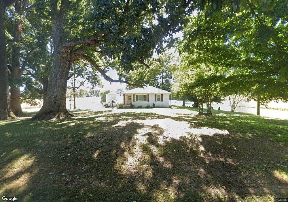
1827 Allie Campbell Rd Union City, TN 38261
Estimated Value: $98,000 - $161,000
--
Bed
1
Bath
989
Sq Ft
$133/Sq Ft
Est. Value
About This Home
This home is located at 1827 Allie Campbell Rd, Union City, TN 38261 and is currently estimated at $131,644, approximately $133 per square foot. 1827 Allie Campbell Rd is a home located in Obion County.
Ownership History
Date
Name
Owned For
Owner Type
Purchase Details
Closed on
Aug 27, 2019
Sold by
Martin Terry
Bought by
Wisdom Tracy and Wisdom Simone
Current Estimated Value
Home Financials for this Owner
Home Financials are based on the most recent Mortgage that was taken out on this home.
Original Mortgage
$41,600
Outstanding Balance
$26,813
Interest Rate
3.7%
Mortgage Type
New Conventional
Estimated Equity
$104,831
Purchase Details
Closed on
Apr 20, 2015
Sold by
Martin Terry
Bought by
Tanner Elwin and Tanner Brenda
Purchase Details
Closed on
Mar 16, 2010
Sold by
Tanner Robbie Marie
Bought by
Martin Terry
Purchase Details
Closed on
Feb 15, 1947
Bought by
Tanner Cecil and Robbie Marie
Create a Home Valuation Report for This Property
The Home Valuation Report is an in-depth analysis detailing your home's value as well as a comparison with similar homes in the area
Home Values in the Area
Average Home Value in this Area
Purchase History
| Date | Buyer | Sale Price | Title Company |
|---|---|---|---|
| Wisdom Tracy | $50,000 | -- | |
| Tanner Elwin | $278,500 | -- | |
| Martin Terry | -- | -- | |
| Tanner Cecil | -- | -- |
Source: Public Records
Mortgage History
| Date | Status | Borrower | Loan Amount |
|---|---|---|---|
| Open | Wisdom Tracy | $41,600 |
Source: Public Records
Tax History Compared to Growth
Tax History
| Year | Tax Paid | Tax Assessment Tax Assessment Total Assessment is a certain percentage of the fair market value that is determined by local assessors to be the total taxable value of land and additions on the property. | Land | Improvement |
|---|---|---|---|---|
| 2024 | $301 | $21,775 | $3,525 | $18,250 |
| 2023 | $301 | $21,775 | $3,525 | $18,250 |
| 2022 | $259 | $13,625 | $4,250 | $9,375 |
| 2021 | $259 | $13,625 | $4,250 | $9,375 |
| 2020 | $235 | $12,375 | $4,250 | $8,125 |
| 2019 | $235 | $12,375 | $4,250 | $8,125 |
| 2018 | $236 | $12,375 | $4,250 | $8,125 |
| 2017 | $262 | $13,075 | $4,250 | $8,825 |
| 2016 | $262 | $13,075 | $4,250 | $8,825 |
| 2015 | $262 | $13,075 | $4,250 | $8,825 |
| 2014 | -- | $32,375 | $23,550 | $8,825 |
Source: Public Records
Map
Nearby Homes
- 1719 Martin Dr
- 2610-2608 Nettle St
- 1428 Meadow Dr
- 0 Add Osburn Rd
- 488 Allyson Dr
- 2235 Bel Air Cir
- 0 Vaden St
- 1587 Troy Hickman Rd
- 1129 S 4th St
- 612 Wynridge Dr
- Lot 11 Wynridge
- Lot 10 Wynridge
- 2203 Wedgewood Dr
- 2005 Stonewall Dr
- 1403 Lynn Place
- 713 Nelson St
- 2703 Salem Dr
- 210 Graham St
- 604 Denver Dr
- 605 S 5th St
- 1828 Allie Campbell Rd
- 1701 Martin Dr
- 1669 Martin Dr
- 1698 Martin Dr
- 1680 Martin Dr
- 1680 Martin Dr
- 1534 N Highway 51 S
- 1271 Forrester Rd
- 1269 Forrester Rd
- 1409 Quail Ridge Cove
- 0 Highway 51 S Unit 43358
- 1451 Martin Dr
- 1556 Quail Ridge Cove
- 1556 Quail Ridge Rd
- 1544 Reese Alexander Rd
- 1455 Martin Dr
- 1267 Forrester Rd
- 2154 Allie Campbell Rd
- 00 Wade Wiley
- 2150 Allie Campbell Rd