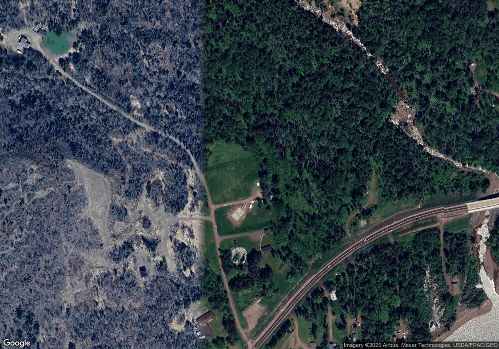
1827 Highway 61 Two Harbors, MN 55616
Estimated Value: $331,000 - $601,000
2
Beds
1
Bath
936
Sq Ft
$486/Sq Ft
Est. Value
About This Home
This home is located at 1827 Highway 61, Two Harbors, MN 55616 and is currently estimated at $454,649, approximately $485 per square foot. 1827 Highway 61 is a home located in Lake County with nearby schools including Minnehaha Elementary School, Two Harbors Secondary, and Northwoods Christian Academy.
Ownership History
Date
Name
Owned For
Owner Type
Purchase Details
Closed on
Apr 6, 2020
Sold by
Thomas Michael
Bought by
Ruesink Kathleen M and Ruesink David G
Current Estimated Value
Purchase Details
Closed on
Jan 31, 2020
Sold by
Ruesink David G
Bought by
Ruesink Kathleen M
Purchase Details
Closed on
Nov 26, 2019
Sold by
Thomas Michael
Bought by
Ruesink Kathleen M and Ruesink David G
Purchase Details
Closed on
Dec 21, 2015
Sold by
Hansen Connie P
Bought by
Johnson Nikki M
Create a Home Valuation Report for This Property
The Home Valuation Report is an in-depth analysis detailing your home's value as well as a comparison with similar homes in the area
Home Values in the Area
Average Home Value in this Area
Purchase History
| Date | Buyer | Sale Price | Title Company |
|---|---|---|---|
| Ruesink Kathleen M | -- | None Available | |
| Ruesink Kathleen M | -- | None Available | |
| Ruesink Kathleen M | $115,000 | None Available | |
| Johnson Nikki M | -- | None Available |
Source: Public Records
Tax History Compared to Growth
Tax History
| Year | Tax Paid | Tax Assessment Tax Assessment Total Assessment is a certain percentage of the fair market value that is determined by local assessors to be the total taxable value of land and additions on the property. | Land | Improvement |
|---|---|---|---|---|
| 2025 | $1,640 | $403,500 | $128,100 | $275,400 |
| 2024 | $1,014 | $249,700 | $65,900 | $183,800 |
| 2023 | $886 | $247,600 | $60,200 | $187,400 |
| 2022 | $1,007 | $196,000 | $45,600 | $150,400 |
| 2021 | $1,003 | $110,300 | $45,600 | $64,700 |
| 2020 | $786 | $108,400 | $44,800 | $63,600 |
| 2019 | $329 | $40,800 | $40,800 | $0 |
| 2018 | $336 | $40,800 | $40,800 | $0 |
| 2017 | $391 | $40,800 | $40,800 | $0 |
| 2016 | $373 | $48,100 | $48,100 | $0 |
| 2015 | $393 | $44,800 | $44,800 | $0 |
| 2014 | $393 | $0 | $0 | $0 |
| 2013 | $379 | $0 | $0 | $0 |
| 2012 | $406 | $0 | $0 | $0 |
Source: Public Records
Map
Nearby Homes
- 1928 Loop Rd
- 1690 Highway 61
- 1768 Stewart River Rd
- 2202 Fors Rd
- 1563 Highway 61
- 1621 #71 Superior Shores Unit 1/8 fractional owner
- 1611 #57B Superior Shores Unit 1/8 Interval Ownersh
- 1603 Superior Shores Dr Unit 49
- 1624 #85 Superior Shores Unit 1/8 fractional owner
- 1594 Superior Shores Dr Unit 111
- 1621 Superior Shores Dr Unit 71
- 1567 Superior Shores Dr Unit 27
- 1555 Superior Shores Dr Unit 15
- 1611 Superior Shores Dr Unit 57B
- 1611 Superior Shores Dr Unit 57A
- 2036 Highway 2
- 1871 Highway 2
- 1412 #5-302a Burlington Rd
- 1412 #5-202a Burlington Rd
- 1412 #5-404a Burlington Rd
- 1828 Silver Fox Ln
- 1825 Scenic Hwy 61
- 1825 Scenic Hwy 61
- 1825 Scenic Hwy 61
- 1825 Highway 61
- 1830 Highway 61
- 1830 Highway 61
- 1830 Highway 61
- 1830 Highway 61
- 1830 Highway 61
- 1830 Highway 61
- 1830 Highway 61
- 1830 Highway 61
- 1830 Highway 61
- 1830 Highway 61
- 1830 Highway 61
- 1830 Highway 61
- 1830 Highway 61
- 1830 Highway 61
- 1830 Highway 61
