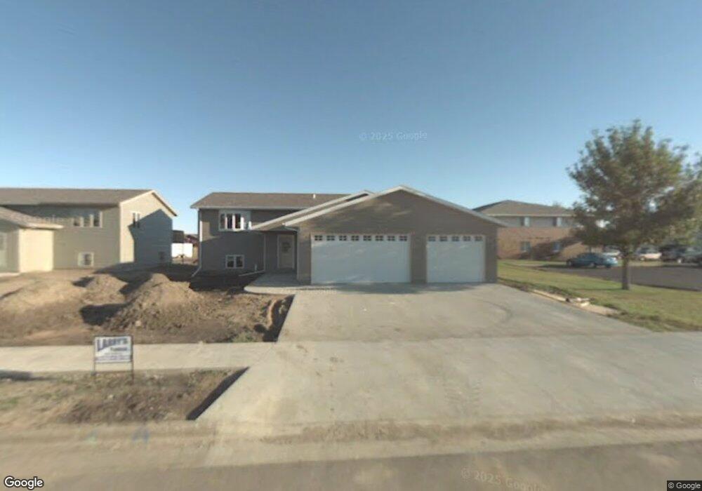
1828 Kennedy Dr Pierre, SD 57501
Estimated Value: $397,052 - $445,000
4
Beds
3
Baths
1,388
Sq Ft
$299/Sq Ft
Est. Value
About This Home
This home is located at 1828 Kennedy Dr, Pierre, SD 57501 and is currently estimated at $415,513, approximately $299 per square foot. 1828 Kennedy Dr is a home with nearby schools including T.F. Riggs High School and Pierre SDA School.
Ownership History
Date
Name
Owned For
Owner Type
Purchase Details
Closed on
Oct 29, 2008
Sold by
Kennedy Property Development Llc
Bought by
Jost Erick and Jost Amanda
Current Estimated Value
Home Financials for this Owner
Home Financials are based on the most recent Mortgage that was taken out on this home.
Original Mortgage
$199,622
Outstanding Balance
$131,101
Interest Rate
6.09%
Estimated Equity
$284,412
Create a Home Valuation Report for This Property
The Home Valuation Report is an in-depth analysis detailing your home's value as well as a comparison with similar homes in the area
Home Values in the Area
Average Home Value in this Area
Purchase History
| Date | Buyer | Sale Price | Title Company |
|---|---|---|---|
| Jost Erick | $202,000 | -- |
Source: Public Records
Mortgage History
| Date | Status | Borrower | Loan Amount |
|---|---|---|---|
| Open | Jost Erick | $199,622 |
Source: Public Records
Tax History Compared to Growth
Tax History
| Year | Tax Paid | Tax Assessment Tax Assessment Total Assessment is a certain percentage of the fair market value that is determined by local assessors to be the total taxable value of land and additions on the property. | Land | Improvement |
|---|---|---|---|---|
| 2025 | $4,074 | $348,538 | $50,833 | $297,705 |
| 2024 | $4,068 | $334,362 | $50,833 | $283,529 |
| 2023 | $3,735 | $325,258 | $48,644 | $276,614 |
| 2022 | $3,514 | $276,840 | $46,328 | $230,512 |
| 2021 | $3,442 | $247,178 | $41,364 | $205,814 |
| 2020 | $3,524 | $239,978 | $40,159 | $199,819 |
| 2019 | $3,517 | $239,978 | $40,159 | $199,819 |
| 2018 | $3,368 | $232,988 | $38,989 | $193,999 |
| 2017 | -- | $221,893 | $37,132 | $184,761 |
| 2016 | $3,526 | $221,893 | $37,132 | $184,761 |
| 2015 | -- | $215,430 | $36,050 | $179,380 |
| 2014 | -- | $209,155 | $35,000 | $174,155 |
| 2013 | -- | $209,155 | $35,000 | $174,155 |
| 2011 | -- | $195,943 | $34,278 | $161,665 |
Source: Public Records
Map
Nearby Homes
- 1913 Flag Mountain Dr
- 109 Baja Dr
- 2106 Antelope St
- 137 Hampton Dr
- 139 Hampton Dr
- 1101 Winchester Dr
- 620 N Harrison Ave
- 1617 Abbey Rd
- 306 N Tyler Ave
- Lot 13R N Garfield Ave
- 216 N Fir St
- 1217 Hilgers Dr
- 1509 E Church St
- 203 N Tyler Ave
- 1623 E Robinson Ave
- 419 N Van Buren Ave
- 2009 E Capitol Ave
- 2024 E Erskine St
- 111 N Harrison Ave
- 1515 E Capitol Ave
- 1824 Kennedy Dr
- 753 Kennedy Loop
- 749 Kennedy Loop
- 1911 Riggs Dr
- 1823 Kennedy Dr
- 1820 Kennedy Dr
- 742 Kennedy Loop
- 1821 Kennedy Dr
- 1927 Riggs Dr
- 745 Kennedy Loop
- 741 Kennedy Loop
- 1917 Riggs Dr
- 1904 Riggs Dr
- 734 Kennedy Loop
- 1817 Kennedy Dr
- 1923 Riggs Dr
- 2252 Flag Mountain Dr
- 1908 Riggs Dr
- 105 Sheila Dr
- 1932 Riggs Dr