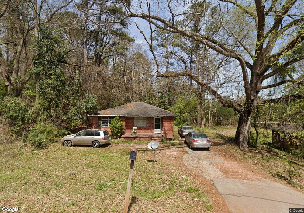
183 Buck Murphy Rd Lagrange, GA 30241
Estimated Value: $71,000 - $172,000
2
Beds
1
Bath
948
Sq Ft
$119/Sq Ft
Est. Value
About This Home
This home is located at 183 Buck Murphy Rd, Lagrange, GA 30241 and is currently estimated at $112,758, approximately $118 per square foot. 183 Buck Murphy Rd is a home located in Troup County with nearby schools including Whitesville Road Elementary School, Berta Weathersbee Elementary School, and Rosemont Elementary School.
Ownership History
Date
Name
Owned For
Owner Type
Purchase Details
Closed on
Aug 10, 1996
Sold by
Jimmy Keith
Bought by
Keith Jimmy and Keith Carol
Current Estimated Value
Purchase Details
Closed on
Aug 9, 1996
Sold by
William E Tatum
Bought by
Jimmy Keith
Purchase Details
Closed on
Apr 30, 1986
Sold by
Evans Marshall E
Bought by
William E Tatum
Create a Home Valuation Report for This Property
The Home Valuation Report is an in-depth analysis detailing your home's value as well as a comparison with similar homes in the area
Purchase History
| Date | Buyer | Sale Price | Title Company |
|---|---|---|---|
| Keith Jimmy | -- | -- | |
| Jimmy Keith | $31,000 | -- | |
| William E Tatum | $120,000 | -- |
Source: Public Records
Tax History
| Year | Tax Paid | Tax Assessment Tax Assessment Total Assessment is a certain percentage of the fair market value that is determined by local assessors to be the total taxable value of land and additions on the property. | Land | Improvement |
|---|---|---|---|---|
| 2025 | $527 | $21,120 | $4,000 | $17,120 |
| 2024 | $527 | $19,320 | $4,000 | $15,320 |
| 2023 | $538 | $19,720 | $4,000 | $15,720 |
| 2022 | $521 | $18,680 | $4,000 | $14,680 |
| 2021 | $376 | $12,480 | $4,000 | $8,480 |
| 2020 | $376 | $12,480 | $4,000 | $8,480 |
| 2019 | $360 | $11,920 | $4,000 | $7,920 |
| 2018 | $359 | $11,920 | $4,000 | $7,920 |
| 2017 | $306 | $11,920 | $4,000 | $7,920 |
| 2016 | $412 | $13,647 | $4,000 | $9,647 |
| 2015 | $423 | $14,018 | $4,000 | $10,018 |
| 2014 | $408 | $13,491 | $4,000 | $9,491 |
| 2013 | -- | $14,237 | $4,000 | $10,237 |
Source: Public Records
Map
Nearby Homes
- 432 Cooley Rd
- 1315 Hamilton Rd
- 1216 Hamilton Rd
- 0 Lanett Ave
- 213 Euclid Ave
- 216 Euclid Ave
- 2222 Whitesville Rd
- 241 Rooker Dr
- 243 Rooker Dr
- 235 Rooker Dr
- 233 Rooker Dr
- 239 Rooker Dr
- 231 Rooker Dr
- LOT 33 E Hillside Dr
- LOT 34 E Hillside Dr
- 249 Rooker Dr
- 251 Rooker Dr
- 253 Rooker Dr
- Cannaberra Plan at Bryant Lake
- Aspen Plan at Bryant Lake
- 187 Buck Murphy Rd
- 185 Buck Murphy Rd
- 172 Buck Murphy Rd
- 184 Buck Murphy Rd
- 6 Duffey Dr
- 169 Buck Murphy Rd
- 188 Buck Murphy Rd
- 170 Buck Murphy Rd
- 5 Duffey Dr
- 9 Duffey Dr
- 1804 Hamilton Rd
- 4 Duffey Dr
- 1800 Hamilton Rd
- 1724 Hamilton Rd
- 113 Alicia Way
- S S Davis Rd
- 1801 Hamilton Rd Unit 37215542
- 1801 Hamilton Rd Unit 37215416
- 1801 Hamilton Rd Unit 37215204
- 1801 Hamilton Rd Unit EVERGREEN