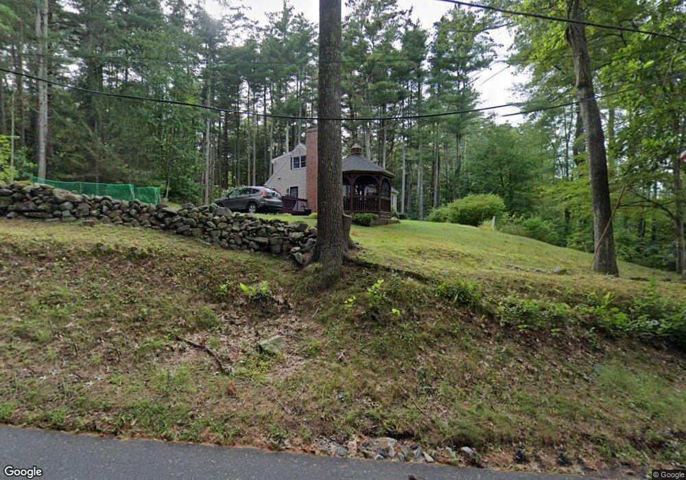
183 Crane Hill Rd Wilbraham, MA 01095
Estimated Value: $389,289 - $438,000
4
Beds
2
Baths
1,469
Sq Ft
$282/Sq Ft
Est. Value
About This Home
This home is located at 183 Crane Hill Rd, Wilbraham, MA 01095 and is currently estimated at $414,822, approximately $282 per square foot. 183 Crane Hill Rd is a home located in Hampden County with nearby schools including Minnechaug Regional High School and Wilbraham & Monson Academy.
Ownership History
Date
Name
Owned For
Owner Type
Purchase Details
Closed on
Nov 30, 2001
Sold by
Lavoie Timothy C and Lavoie Anna L
Bought by
Desantis James T and Desantis Karen M
Current Estimated Value
Home Financials for this Owner
Home Financials are based on the most recent Mortgage that was taken out on this home.
Original Mortgage
$135,000
Outstanding Balance
$53,104
Interest Rate
6.66%
Mortgage Type
Purchase Money Mortgage
Estimated Equity
$361,718
Purchase Details
Closed on
Mar 5, 1999
Sold by
Getchell Beverly E
Bought by
Lavoie Timothy C
Home Financials for this Owner
Home Financials are based on the most recent Mortgage that was taken out on this home.
Original Mortgage
$102,400
Interest Rate
6.76%
Mortgage Type
Purchase Money Mortgage
Create a Home Valuation Report for This Property
The Home Valuation Report is an in-depth analysis detailing your home's value as well as a comparison with similar homes in the area
Home Values in the Area
Average Home Value in this Area
Purchase History
| Date | Buyer | Sale Price | Title Company |
|---|---|---|---|
| Desantis James T | $175,000 | -- | |
| Lavoie Timothy C | $128,000 | -- |
Source: Public Records
Mortgage History
| Date | Status | Borrower | Loan Amount |
|---|---|---|---|
| Open | Lavoie Timothy C | $135,000 | |
| Previous Owner | Lavoie Timothy C | $102,400 | |
| Previous Owner | Lavoie Timothy C | $50,000 |
Source: Public Records
Tax History Compared to Growth
Tax History
| Year | Tax Paid | Tax Assessment Tax Assessment Total Assessment is a certain percentage of the fair market value that is determined by local assessors to be the total taxable value of land and additions on the property. | Land | Improvement |
|---|---|---|---|---|
| 2025 | $5,714 | $319,600 | $93,000 | $226,600 |
| 2024 | $5,171 | $279,500 | $93,000 | $186,500 |
| 2023 | $5,120 | $267,200 | $93,000 | $174,200 |
| 2022 | $5,120 | $249,900 | $93,000 | $156,900 |
| 2021 | $4,847 | $211,100 | $101,400 | $109,700 |
| 2020 | $4,724 | $211,100 | $101,400 | $109,700 |
| 2019 | $4,602 | $211,100 | $101,400 | $109,700 |
| 2018 | $4,505 | $199,000 | $101,400 | $97,600 |
| 2017 | $4,378 | $199,000 | $101,400 | $97,600 |
| 2016 | $4,333 | $200,600 | $107,600 | $93,000 |
| 2015 | $4,189 | $200,600 | $107,600 | $93,000 |
Source: Public Records
Map
Nearby Homes
- 182 Mountain Rd
- 474-480 Mountain Rd
- 60 Lakeshore Dr
- 225 Maynard Rd
- 6 Hawthorne Rd
- 474 Mountain Rd
- 38 King Dr
- 2 Vista Rd
- 20 Old Orchard Rd
- 12 Highridge Rd
- 54 High Pine Cir
- 6 Hilltop Park
- 69 High Pine Cir
- L16 Wilbraham St
- 2 Bayberry Dr Unit 51
- 319 Ventura St
- 35 Lake Dr
- 88-90 Miller St
- 4 Hillcrest Dr
- 22 Balsam Hill Rd
- 199 Crane Hill Rd
- 179 Crane Hill Rd
- 194 Crane Hill Rd
- 169 Crane Hill Rd
- 6 Squire Dr
- 6 Squire Dr Unit 6
- 6 Squire Dr
- 8 Squire Dr
- 205 Crane Hill Rd
- 14 Squire Dr
- 12 Squire Dr
- 13 Squire Dr
- 11 Squire Dr
- 163 Crane Hill Rd
- 4 Squire Dr
- 9 Squire Dr
- 222 Crane Hill Rd
- 210 Crane Hill Rd
- 211 Crane Hill Rd
- 180 Crane Hill Rd