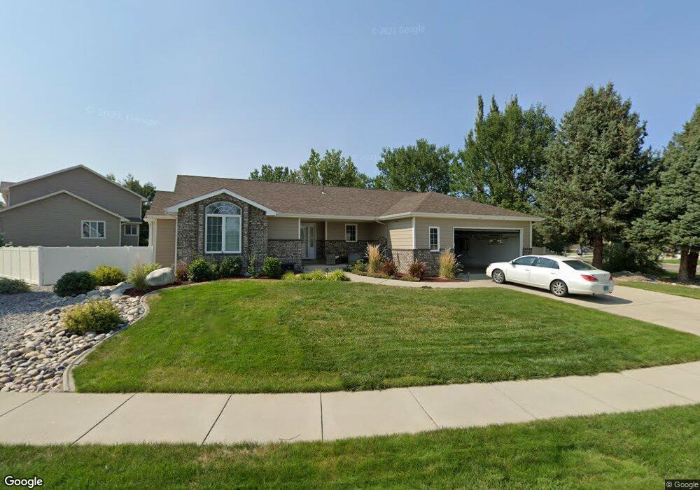
1830 Wentworth Dr Billings, MT 59105
Billings Heights NeighborhoodEstimated Value: $488,000 - $576,000
5
Beds
3
Baths
3,361
Sq Ft
$162/Sq Ft
Est. Value
About This Home
This home is located at 1830 Wentworth Dr, Billings, MT 59105 and is currently estimated at $545,441, approximately $162 per square foot. 1830 Wentworth Dr is a home located in Yellowstone County with nearby schools including Sandstone School, Castle Rock Junior High School, and Skyview High School.
Ownership History
Date
Name
Owned For
Owner Type
Purchase Details
Closed on
Nov 14, 2018
Sold by
Scott Randall and Scott Lynette
Bought by
Hasquet Jordan and Hasquet Lauren
Current Estimated Value
Home Financials for this Owner
Home Financials are based on the most recent Mortgage that was taken out on this home.
Original Mortgage
$264,000
Outstanding Balance
$232,135
Interest Rate
4.8%
Mortgage Type
New Conventional
Estimated Equity
$313,306
Create a Home Valuation Report for This Property
The Home Valuation Report is an in-depth analysis detailing your home's value as well as a comparison with similar homes in the area
Home Values in the Area
Average Home Value in this Area
Purchase History
| Date | Buyer | Sale Price | Title Company |
|---|---|---|---|
| Hasquet Jordan | -- | -- |
Source: Public Records
Mortgage History
| Date | Status | Borrower | Loan Amount |
|---|---|---|---|
| Open | Hasquet Jordan | $264,000 |
Source: Public Records
Tax History Compared to Growth
Tax History
| Year | Tax Paid | Tax Assessment Tax Assessment Total Assessment is a certain percentage of the fair market value that is determined by local assessors to be the total taxable value of land and additions on the property. | Land | Improvement |
|---|---|---|---|---|
| 2025 | $5,523 | $581,800 | $107,520 | $474,280 |
| 2024 | $5,523 | $533,900 | $104,002 | $429,898 |
| 2023 | $5,512 | $533,900 | $104,002 | $429,898 |
| 2022 | $4,409 | $368,000 | $0 | $0 |
| 2021 | $4,166 | $368,000 | $0 | $0 |
| 2020 | $4,095 | $345,000 | $0 | $0 |
| 2019 | $3,925 | $363,200 | $0 | $0 |
| 2018 | $3,837 | $330,600 | $0 | $0 |
| 2017 | $3,060 | $330,600 | $0 | $0 |
| 2016 | $3,535 | $315,700 | $0 | $0 |
| 2015 | $3,464 | $315,700 | $0 | $0 |
| 2014 | $3,477 | $169,441 | $0 | $0 |
Source: Public Records
Map
Nearby Homes
- 107 Glenhaven Dr
- 1949 St Andrews Dr
- 2049 Saint Andrews Dr
- 2029 Ridgeview Dr
- 2115 Saint Andrews Dr
- 243 Westchester Square N Unit A2
- TBD Saint Andrews Dr
- 104 Stillwater Ln
- 1534 Westchester Square E Unit 6
- 1524 Westchester Square E
- 130 132 Stillwater Ln
- 1485 Westchester Square E
- TBD Gayle Block 17 Lot 4 Dr
- TBD Gayle Blk 10 Lot 5 Dr
- 2030 Gayle Dr
- 269 Westchester Square S
- TBD Sharron Block 14 Lot8 Ln
- 2143 Interlachen Dr
- 650 Pinehurst Rd
- 2043 Cypress Point
- 1840 Wentworth Dr
- 1824 Wentworth Dr
- 324 Eastlake Cir
- 1833 Wentworth Dr
- 1829 Wentworth Dr
- 1825 Wentworth Dr
- 1837 Wentworth Dr
- 1823 Wentworth Dr
- 1844 Wentworth Dr
- 1841 Wentworth Dr
- 1845 Wentworth Dr
- 320 Eastlake Cir
- 1821 Wentworth Dr
- 1820 Wentworth Dr
- 1901 Wentworth Dr
- 1870 Wentworth Dr
- 317 Eastlake Cir
- 1817 Wentworth Dr
- 316 Eastlake Cir
- 1816 Wentworth Dr