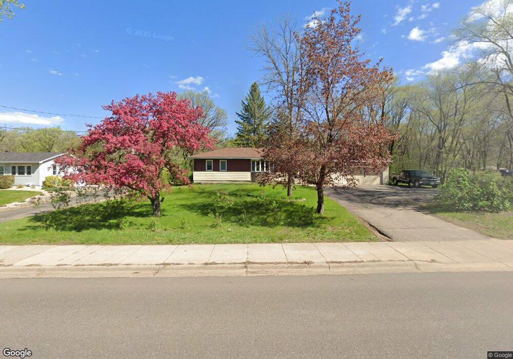
1831 Andover Blvd NW Andover, MN 55304
Estimated Value: $292,000 - $317,377
3
Beds
1
Bath
1,139
Sq Ft
$266/Sq Ft
Est. Value
About This Home
This home is located at 1831 Andover Blvd NW, Andover, MN 55304 and is currently estimated at $302,844, approximately $265 per square foot. 1831 Andover Blvd NW is a home located in Anoka County with nearby schools including Andover Elementary School, Oak View Middle School, and Andover Senior High School.
Ownership History
Date
Name
Owned For
Owner Type
Purchase Details
Closed on
Jun 30, 2015
Sold by
Boos Jayme
Bought by
Hentges David
Current Estimated Value
Home Financials for this Owner
Home Financials are based on the most recent Mortgage that was taken out on this home.
Original Mortgage
$135,375
Outstanding Balance
$106,253
Interest Rate
4.05%
Mortgage Type
New Conventional
Estimated Equity
$196,591
Create a Home Valuation Report for This Property
The Home Valuation Report is an in-depth analysis detailing your home's value as well as a comparison with similar homes in the area
Home Values in the Area
Average Home Value in this Area
Purchase History
| Date | Buyer | Sale Price | Title Company |
|---|---|---|---|
| Hentges David | $142,500 | Fatco |
Source: Public Records
Mortgage History
| Date | Status | Borrower | Loan Amount |
|---|---|---|---|
| Open | Hentges David | $135,375 |
Source: Public Records
Tax History Compared to Growth
Tax History
| Year | Tax Paid | Tax Assessment Tax Assessment Total Assessment is a certain percentage of the fair market value that is determined by local assessors to be the total taxable value of land and additions on the property. | Land | Improvement |
|---|---|---|---|---|
| 2025 | $2,824 | $280,900 | $116,100 | $164,800 |
| 2024 | $2,824 | $271,900 | $108,900 | $163,000 |
| 2023 | $2,751 | $263,600 | $99,200 | $164,400 |
| 2022 | $2,318 | $271,000 | $96,100 | $174,900 |
| 2021 | $2,591 | $213,500 | $70,700 | $142,800 |
| 2020 | $2,368 | $197,400 | $62,200 | $135,200 |
| 2019 | $1,832 | $191,400 | $62,200 | $129,200 |
| 2018 | $1,823 | $172,300 | $0 | $0 |
| 2017 | $1,610 | $168,700 | $0 | $0 |
| 2016 | $1,646 | $148,500 | $0 | $0 |
| 2015 | -- | $148,500 | $55,300 | $93,200 |
| 2014 | -- | $119,700 | $37,800 | $81,900 |
Source: Public Records
Map
Nearby Homes
- 14553 Ibis St NW
- 14395 Partridge St NW
- 14404 Osage St NW
- 14994 Crane St NW
- 13919 Nightingale St NW
- 2066 151st Ave NW
- 2080 151st Ave NW
- 1184 143rd Ave NW
- 13993 Crosstown Blvd NW
- 15285 Quinn St NW
- 1096 142nd Ave NW
- 14023 Yellow Pine St NW
- 2334 Veterans Memorial Blvd NW
- 14931 Sycamore St NW
- 1253 152nd Ave NW
- 917 174th Ave NE
- 13624 Partridge Cir NW
- 930 151st Ave NW
- 1684 155th Ave NW
- 1769 155th Ave NW
- 1845 Andover Blvd NW
- 1853 Andover Blvd NW
- 1815 Andover Blvd NW
- 1846 Andover Blvd NW
- 1826 Andover Blvd NW
- 1865 Andover Blvd NW
- 1805 Andover Blvd NW
- 1806 Andover Blvd NW
- 1850 146th Ave NW
- 1907 Andover Blvd NW
- 14532 Jay St NW
- 14544 Jay St NW
- 1762 Andover Blvd NW
- 14569 Killdeer St NW
- 14556 Jay St NW
- 14520 Jay St NW
- 14569 Martin Ct NW
- 14568 Jay St NW
- 1836 Andover Blvd NW
- 1748 Andover Blvd NW