Estimated Value: $558,049 - $712,000
3
Beds
2
Baths
4,419
Sq Ft
$144/Sq Ft
Est. Value
About This Home
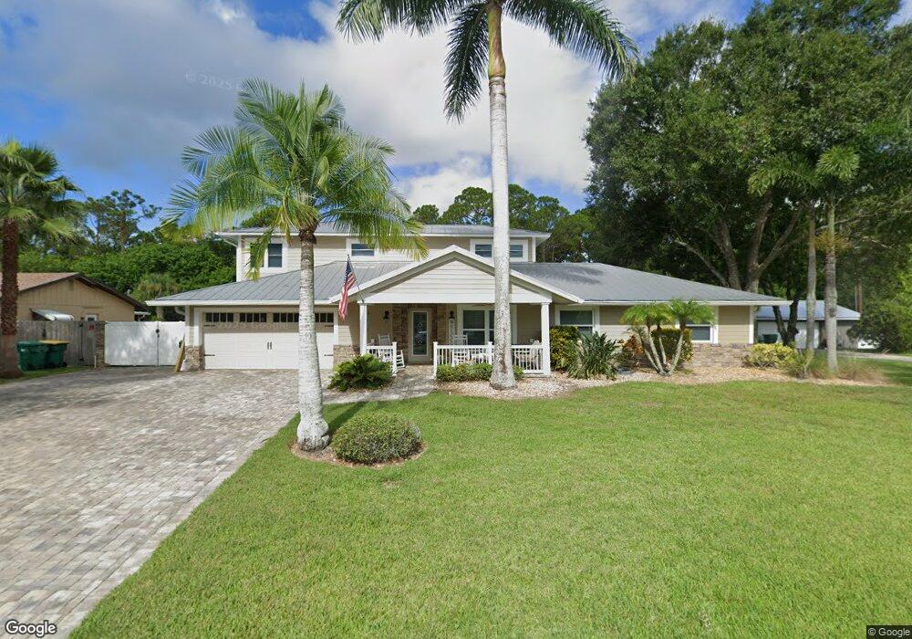
This home is located at 1831 Britt Rd, Cocoa, FL 32926 and is currently estimated at $637,012, approximately $144 per square foot. 1831 Britt Rd is a home located in Brevard County with nearby schools including Cocoa High School, Saturn Elementary School, and Space Coast Christian Academy.
Ownership History
Date
Name
Owned For
Owner Type
Purchase Details
Closed on
Jul 27, 2023
Sold by
Lightholder Jeffrey and Lightholder Nancy Anne
Bought by
Lightholder Jeffrey and Lightholder Nancy Anne
Current Estimated Value
Purchase Details
Closed on
Oct 14, 2016
Sold by
Revares Rebecca F and Merriam Revecca F
Bought by
Lighholder Nancy
Purchase Details
Closed on
Feb 11, 2003
Sold by
Norris Denise Patricia and Lightholder Denise Patricia
Bought by
Lightholder Jeffrey
Purchase Details
Closed on
Dec 28, 1994
Sold by
Britt A C and Britt Reba
Bought by
Lightholder Jeffrey S and Lightholder Denise P
Home Financials for this Owner
Home Financials are based on the most recent Mortgage that was taken out on this home.
Original Mortgage
$60,000
Interest Rate
9.17%
Create a Home Valuation Report for This Property
The Home Valuation Report is an in-depth analysis detailing your home's value as well as a comparison with similar homes in the area
Home Values in the Area
Average Home Value in this Area
Purchase History
| Date | Buyer | Sale Price | Title Company |
|---|---|---|---|
| Lightholder Jeffrey | $100 | None Listed On Document | |
| Lighholder Nancy | $154,900 | Island Title & Escrow | |
| Lightholder Jeffrey | -- | Attorney | |
| Lightholder Jeffrey S | $60,000 | -- |
Source: Public Records
Mortgage History
| Date | Status | Borrower | Loan Amount |
|---|---|---|---|
| Previous Owner | Lightholder Jeffrey S | $60,000 |
Source: Public Records
Tax History
| Year | Tax Paid | Tax Assessment Tax Assessment Total Assessment is a certain percentage of the fair market value that is determined by local assessors to be the total taxable value of land and additions on the property. | Land | Improvement |
|---|---|---|---|---|
| 2025 | $3,334 | $246,660 | -- | -- |
| 2024 | $3,285 | $239,710 | -- | -- |
| 2023 | $3,285 | $232,730 | $0 | $0 |
| 2022 | $3,083 | $225,960 | $0 | $0 |
| 2021 | $3,148 | $219,380 | $0 | $0 |
| 2020 | $3,062 | $216,360 | $0 | $0 |
| 2019 | $3,012 | $211,500 | $0 | $0 |
| 2018 | $3,019 | $207,560 | $0 | $0 |
| 2017 | $3,045 | $203,300 | $0 | $0 |
| 2016 | $3,091 | $199,120 | $19,000 | $180,120 |
| 2015 | $3,136 | $197,740 | $19,000 | $178,740 |
| 2014 | $3,144 | $196,180 | $19,000 | $177,180 |
Source: Public Records
Map
Nearby Homes
- 1870 Britt Rd
- TBD Rayburn Rd
- 4550 Highway 524
- 4655 Rector Rd
- 5101 Craig Rd
- 1325 Friday Rd
- 4005 Pinyon Dr
- 4651 N Friday Cir
- 2209 Spring Cir
- 634 Outer Dr
- 2212 Spring Cir
- 755 Outer Dr Unit 362
- 785 Outer Dr
- 3808 Arrowsmith Dr
- 3808 Arrowsmith Dr Unit 7
- 427 Horseshoe Bend Cir Unit 151
- 694 Outer Dr Unit 184
- 365 Outer Dr
- 495 Outer Dr Unit 201
- 336 Horseshoe Bend Cir Unit 197
Your Personal Tour Guide
Ask me questions while you tour the home.