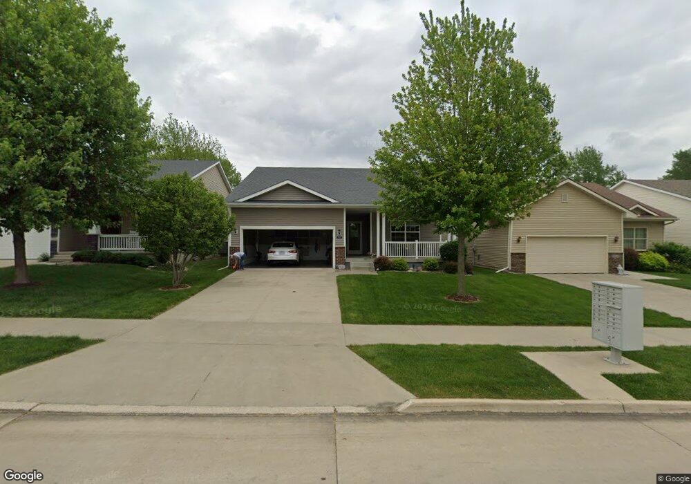
1832 Bristol St Norwalk, IA 50211
Estimated Value: $330,673 - $362,000
3
Beds
2
Baths
1,436
Sq Ft
$239/Sq Ft
Est. Value
About This Home
This home is located at 1832 Bristol St, Norwalk, IA 50211 and is currently estimated at $342,918, approximately $238 per square foot. 1832 Bristol St is a home located in Warren County with nearby schools including Oviatt Elementary School, Lakewood Elementary School, and Orchard Hills Elementary School.
Ownership History
Date
Name
Owned For
Owner Type
Purchase Details
Closed on
Sep 9, 2021
Sold by
Brandsfield Kristi K
Bought by
Brandsfield Kristi K and Revocable Liv Tr Of Kristi K B
Current Estimated Value
Purchase Details
Closed on
Oct 23, 2009
Sold by
Villas At The Legacy Llc
Bought by
Brandsfield Charles A and Brandsfield Kristi K
Purchase Details
Closed on
May 16, 2009
Sold by
H & Cm Llc
Bought by
Villas At The Legacy Llc
Create a Home Valuation Report for This Property
The Home Valuation Report is an in-depth analysis detailing your home's value as well as a comparison with similar homes in the area
Home Values in the Area
Average Home Value in this Area
Purchase History
| Date | Buyer | Sale Price | Title Company |
|---|---|---|---|
| Brandsfield Kristi K | -- | None Available | |
| Brandsfield Charles A | $207,000 | None Available | |
| Villas At The Legacy Llc | -- | None Available |
Source: Public Records
Tax History Compared to Growth
Tax History
| Year | Tax Paid | Tax Assessment Tax Assessment Total Assessment is a certain percentage of the fair market value that is determined by local assessors to be the total taxable value of land and additions on the property. | Land | Improvement |
|---|---|---|---|---|
| 2025 | $4,696 | $291,300 | $44,700 | $246,600 |
| 2024 | $4,808 | $281,600 | $30,600 | $251,000 |
| 2023 | $5,176 | $281,600 | $30,600 | $251,000 |
| 2022 | $5,158 | $243,700 | $30,600 | $213,100 |
| 2021 | $5,136 | $243,700 | $30,600 | $213,100 |
| 2020 | $5,136 | $229,000 | $30,000 | $199,000 |
| 2019 | $4,890 | $229,000 | $30,000 | $199,000 |
| 2018 | $4,734 | $214,500 | $0 | $0 |
| 2017 | $4,938 | $214,500 | $0 | $0 |
| 2016 | $4,894 | $215,700 | $0 | $0 |
| 2015 | $4,894 | $215,700 | $0 | $0 |
| 2014 | $3,088 | $140,300 | $0 | $0 |
Source: Public Records
Map
Nearby Homes
- 1725 Holly Dr
- 1808 Dorchester St
- 1321 Meadow Dr
- 1000 Gordon Ave
- 2204 Legacy Dr
- 1118 Holly Dr
- 2208 Legacy Dr
- 2212 Legacy Dr
- 932 Sawgrass Dr
- 2216 Legacy Dr
- 936 Sawgrass Dr
- 2224 Legacy Dr
- 2228 Legacy Dr
- 952 Sawgrass Dr
- 801 Oakmont Place
- 2232 Legacy Dr
- 1111 Skylane Dr
- 620 Nantucket Place
- 2310 Legacy Dr
- 2314 Legacy Dr
- 1828 Bristol St
- 1904 Bristol St
- 1908 Bristol St
- 1824 Bristol St
- 1713 Holly Dr
- 1820 Bristol St
- 1905 Bristol St
- 1912 Bristol St
- 604 Gordon Ave
- 1829 Bristol St
- 1709 Holly Dr
- 1825 Bristol St
- 1719 Holly Dr
- 1816 Bristol St
- 1817 Bristol St
- 612 Gordon Ave
- 1909 Bristol St
- 1813 Bristol St
- 1812 Bristol St
- 1703 Holly Dr