Estimated Value: $261,000 - $305,000
2
Beds
1
Bath
1,272
Sq Ft
$226/Sq Ft
Est. Value
About This Home
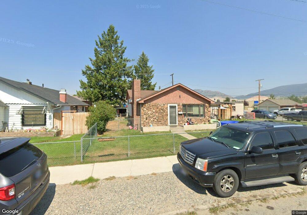
This home is located at 1833 C St, Butte, MT 59701 and is currently estimated at $287,512, approximately $226 per square foot. 1833 C St is a home located in Silver Bow County with nearby schools including Emerson School, East Middle School, and Butte High School.
Ownership History
Date
Name
Owned For
Owner Type
Purchase Details
Closed on
Feb 10, 2022
Sold by
Travis Earles
Bought by
Hennies Kristy and Howerton Shawn
Current Estimated Value
Home Financials for this Owner
Home Financials are based on the most recent Mortgage that was taken out on this home.
Original Mortgage
$162,000
Outstanding Balance
$150,447
Interest Rate
3.56%
Mortgage Type
New Conventional
Estimated Equity
$137,065
Create a Home Valuation Report for This Property
The Home Valuation Report is an in-depth analysis detailing your home's value as well as a comparison with similar homes in the area
Purchase History
| Date | Buyer | Sale Price | Title Company |
|---|---|---|---|
| Hennies Kristy | -- | None Listed On Document |
Source: Public Records
Mortgage History
| Date | Status | Borrower | Loan Amount |
|---|---|---|---|
| Open | Hennies Kristy | $162,000 |
Source: Public Records
Tax History
| Year | Tax Paid | Tax Assessment Tax Assessment Total Assessment is a certain percentage of the fair market value that is determined by local assessors to be the total taxable value of land and additions on the property. | Land | Improvement |
|---|---|---|---|---|
| 2025 | $2,233 | $276,800 | $0 | $0 |
| 2024 | $2,483 | $214,900 | $0 | $0 |
| 2023 | $2,521 | $214,900 | $0 | $0 |
| 2022 | $2,027 | $128,500 | $0 | $0 |
| 2021 | $1,424 | $128,500 | $0 | $0 |
| 2020 | $1,914 | $108,600 | $0 | $0 |
| 2019 | $1,906 | $108,600 | $0 | $0 |
| 2018 | $1,724 | $96,200 | $0 | $0 |
| 2017 | $976 | $96,200 | $0 | $0 |
| 2016 | $1,517 | $85,400 | $0 | $0 |
| 2015 | $901 | $85,400 | $0 | $0 |
| 2014 | $1,261 | $34,980 | $0 | $0 |
Source: Public Records
Map
Nearby Homes
- 1806 C St
- 1727 A St
- 2210 Massachusetts Ave
- 1801 Yale Ave
- 2007 Florida Ave
- 1408 C St
- 2000 Massachusetts Ave
- 1875 Harrison Ave
- 2250 Cross Dr
- 2223 Princeton St
- 2319 Princeton St
- 1863 Dewey Blvd
- 1636 Schley Ave
- 1734 Whitman Ave
- 1953 George St
- 1920 Aberdeen St
- 2410 Yale Ave
- 1639 Lowell Ave
- 2040 Adams Ave
- TBD Princeton St
Your Personal Tour Guide
Ask me questions while you tour the home.