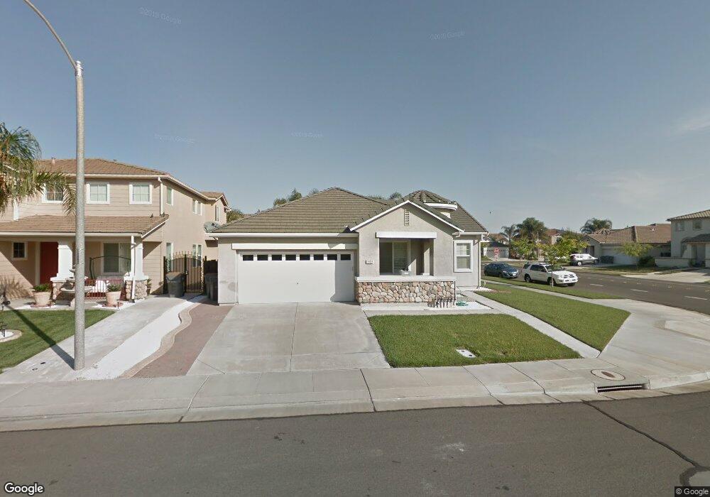
1833 Lowe Dr Woodland, CA 95776
Estimated Value: $538,902 - $585,000
3
Beds
2
Baths
1,857
Sq Ft
$304/Sq Ft
Est. Value
About This Home
This home is located at 1833 Lowe Dr, Woodland, CA 95776 and is currently estimated at $564,726, approximately $304 per square foot. 1833 Lowe Dr is a home located in Yolo County with nearby schools including Ramon S. Tafoya Elementary School, Douglass Middle School, and Pioneer High School.
Ownership History
Date
Name
Owned For
Owner Type
Purchase Details
Closed on
Aug 24, 2009
Sold by
Mariscal Angel
Bought by
Us Bank National Association and Downey Savings & Loan Association Fa
Current Estimated Value
Purchase Details
Closed on
Jul 29, 2008
Sold by
Mariscal Angel
Bought by
Wilmington Security Inc
Purchase Details
Closed on
Oct 22, 2005
Sold by
Mariscal Gladys
Bought by
Mariscal Angel
Home Financials for this Owner
Home Financials are based on the most recent Mortgage that was taken out on this home.
Original Mortgage
$388,000
Interest Rate
6.46%
Mortgage Type
Negative Amortization
Purchase Details
Closed on
May 28, 2004
Sold by
Home Builders Inc
Bought by
Mariscal Angel and Mariscal Gladys
Home Financials for this Owner
Home Financials are based on the most recent Mortgage that was taken out on this home.
Original Mortgage
$259,672
Interest Rate
3.87%
Mortgage Type
Credit Line Revolving
Create a Home Valuation Report for This Property
The Home Valuation Report is an in-depth analysis detailing your home's value as well as a comparison with similar homes in the area
Home Values in the Area
Average Home Value in this Area
Purchase History
| Date | Buyer | Sale Price | Title Company |
|---|---|---|---|
| Us Bank National Association | $206,250 | Lawyers Title | |
| Wilmington Security Inc | -- | None Available | |
| Mariscal Angel | -- | Fidelity National Title | |
| Mariscal Angel | $325,000 | First American Title |
Source: Public Records
Mortgage History
| Date | Status | Borrower | Loan Amount |
|---|---|---|---|
| Previous Owner | Mariscal Angel | $388,000 | |
| Previous Owner | Mariscal Angel | $259,672 | |
| Closed | Mariscal Angel | $64,918 |
Source: Public Records
Tax History Compared to Growth
Tax History
| Year | Tax Paid | Tax Assessment Tax Assessment Total Assessment is a certain percentage of the fair market value that is determined by local assessors to be the total taxable value of land and additions on the property. | Land | Improvement |
|---|---|---|---|---|
| 2025 | $3,906 | $316,233 | $129,073 | $187,160 |
| 2023 | $3,906 | $303,956 | $124,062 | $179,894 |
| 2022 | $4,180 | $297,997 | $121,630 | $176,367 |
| 2021 | $4,131 | $292,155 | $119,246 | $172,909 |
| 2020 | $4,085 | $289,161 | $118,024 | $171,137 |
| 2019 | $4,017 | $283,492 | $115,710 | $167,782 |
| 2018 | $3,980 | $277,935 | $113,442 | $164,493 |
| 2017 | $3,906 | $272,486 | $111,218 | $161,268 |
| 2016 | $3,846 | $267,144 | $109,038 | $158,106 |
| 2015 | $3,744 | $263,133 | $107,401 | $155,732 |
| 2014 | $3,744 | $257,980 | $105,298 | $152,682 |
Source: Public Records
Map
Nearby Homes
- 1840 E Gum Ave
- 737 Farnham Ave
- 1808 Farnham Ave
- 1967 Hawkins Ct
- 1729 Lee Dr
- 976 Huston Cir
- 1095 Powers Cir
- 1060 Powers Cir
- 2120 Freeway Dr
- 1455 Willow Springs Dr
- 541 Edwards Cir
- Residence 1943 Plan at Ruby Cottages
- Residence 2117 Plan at Ruby Cottages
- Residence 1709 Plan at Ruby Cottages
- 1414 St Louis Way
- 2001 Baker Place
- 2021 Santos St
- 925 Stetson St
- 1446 Peterson Dr
- 1429 Patriot Way