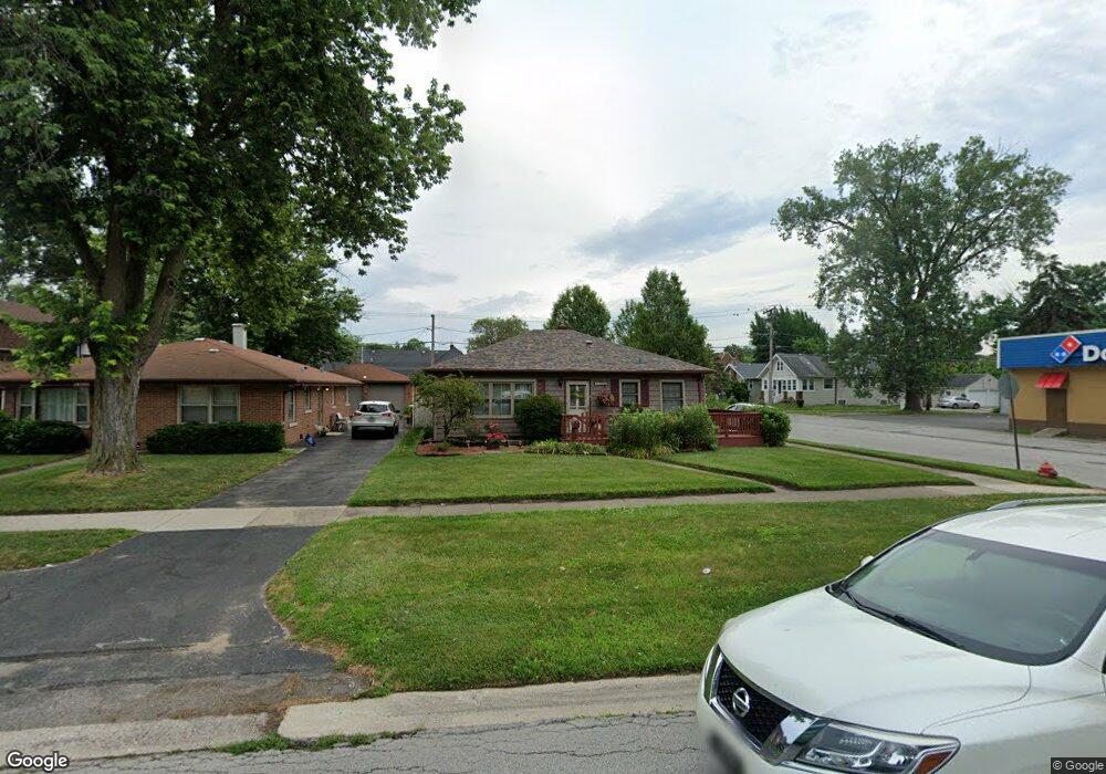
18345 Burnham Ave Lansing, IL 60438
Estimated Value: $162,031 - $238,000
2
Beds
1
Bath
1,498
Sq Ft
$136/Sq Ft
Est. Value
About This Home
This home is located at 18345 Burnham Ave, Lansing, IL 60438 and is currently estimated at $203,258, approximately $135 per square foot. 18345 Burnham Ave is a home located in Cook County with nearby schools including Coolidge Elementary School, Memorial Jr High School, and Thornton Fractnl So High School.
Ownership History
Date
Name
Owned For
Owner Type
Purchase Details
Closed on
Jul 22, 1998
Sold by
Cotton Gerald and Cotton Lisa M
Bought by
Schroeder Deborah L
Current Estimated Value
Home Financials for this Owner
Home Financials are based on the most recent Mortgage that was taken out on this home.
Original Mortgage
$110,072
Outstanding Balance
$20,950
Interest Rate
7.13%
Mortgage Type
FHA
Estimated Equity
$182,308
Create a Home Valuation Report for This Property
The Home Valuation Report is an in-depth analysis detailing your home's value as well as a comparison with similar homes in the area
Home Values in the Area
Average Home Value in this Area
Purchase History
| Date | Buyer | Sale Price | Title Company |
|---|---|---|---|
| Schroeder Deborah L | $111,000 | -- |
Source: Public Records
Mortgage History
| Date | Status | Borrower | Loan Amount |
|---|---|---|---|
| Open | Schroeder Deborah L | $110,072 |
Source: Public Records
Tax History
| Year | Tax Paid | Tax Assessment Tax Assessment Total Assessment is a certain percentage of the fair market value that is determined by local assessors to be the total taxable value of land and additions on the property. | Land | Improvement |
|---|---|---|---|---|
| 2025 | $793 | $8,425 | $1,719 | $6,706 |
| 2024 | $793 | $8,425 | $1,719 | $6,706 |
| 2023 | $841 | $8,425 | $1,719 | $6,706 |
| 2022 | $841 | $5,262 | $1,484 | $3,778 |
| 2021 | $884 | $5,261 | $1,484 | $3,777 |
| 2020 | $822 | $5,261 | $1,484 | $3,777 |
| 2019 | $1,444 | $6,117 | $1,250 | $4,867 |
| 2018 | $1,414 | $6,117 | $1,250 | $4,867 |
| 2017 | $2,347 | $6,117 | $1,250 | $4,867 |
| 2016 | $2,179 | $5,433 | $1,171 | $4,262 |
| 2015 | $1,987 | $5,433 | $1,171 | $4,262 |
| 2014 | $1,976 | $5,433 | $1,171 | $4,262 |
| 2013 | $2,165 | $6,333 | $1,171 | $5,162 |
Source: Public Records
Map
Nearby Homes
- 18315 Burnham Ave Unit 204
- 18324 Roy St
- 3316 Ann St
- 3250 186th St
- 3310 186th St
- 3359 Ann St
- 18275 Ada St
- 18309 Grant St
- 3225 Otto St
- 18514 Ridgewood Ave
- 18241 Ridgewood Ave
- 19510 Burnham Ave
- 18644 William St
- 18504 Wentworth Ave
- 18634 Bernadine St
- 18655 Oakwood Ave
- 18405 Wentworth Ave Unit 1D
- 18747 Sherman St
- 3527 Lake St
- 18019 Lorenz Ave
- 18345 Burnham Ave
- 18341 Burnham Ave
- 18341 Burnham Ave
- 18339 Burnham Ave
- 3218 Ann St
- 18401 Burnham Ave
- 18333 Burnham Ave
- 18409 Burnham Ave
- 3217 Ann St
- 18332 Walter St
- 18340 Burnham Ave Unit 16
- 18340 Burnham Ave Unit 1
- 18340 Burnham Ave Unit 5
- 18340 Burnham Ave Unit 14
- 18340 Burnham Ave Unit 9
- 18340 Burnham Ave Unit 6
- 18340 Burnham Ave Unit 8
- 18340 Burnham Ave Unit 15
- 18340 Burnham Ave Unit 3
- 18340 Burnham Ave Unit 10
Your Personal Tour Guide
Ask me questions while you tour the home.