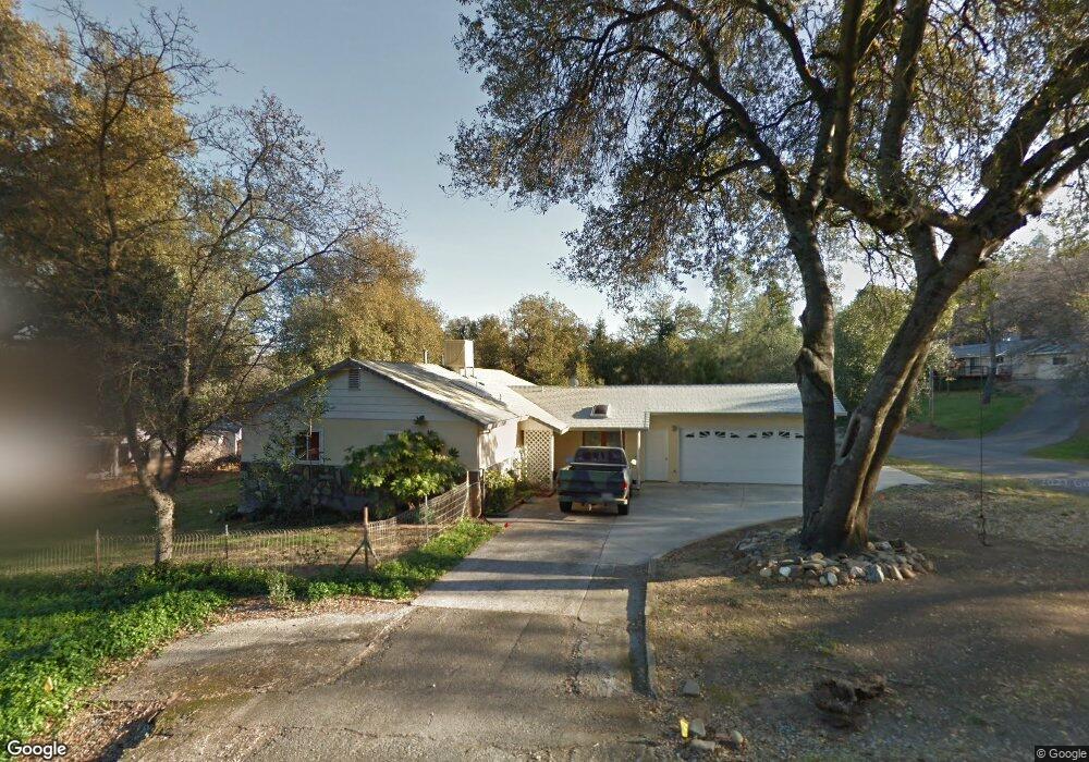
18377 Utility Ave Anderson, CA 96007
Estimated Value: $244,000 - $411,000
3
Beds
1
Bath
1,505
Sq Ft
$213/Sq Ft
Est. Value
About This Home
This home is located at 18377 Utility Ave, Anderson, CA 96007 and is currently estimated at $320,345, approximately $212 per square foot. 18377 Utility Ave is a home located in Shasta County with nearby schools including Meadow Lane Elementary School, Anderson Heights Elementary School, and Anderson Middle School.
Ownership History
Date
Name
Owned For
Owner Type
Purchase Details
Closed on
Jun 6, 2011
Sold by
Federal Home Loan Mortgage Corporation
Bought by
Carter Susan
Current Estimated Value
Home Financials for this Owner
Home Financials are based on the most recent Mortgage that was taken out on this home.
Original Mortgage
$94,541
Outstanding Balance
$65,175
Interest Rate
4.63%
Mortgage Type
FHA
Estimated Equity
$255,170
Purchase Details
Closed on
Nov 9, 2010
Sold by
Kerwin Kenneth J and Kerwin Jeanne E
Bought by
Federal Home Loan Mortgage Corporation
Purchase Details
Closed on
Jul 8, 1999
Sold by
Prince and Constance
Bought by
Kerwin Kenneth J and Kerwin Jeanne E
Home Financials for this Owner
Home Financials are based on the most recent Mortgage that was taken out on this home.
Original Mortgage
$92,000
Interest Rate
7.4%
Mortgage Type
Purchase Money Mortgage
Create a Home Valuation Report for This Property
The Home Valuation Report is an in-depth analysis detailing your home's value as well as a comparison with similar homes in the area
Home Values in the Area
Average Home Value in this Area
Purchase History
| Date | Buyer | Sale Price | Title Company |
|---|---|---|---|
| Carter Susan | $97,000 | Ticor Title Riverside | |
| Federal Home Loan Mortgage Corporation | $90,984 | Accommodation | |
| Kerwin Kenneth J | $115,000 | Fidelity National Title Co |
Source: Public Records
Mortgage History
| Date | Status | Borrower | Loan Amount |
|---|---|---|---|
| Open | Carter Susan | $94,541 | |
| Previous Owner | Kerwin Kenneth J | $92,000 |
Source: Public Records
Tax History Compared to Growth
Tax History
| Year | Tax Paid | Tax Assessment Tax Assessment Total Assessment is a certain percentage of the fair market value that is determined by local assessors to be the total taxable value of land and additions on the property. | Land | Improvement |
|---|---|---|---|---|
| 2025 | $1,281 | $124,263 | $38,430 | $85,833 |
| 2024 | $1,255 | $121,827 | $37,677 | $84,150 |
| 2023 | $1,255 | $119,439 | $36,939 | $82,500 |
| 2022 | $1,214 | $117,098 | $36,215 | $80,883 |
| 2021 | $1,201 | $114,803 | $35,505 | $79,298 |
| 2020 | $1,212 | $113,626 | $35,141 | $78,485 |
| 2019 | $1,158 | $111,399 | $34,452 | $76,947 |
| 2018 | $1,138 | $109,216 | $33,777 | $75,439 |
| 2017 | $1,141 | $107,075 | $33,115 | $73,960 |
| 2016 | $1,056 | $104,976 | $32,466 | $72,510 |
| 2015 | $1,058 | $103,400 | $31,979 | $71,421 |
| 2014 | $1,030 | $101,375 | $31,353 | $70,022 |
Source: Public Records
Map
Nearby Homes
- 18376 Utility Ave
- 7059 Marie Ln
- 18411 Majestic View Dr
- 7725 Happy Valley Rd
- 7252 Whitehouse Dr
- 6973 Happy Valley Rd
- 8500 Copper Dr
- 0 Nut Tree Ln
- 7728 Pit Rd
- 7795 Pit Rd
- 8641 Redbank Rd
- 8818 Valley View Rd
- 000 Glenbo Ln
- 6955 Yvonne Ct
- 6951 Marvin Trail
- 6871 Hemlock St
- 2486 Neighborly Way
- 17956 / 58 New Riders Way
- 6787 Hemlock St
- 2551 S Waverly Ave
- 18389 Utility Ave
- 6975 Pine Dr
- 18405 Utility Ave
- 18388 Utility Ave
- 6976 Pine Dr
- 7064 White Oak Dr
- 18406 Utility Ave
- 7066 White Oak Dr
- 6955 Pine Dr
- 7536 Happy V Rd
- 7050 White Oak Dr
- 7058 White Oak Dr
- 6960 Pine Dr
- 6960 Pine Dr
- 7096 White Oak Dr
- 7042 White Oak Dr
- 6945 Pine Dr
- 7520 Happy Valley Rd
- 7067 White Oak Dr
- 7032 White Oak Dr