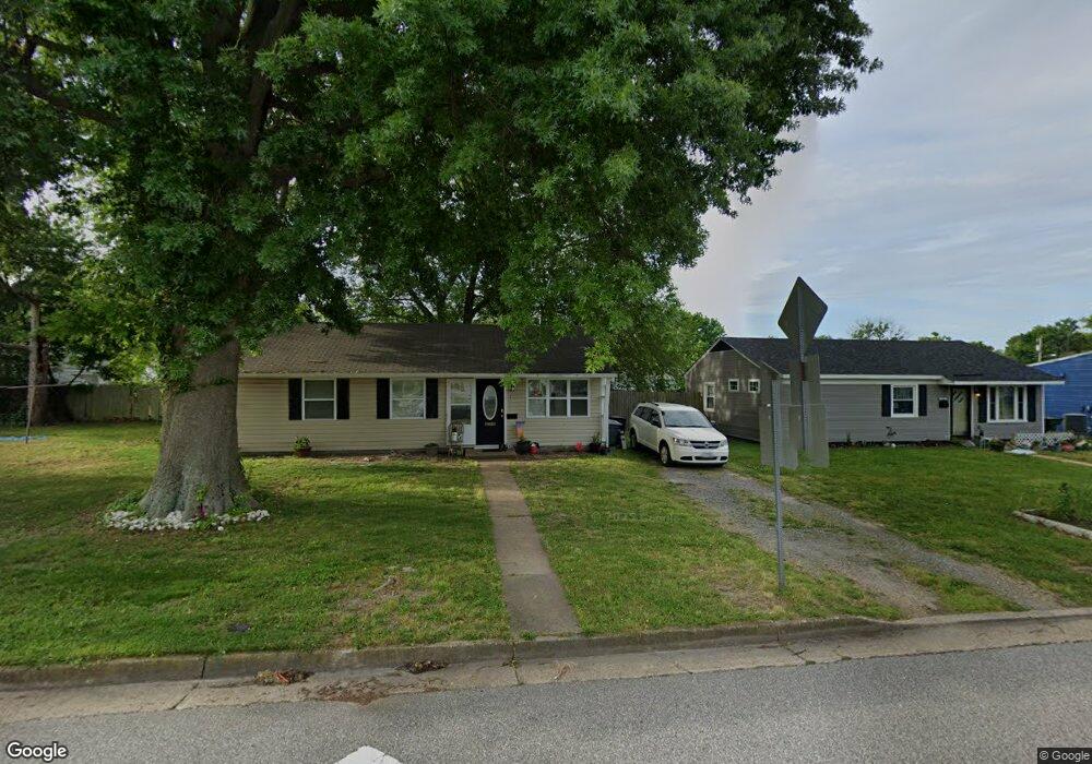
1838 Andrews Blvd Hampton, VA 23663
Buckroe Beach NeighborhoodEstimated Value: $215,000 - $263,000
3
Beds
2
Baths
1,100
Sq Ft
$213/Sq Ft
Est. Value
About This Home
This home is located at 1838 Andrews Blvd, Hampton, VA 23663 and is currently estimated at $233,981, approximately $212 per square foot. 1838 Andrews Blvd is a home located in Hampton City with nearby schools including Capt. John Smith Elementary School, Benjamin Syms Middle School, and Phoebus High School.
Ownership History
Date
Name
Owned For
Owner Type
Purchase Details
Closed on
Feb 10, 2021
Sold by
Way Shawn R
Bought by
Wendelken Amber
Current Estimated Value
Home Financials for this Owner
Home Financials are based on the most recent Mortgage that was taken out on this home.
Original Mortgage
$143,846
Outstanding Balance
$128,431
Interest Rate
2.6%
Mortgage Type
FHA
Estimated Equity
$105,550
Purchase Details
Closed on
Sep 8, 2015
Sold by
Ken Simon Properties Llc
Bought by
Way Shawn R
Home Financials for this Owner
Home Financials are based on the most recent Mortgage that was taken out on this home.
Original Mortgage
$111,836
Interest Rate
3.87%
Mortgage Type
FHA
Purchase Details
Closed on
May 29, 2014
Sold by
Bushnell Capital Corp
Bought by
Ken Simon Properties Llc
Home Financials for this Owner
Home Financials are based on the most recent Mortgage that was taken out on this home.
Original Mortgage
$103,939
Interest Rate
4.33%
Mortgage Type
Construction
Create a Home Valuation Report for This Property
The Home Valuation Report is an in-depth analysis detailing your home's value as well as a comparison with similar homes in the area
Home Values in the Area
Average Home Value in this Area
Purchase History
| Date | Buyer | Sale Price | Title Company |
|---|---|---|---|
| Wendelken Amber | $146,500 | Old Republic National Title | |
| Way Shawn R | $113,900 | None Available | |
| Ken Simon Properties Llc | $52,000 | -- |
Source: Public Records
Mortgage History
| Date | Status | Borrower | Loan Amount |
|---|---|---|---|
| Open | Wendelken Amber | $143,846 | |
| Previous Owner | Way Shawn R | $111,836 | |
| Previous Owner | Ken Simon Properties Llc | $103,939 |
Source: Public Records
Tax History
| Year | Tax Paid | Tax Assessment Tax Assessment Total Assessment is a certain percentage of the fair market value that is determined by local assessors to be the total taxable value of land and additions on the property. | Land | Improvement |
|---|---|---|---|---|
| 2025 | $2,432 | $209,100 | $55,000 | $154,100 |
| 2024 | $2,185 | $190,000 | $55,000 | $135,000 |
| 2023 | $2,204 | $190,000 | $55,000 | $135,000 |
| 2022 | $1,907 | $161,600 | $50,000 | $111,600 |
| 2021 | $1,885 | $141,500 | $42,000 | $99,500 |
| 2020 | $1,597 | $128,800 | $38,300 | $90,500 |
| 2019 | $1,554 | $125,300 | $38,300 | $87,000 |
| 2018 | $1,542 | $113,100 | $38,300 | $74,800 |
| 2017 | $1,496 | $0 | $0 | $0 |
| 2016 | $1,696 | $113,100 | $0 | $0 |
| 2015 | $1,496 | $0 | $0 | $0 |
| 2014 | $1,390 | $95,200 | $38,300 | $56,900 |
Source: Public Records
Map
Nearby Homes
- 1814 Somerville Dr
- 1923 Rawood Dr
- 1845 Kensington Dr
- 1912 Beall Dr
- 1926 Somerville Dr
- 706 Grimes Rd
- 1909 Long Green Ln
- 1915 Long Green Ln
- 1530 Morgan Dr
- 54 George Ct
- 2007 Egger Cir
- 2013 Whitman Place
- 2013 Egger Cir
- 1358 Coral Place
- 304 Woodland Rd
- 2000 Beall Dr
- 385 Woodland Rd
- 213 Ireland St
- 1504 E Pembroke Ave
- 2020 Seward Dr
- 1836 Andrews Blvd
- 1840 Andrews Blvd
- 1103 Grimes Rd
- 1839 Bancroft Dr
- 1837 Bancroft Dr
- 1834 Andrews Blvd
- 1101 Grimes Rd
- 1835 Bancroft Dr
- 1839 Andrews Blvd
- 1837 Andrews Blvd
- 1833 Bancroft Dr
- 1835 Andrews Blvd
- 1900 Andrews Blvd
- 1102 Grimes Rd
- 1830 Andrews Blvd
- 1840 Bancroft Dr
- 1203 Grimes Rd
- 1838 Bancroft Dr
- 1833 Andrews Blvd
- 1903 Bancroft Dr
Your Personal Tour Guide
Ask me questions while you tour the home.