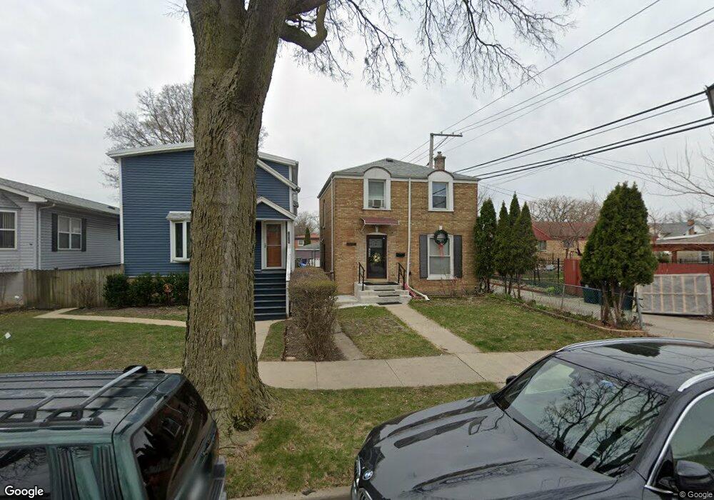
1838 Laurel Ave Evanston, IL 60201
West Evanston NeighborhoodEstimated Value: $270,000 - $351,245
3
Beds
1
Bath
1,085
Sq Ft
$283/Sq Ft
Est. Value
About This Home
This home is located at 1838 Laurel Ave, Evanston, IL 60201 and is currently estimated at $306,811, approximately $282 per square foot. 1838 Laurel Ave is a home located in Cook County with nearby schools including Lincolnwood Elementary School, Haven Middle School, and Evanston Township High School.
Ownership History
Date
Name
Owned For
Owner Type
Purchase Details
Closed on
May 30, 2000
Sold by
Morgridge Gladstone L and Morgridge Clarrissa E
Bought by
Giroux Frank S and Giroux Julia C
Current Estimated Value
Home Financials for this Owner
Home Financials are based on the most recent Mortgage that was taken out on this home.
Original Mortgage
$149,000
Outstanding Balance
$52,378
Interest Rate
8.18%
Estimated Equity
$254,433
Create a Home Valuation Report for This Property
The Home Valuation Report is an in-depth analysis detailing your home's value as well as a comparison with similar homes in the area
Home Values in the Area
Average Home Value in this Area
Purchase History
| Date | Buyer | Sale Price | Title Company |
|---|---|---|---|
| Giroux Frank S | $149,000 | Chicago Title Insurance Co |
Source: Public Records
Mortgage History
| Date | Status | Borrower | Loan Amount |
|---|---|---|---|
| Open | Giroux Frank S | $149,000 |
Source: Public Records
Tax History Compared to Growth
Tax History
| Year | Tax Paid | Tax Assessment Tax Assessment Total Assessment is a certain percentage of the fair market value that is determined by local assessors to be the total taxable value of land and additions on the property. | Land | Improvement |
|---|---|---|---|---|
| 2024 | $5,007 | $24,000 | $4,633 | $19,367 |
| 2023 | $4,780 | $24,000 | $4,633 | $19,367 |
| 2022 | $4,780 | $24,000 | $4,633 | $19,367 |
| 2021 | $3,772 | $17,543 | $4,247 | $13,296 |
| 2020 | $3,781 | $17,543 | $4,247 | $13,296 |
| 2019 | $3,805 | $19,668 | $4,247 | $15,421 |
| 2018 | $4,248 | $18,940 | $3,474 | $15,466 |
| 2017 | $4,153 | $18,940 | $3,474 | $15,466 |
| 2016 | $4,161 | $18,940 | $3,474 | $15,466 |
| 2015 | $2,845 | $13,233 | $2,992 | $10,241 |
| 2014 | $2,832 | $13,233 | $2,992 | $10,241 |
| 2013 | $2,751 | $13,233 | $2,992 | $10,241 |
Source: Public Records
Map
Nearby Homes
- 1808 Laurel Ave
- 2224 Foster St
- 2309 Foster St
- 2211 Foster St
- 1832 Hovland Ct
- 2122 Foster St
- 1718 Hovland Ct
- 1633 Mcdaniel Ave
- 1801 Brown Ave
- 2022 Mcdaniel Ave
- 1739 Dodge Ave
- 1940 Dodge Ave
- 2025 Bennett Ave
- 9353 Ewing Ave
- 1801 Lyons St
- 9237 Forestview Rd
- 1617 Church St
- 1918 Noyes St
- 3500 Church St Unit 204
- 3500 Church St Unit 104
- 1832 Laurel Ave
- 2306 Emerson St
- 1830 Laurel Ave
- 2304 Emerson St
- 2308 Emerson St
- 2300 Emerson St
- 2310 Emerson St
- 1828 Laurel Ave
- 2312 Emerson St
- 1837 Lemar Ave
- 1835 Lemar Ave
- 1826 Laurel Ave
- 2316 Emerson St
- 2226 Emerson St
- 1833 Lemar Ave
- 1831 Lemar Ave
- 2318 Emerson St
- 1822 Laurel Ave
- 1839 Laurel Ave
- 1835 Laurel Ave