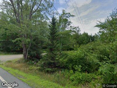
184 the Shore Rd Castine, ME 04421
Estimated Value: $638,000 - $1,027,344
--
Bed
--
Bath
--
Sq Ft
9
Acres
About This Home
This home is located at 184 the Shore Rd, Castine, ME 04421 and is currently estimated at $802,448. 184 the Shore Rd is a home located in Hancock County with nearby schools including Adams School.
Ownership History
Date
Name
Owned For
Owner Type
Purchase Details
Closed on
Sep 23, 2020
Sold by
New Corey A and New Karla H
Bought by
Teicher Perry and Wolfe Caroline
Current Estimated Value
Home Financials for this Owner
Home Financials are based on the most recent Mortgage that was taken out on this home.
Original Mortgage
$640,000
Outstanding Balance
$581,958
Interest Rate
2.9%
Mortgage Type
Purchase Money Mortgage
Estimated Equity
$305,179
Purchase Details
Closed on
Jun 9, 2015
Sold by
Bishop Patricia A
Bought by
New Corey and New Karla
Home Financials for this Owner
Home Financials are based on the most recent Mortgage that was taken out on this home.
Original Mortgage
$748,500
Interest Rate
3%
Mortgage Type
Commercial
Purchase Details
Closed on
Oct 11, 2007
Sold by
Shull Thomas C and Carroll Dorothy J
Bought by
Bishop John P and Bishop Patricia A
Home Financials for this Owner
Home Financials are based on the most recent Mortgage that was taken out on this home.
Original Mortgage
$1,500,000
Interest Rate
6.49%
Mortgage Type
Commercial
Create a Home Valuation Report for This Property
The Home Valuation Report is an in-depth analysis detailing your home's value as well as a comparison with similar homes in the area
Home Values in the Area
Average Home Value in this Area
Purchase History
| Date | Buyer | Sale Price | Title Company |
|---|---|---|---|
| Teicher Perry | -- | None Available | |
| New Corey | -- | -- | |
| Bishop John P | -- | -- |
Source: Public Records
Mortgage History
| Date | Status | Borrower | Loan Amount |
|---|---|---|---|
| Open | Teicher Perry | $640,000 | |
| Previous Owner | New Corey | $748,500 | |
| Previous Owner | Bishop John P | $1,500,000 |
Source: Public Records
Tax History Compared to Growth
Tax History
| Year | Tax Paid | Tax Assessment Tax Assessment Total Assessment is a certain percentage of the fair market value that is determined by local assessors to be the total taxable value of land and additions on the property. | Land | Improvement |
|---|---|---|---|---|
| 2024 | $8,180 | $861,000 | $670,500 | $190,500 |
| 2023 | $7,703 | $652,800 | $508,000 | $144,800 |
| 2022 | $7,292 | $560,900 | $436,400 | $124,500 |
| 2021 | $6,394 | $560,900 | $436,400 | $124,500 |
| 2020 | $6,394 | $560,900 | $436,400 | $124,500 |
| 2019 | $6,394 | $560,900 | $436,400 | $124,500 |
| 2018 | $6,591 | $560,900 | $436,400 | $124,500 |
| 2017 | $6,591 | $560,900 | $436,400 | $124,500 |
| 2016 | $6,300 | $659,700 | $513,500 | $146,200 |
| 2015 | $8,636 | $904,300 | $758,100 | $146,200 |
| 2013 | $8,410 | $904,300 | $758,100 | $146,200 |
Source: Public Records
Map
Nearby Homes
- 73 Back Shore Rd
- 58 Back Shore Rd
- 390 Castine Rd
- 35 Old Fields Way
- 26 State St
- 86 Water St
- 61 Water St
- M17 L15 Battle Ave
- 56 Court St
- 37 Water St
- 197 Perkins St
- M6 L25 Esther Island
- 33 Latour St
- M17 L15 Perkins St
- 33 Dyces Head Rd
- 684 the Shore Rd
- 1026 Castine Rd
- 1057 Castine Rd
- 519 Dunbar Rd
- 9 S Cape Shore Unit 9
- 184 the Shore Rd
- 166A, the Shore Rd
- 161 the Shore Rd
- 210 the Shore Rd
- 202 Shore Rd
- 137 the Shore Rd
- 11 Riverside Dr
- 15 Riverside Dr
- 14 Simpson Rd
- 18 Simpson Rd
- 20 Simpson Rd
- 8 Simpson Rd
- 8 Riverside Dr
- 12 Riverside Dr
- 253 the Shore Rd
- 0 Route 166a Unit 486555
- 0 Route 166a Unit 1084439
- 0 Route 166a Unit 1102594
- 48 Bowden Rd
- 113 the Shore Rd
