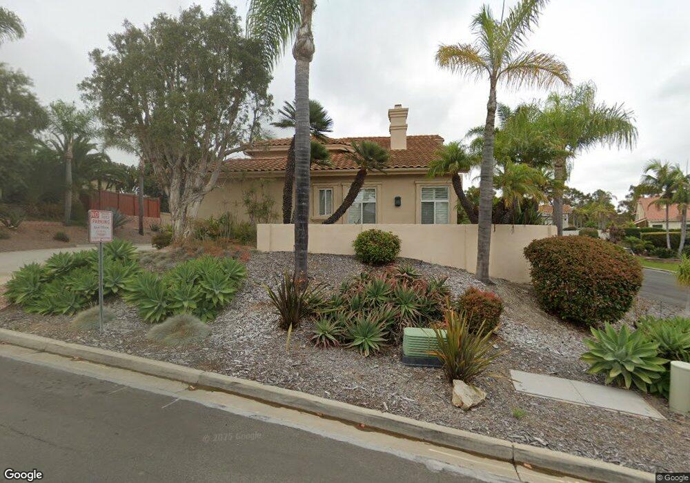
1840 Downs St Oceanside, CA 92054
Fire Mountain NeighborhoodEstimated Value: $1,564,419 - $1,663,000
4
Beds
3
Baths
2,748
Sq Ft
$593/Sq Ft
Est. Value
About This Home
This home is located at 1840 Downs St, Oceanside, CA 92054 and is currently estimated at $1,630,605, approximately $593 per square foot. 1840 Downs St is a home located in San Diego County with nearby schools including Palmquist Elementary School, Lincoln Middle School, and Oceanside High School.
Ownership History
Date
Name
Owned For
Owner Type
Purchase Details
Closed on
Oct 27, 2005
Sold by
Hendrickson Michael and Hendrickson Susan
Bought by
Hendrickson Michael W and Hendrickson Susan J
Current Estimated Value
Purchase Details
Closed on
Mar 14, 2003
Sold by
White Meredyth P
Bought by
Hendrickson Michael and Hendrickson Susan
Purchase Details
Closed on
May 27, 1993
Purchase Details
Closed on
Feb 21, 1992
Purchase Details
Closed on
Feb 13, 1992
Create a Home Valuation Report for This Property
The Home Valuation Report is an in-depth analysis detailing your home's value as well as a comparison with similar homes in the area
Home Values in the Area
Average Home Value in this Area
Purchase History
| Date | Buyer | Sale Price | Title Company |
|---|---|---|---|
| Hendrickson Michael W | -- | -- | |
| Hendrickson Michael | $545,000 | Chicago Title Co | |
| -- | $343,200 | -- | |
| -- | $105,000 | -- | |
| -- | $95,000 | -- |
Source: Public Records
Tax History
| Year | Tax Paid | Tax Assessment Tax Assessment Total Assessment is a certain percentage of the fair market value that is determined by local assessors to be the total taxable value of land and additions on the property. | Land | Improvement |
|---|---|---|---|---|
| 2025 | $8,625 | $789,320 | $391,039 | $398,281 |
| 2024 | $8,625 | $773,844 | $383,372 | $390,472 |
| 2023 | $8,359 | $758,671 | $375,855 | $382,816 |
| 2022 | $8,231 | $743,796 | $368,486 | $375,310 |
| 2021 | $8,262 | $729,212 | $361,261 | $367,951 |
| 2020 | $8,005 | $721,736 | $357,557 | $364,179 |
| 2019 | $7,771 | $707,586 | $350,547 | $357,039 |
| 2018 | $7,687 | $693,713 | $343,674 | $350,039 |
| 2017 | $7,545 | $680,112 | $336,936 | $343,176 |
| 2016 | $7,300 | $666,778 | $330,330 | $336,448 |
| 2015 | $7,085 | $656,764 | $325,369 | $331,395 |
| 2014 | $6,809 | $643,900 | $318,996 | $324,904 |
Source: Public Records
Map
Nearby Homes
- 1839 Samoa Way
- 1732 Downs St
- 1838 Samoa Way
- 1845 Downs St
- 1835 Samoa Way
- 1724 Downs St
- 1721 Avocado Rd
- 1842 Polumele Way
- 1733 Downs St
- 1718 Downs St
- 1834 Samoa Way
- 1725 Downs St
- 1851 Poumele Way
- 1842 Poumele Way
- 1848 Kerisiano Way
- 1848 Kerisiano Way
- 1831 Samoa Way Unit SI ID1308152P
- 1831 Samoa Way Unit ID1308152P
- 1831 Samoa Way
- 1719 Avocado Rd
Your Personal Tour Guide
Ask me questions while you tour the home.