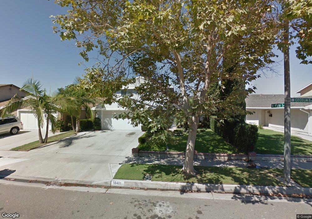
18401 Cecelia Way Cerritos, CA 90703
Estimated Value: $1,156,000 - $1,243,000
4
Beds
2
Baths
1,733
Sq Ft
$687/Sq Ft
Est. Value
About This Home
This home is located at 18401 Cecelia Way, Cerritos, CA 90703 and is currently estimated at $1,190,666, approximately $687 per square foot. 18401 Cecelia Way is a home located in Los Angeles County with nearby schools including Frank C. Leal Elementary School, Tetzlaff (Martin B.) Middle School, and Cerritos High School.
Ownership History
Date
Name
Owned For
Owner Type
Purchase Details
Closed on
Jun 23, 2005
Sold by
Kong Xiangli
Bought by
Mercado Ray Albert and Mercado Shirley
Current Estimated Value
Home Financials for this Owner
Home Financials are based on the most recent Mortgage that was taken out on this home.
Original Mortgage
$559,200
Outstanding Balance
$314,655
Interest Rate
6.99%
Mortgage Type
Purchase Money Mortgage
Estimated Equity
$876,011
Purchase Details
Closed on
Aug 14, 1998
Sold by
Parker Francis G
Bought by
Kong Xiangli and Kong Xiuxian H
Home Financials for this Owner
Home Financials are based on the most recent Mortgage that was taken out on this home.
Original Mortgage
$200,000
Interest Rate
6.91%
Create a Home Valuation Report for This Property
The Home Valuation Report is an in-depth analysis detailing your home's value as well as a comparison with similar homes in the area
Home Values in the Area
Average Home Value in this Area
Purchase History
| Date | Buyer | Sale Price | Title Company |
|---|---|---|---|
| Mercado Ray Albert | $699,000 | Sut | |
| Kong Xiangli | $255,000 | South Coast Title Company |
Source: Public Records
Mortgage History
| Date | Status | Borrower | Loan Amount |
|---|---|---|---|
| Open | Mercado Ray Albert | $559,200 | |
| Previous Owner | Kong Xiangli | $200,000 | |
| Closed | Mercado Ray Albert | $139,800 |
Source: Public Records
Tax History
| Year | Tax Paid | Tax Assessment Tax Assessment Total Assessment is a certain percentage of the fair market value that is determined by local assessors to be the total taxable value of land and additions on the property. | Land | Improvement |
|---|---|---|---|---|
| 2025 | $11,093 | $955,225 | $580,790 | $374,435 |
| 2024 | $11,093 | $936,496 | $569,402 | $367,094 |
| 2023 | $10,722 | $918,135 | $558,238 | $359,897 |
| 2022 | $10,559 | $900,134 | $547,293 | $352,841 |
| 2021 | $10,311 | $882,485 | $536,562 | $345,923 |
| 2020 | $9,849 | $840,000 | $511,800 | $328,200 |
| 2019 | $8,722 | $737,000 | $449,000 | $288,000 |
| 2018 | $8,267 | $737,000 | $449,000 | $288,000 |
| 2016 | $7,443 | $662,000 | $403,000 | $259,000 |
| 2015 | $7,456 | $662,000 | $403,000 | $259,000 |
| 2014 | $6,749 | $598,000 | $364,000 | $234,000 |
Source: Public Records
Map
Nearby Homes
- 18727 Holmes Ave
- 13506 Darvalle St
- 18622 Kamstra Ave
- 13202 Carolyn St
- 13010 Artesia Blvd
- 13026 San Salvador Place
- 17400 Laurelbrook Ct
- 13626 Aclare Ln
- 5271 Niguel Dr
- 12711 Castleford Ln
- 17405 Jasmine Way
- 19335 Derbyshire Ln
- 18704 Stefani Ave
- 7662 Cory Cir
- 12525 Semora St
- 12524 Bryce Cir
- 5091 Sharon Dr
- 17422 Vierra Ave
- 12361 Caravel Place
- 12703 Park St
- 18345 Cecelia Way
- 18407 Cecelia Way
- 13176 Hedda Dr
- 18341 Cecelia Way
- 18411 Cecelia Way
- 13172 Hedda Dr
- 13214 Hedda Place
- 18335 Cecelia Way
- 18417 Cecelia Way
- 13169 Arabella Dr
- 13215 Hedda Place
- 13173 Hedda Dr
- 13173 Arabella Dr
- 13217 Arabella St
- 13220 Hedda Place
- 18421 Cecelia Way
- 13168 Hedda Dr
- 18329 Cecelia Way
- 13221 Hedda Place
- 13165 Arabella Dr
Your Personal Tour Guide
Ask me questions while you tour the home.