Estimated Value: $285,000 - $331,000
4
Beds
2
Baths
1,740
Sq Ft
$180/Sq Ft
Est. Value
About This Home
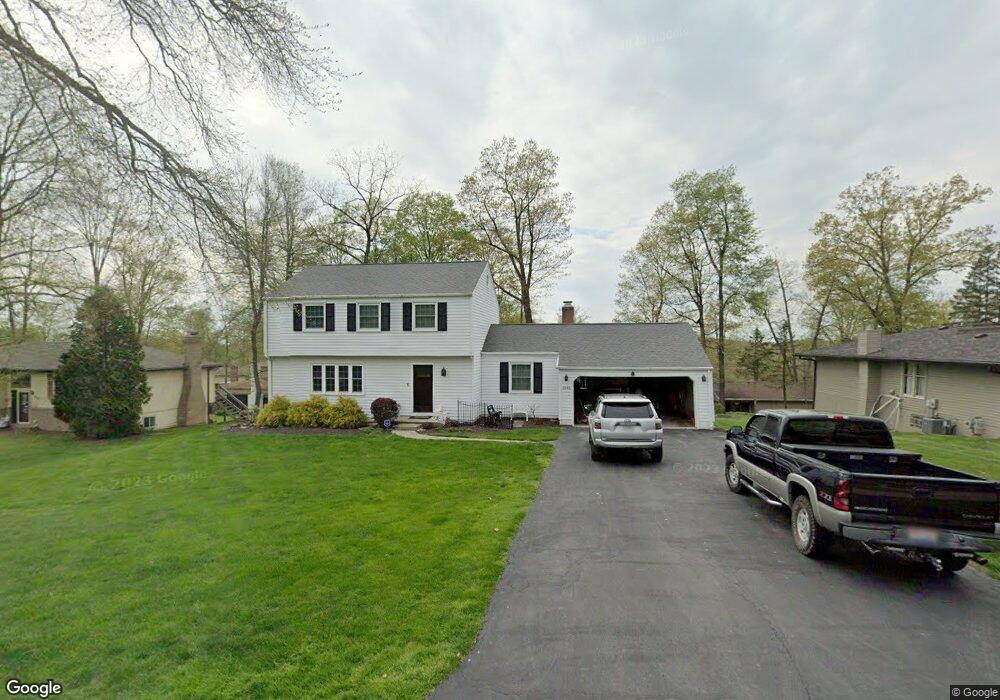
This home is located at 1845 Cedar Cir, Heath, OH 43056 and is currently estimated at $313,552, approximately $180 per square foot. 1845 Cedar Cir is a home located in Licking County with nearby schools including Garfield Elementary School, Stevenson Elementary School, and Heath Middle School.
Ownership History
Date
Name
Owned For
Owner Type
Purchase Details
Closed on
Oct 27, 2020
Sold by
Ragno Kevin A
Bought by
Ragno Kevin A and Ragno Amy
Current Estimated Value
Home Financials for this Owner
Home Financials are based on the most recent Mortgage that was taken out on this home.
Original Mortgage
$91,000
Interest Rate
2.8%
Mortgage Type
New Conventional
Create a Home Valuation Report for This Property
The Home Valuation Report is an in-depth analysis detailing your home's value as well as a comparison with similar homes in the area
Home Values in the Area
Average Home Value in this Area
Purchase History
| Date | Buyer | Sale Price | Title Company |
|---|---|---|---|
| Ragno Kevin A | -- | Patriot Title Agency Inc |
Source: Public Records
Mortgage History
| Date | Status | Borrower | Loan Amount |
|---|---|---|---|
| Closed | Ragno Kevin A | $91,000 |
Source: Public Records
Tax History Compared to Growth
Tax History
| Year | Tax Paid | Tax Assessment Tax Assessment Total Assessment is a certain percentage of the fair market value that is determined by local assessors to be the total taxable value of land and additions on the property. | Land | Improvement |
|---|---|---|---|---|
| 2024 | $3,286 | $76,370 | $19,740 | $56,630 |
| 2023 | $3,636 | $76,370 | $19,740 | $56,630 |
| 2022 | $3,196 | $58,980 | $11,520 | $47,460 |
| 2021 | $3,261 | $58,980 | $11,520 | $47,460 |
| 2020 | $3,282 | $58,980 | $11,520 | $47,460 |
| 2019 | $2,885 | $52,790 | $11,520 | $41,270 |
| 2018 | $2,916 | $0 | $0 | $0 |
| 2017 | $2,915 | $0 | $0 | $0 |
| 2016 | $2,930 | $0 | $0 | $0 |
| 2015 | $2,980 | $0 | $0 | $0 |
| 2014 | $4,191 | $0 | $0 | $0 |
| 2013 | $2,748 | $0 | $0 | $0 |
Source: Public Records
Map
Nearby Homes
- 1933 Blue Jay Rd
- 5185 Linnville Rd
- 606 Kimberly Ct
- 0 Cumberland Crest
- 1782 Cumberland Crest
- 57 Bluebonnett Dr
- 793 Francis Dr
- 748 Francis Dr
- Yosemite Plan at Heron Manor - Maple Street Collection
- Cumberland Plan at Heron Manor - Maple Street Collection
- Wesley Plan at Linnview Crossing - Maple Street Collection
- Breckenridge Plan at Heron Manor - Maple Street Collection
- Yosemite Plan at Linnview Crossing - Maple Street Collection
- DaVinci Plan at Heron Manor - Maple Street Collection
- Fairfax Plan at Linnview Crossing - Maple Street Collection
- Greenbriar Plan at Linnview Crossing - Maple Street Collection
- Jensen Plan at Linnview Crossing - Maple Street Collection
- Jensen Plan at Heron Manor - Maple Street Collection
- Cumberland Plan at Linnview Crossing - Maple Street Collection
- Wesley Plan at Heron Manor - Maple Street Collection