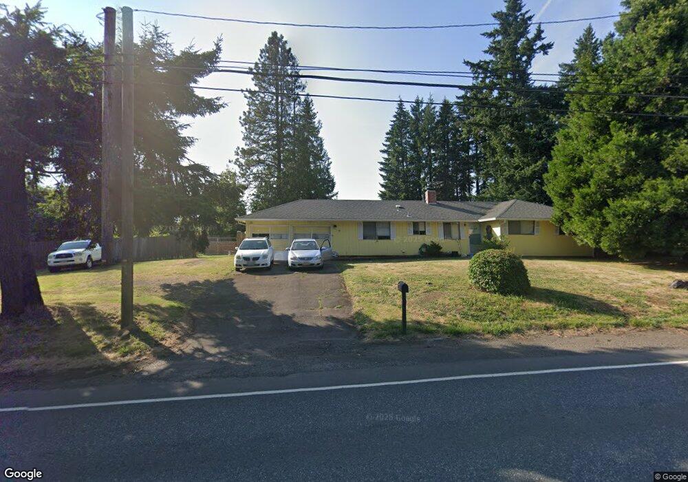
18453 SE Highway 212 Damascus, OR 97089
Estimated Value: $496,660 - $610,000
3
Beds
1
Bath
1,269
Sq Ft
$431/Sq Ft
Est. Value
About This Home
This home is located at 18453 SE Highway 212, Damascus, OR 97089 and is currently estimated at $546,665, approximately $430 per square foot. 18453 SE Highway 212 is a home located in Clackamas County with nearby schools including Deep Creek - Damascus K-8 School, Sam Barlow High School, and Deep Creek-Damascus K-8 School.
Ownership History
Date
Name
Owned For
Owner Type
Purchase Details
Closed on
Oct 14, 2014
Sold by
Bowen Kimberly R
Bought by
Bowen Kimberly R
Current Estimated Value
Purchase Details
Closed on
Sep 13, 2012
Sold by
Bowen Terry E
Bought by
Bowen Patricia R
Create a Home Valuation Report for This Property
The Home Valuation Report is an in-depth analysis detailing your home's value as well as a comparison with similar homes in the area
Home Values in the Area
Average Home Value in this Area
Purchase History
| Date | Buyer | Sale Price | Title Company |
|---|---|---|---|
| Bowen Kimberly R | -- | None Available | |
| Bowen Patricia R | -- | None Available |
Source: Public Records
Tax History Compared to Growth
Tax History
| Year | Tax Paid | Tax Assessment Tax Assessment Total Assessment is a certain percentage of the fair market value that is determined by local assessors to be the total taxable value of land and additions on the property. | Land | Improvement |
|---|---|---|---|---|
| 2025 | $3,958 | $246,474 | -- | -- |
| 2024 | $3,781 | $239,296 | -- | -- |
| 2023 | $3,781 | $232,327 | $0 | $0 |
| 2022 | $3,469 | $225,561 | $0 | $0 |
| 2021 | $3,358 | $218,992 | $0 | $0 |
| 2020 | $3,265 | $212,614 | $0 | $0 |
| 2019 | $3,186 | $206,422 | $0 | $0 |
| 2018 | $3,027 | $200,410 | $0 | $0 |
| 2017 | $2,905 | $194,573 | $0 | $0 |
| 2016 | $2,467 | $188,906 | $0 | $0 |
| 2015 | $2,809 | $183,404 | $0 | $0 |
| 2014 | $2,741 | $178,062 | $0 | $0 |
Source: Public Records
Map
Nearby Homes
- 18680 SE Highway 212
- 18027 SE Emi St
- 14543 SE West Park Ct
- 0 SE Armstrong Cir
- 14548 SE 172nd Ave
- 14790 SE 172nd Ave
- 14120 SE Brent Ave
- 17156 SE Macanudo St
- 17063 SE Macanudo St
- 13633 SE 178th Ave
- 15566 SE Melinda Ct
- 15556 SE Gladys Rose Way
- 16911 SE Siri Ct
- 20320 SE Walgren Rd
- 16566 SE Deer Meadow Loop
- 16381 SE Deer Meadow Loop
- 15400 SE Barlow Ct
- 12672 SE 172nd Ave
- 20160 SE Foster Rd
- 17310 SE Crossroads Ave
- 15156 SE Wy East Ave
- 18331 SE Highway 212
- 15156 SE Wy Ave E
- 15124 SE Wy East Ave
- 15066 SE Wy East Ave
- 15244 SE Wy East Ave
- 18500 SE Highway 212
- 15155 SE Wy East Ave
- 15113 SE Wy East Ave
- 15229 SE Wy East Ave
- 15167 SE Wy Ave E
- 15048 SE Wy East Ave
- 15167 SE Wy East Ave
- 15051 SE Wy East Ave
- 18666 SE Highway 212
- 18666 Or-212
- 14982 SE Wy East Ave
- 15241 SE Wy Ave E
- 15241 SE Wy East Ave
- 15039 SE Wy East Ave