Estimated Value: $318,702 - $340,000
3
Beds
2
Baths
1,568
Sq Ft
$208/Sq Ft
Est. Value
About This Home
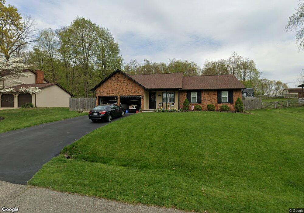
This home is located at 1848 Cedar Cir, Heath, OH 43056 and is currently estimated at $325,426, approximately $207 per square foot. 1848 Cedar Cir is a home located in Licking County with nearby schools including Garfield Elementary School, Stevenson Elementary School, and Heath Middle School.
Ownership History
Date
Name
Owned For
Owner Type
Purchase Details
Closed on
Apr 23, 2015
Sold by
Shaw Thomas C and Shaw Michele
Bought by
Deep Michael H and Deep Linda A
Current Estimated Value
Home Financials for this Owner
Home Financials are based on the most recent Mortgage that was taken out on this home.
Original Mortgage
$83,000
Outstanding Balance
$27,410
Interest Rate
3.77%
Mortgage Type
New Conventional
Estimated Equity
$298,016
Purchase Details
Closed on
Jul 28, 1997
Sold by
Collier Barron G
Bought by
Shaw Thomas C and Shaw Michele
Home Financials for this Owner
Home Financials are based on the most recent Mortgage that was taken out on this home.
Original Mortgage
$111,145
Interest Rate
7.81%
Mortgage Type
FHA
Create a Home Valuation Report for This Property
The Home Valuation Report is an in-depth analysis detailing your home's value as well as a comparison with similar homes in the area
Home Values in the Area
Average Home Value in this Area
Purchase History
We collect this data history from publicly available records. To have your information removed, we recommend requesting removal directly through your county’s website.
| Date | Buyer | Sale Price | Title Company |
|---|---|---|---|
| Deep Michael H | -- | Park Title | |
| Shaw Thomas C | $112,000 | -- |
Source: Public Records
Mortgage History
We collect this data history from publicly available records. To have your information removed, we recommend requesting removal directly through your county’s website.
| Date | Status | Borrower | Loan Amount |
|---|---|---|---|
| Open | Deep Michael H | $83,000 | |
| Previous Owner | Shaw Thomas C | $111,145 |
Source: Public Records
Tax History
| Year | Tax Paid | Tax Assessment Tax Assessment Total Assessment is a certain percentage of the fair market value that is determined by local assessors to be the total taxable value of land and additions on the property. | Land | Improvement |
|---|---|---|---|---|
| 2025 | $3,908 | $88,380 | $20,370 | $68,010 |
| 2024 | $3,802 | $88,380 | $20,370 | $68,010 |
| 2023 | $4,207 | $88,380 | $20,370 | $68,010 |
| 2022 | $3,040 | $56,110 | $11,900 | $44,210 |
| 2021 | $3,102 | $56,110 | $11,900 | $44,210 |
| 2020 | $3,122 | $56,110 | $11,900 | $44,210 |
| 2019 | $2,751 | $50,330 | $11,900 | $38,430 |
| 2018 | $2,781 | $0 | $0 | $0 |
| 2017 | $2,758 | $0 | $0 | $0 |
| 2016 | $2,631 | $0 | $0 | $0 |
| 2015 | $2,737 | $0 | $0 | $0 |
| 2014 | $3,764 | $0 | $0 | $0 |
| 2013 | $2,529 | $0 | $0 | $0 |
Source: Public Records
Map
Nearby Homes
- 1850 Cedar Cir
- 1933 Blue Jay Rd
- 1871 Blue Jay Rd
- 5185 Linnville Rd
- 5280 Cotterman Rd SE
- 1782 Cumberland Crest
- 5500 Linnville Rd SE
- 1664 Watson Rd SE
- 722 Francis Dr
- 1306 Kasey Ct
- 739 Francis Dr
- 723 Francis Dr
- 1444 Blue Jay Rd
- 621 S 2nd St
- 5823 Jacksontown Rd Unit Lot 30
- 445 Linnville Rd SE
- 150 Linnridge Dr Unit Lot 28
- 142 Linnridge Dr Unit Lot 26
- 161 Linnridge Dr Unit Lot 20
- 149 Linnridge Dr Unit Lot 23
Your Personal Tour Guide
Ask me questions while you tour the home.