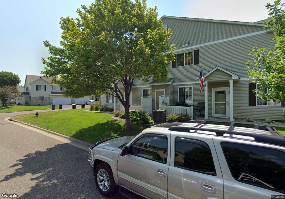
1848 Mockingbird Ave Shakopee, MN 55379
Estimated Value: $257,000 - $274,000
3
Beds
2
Baths
1,562
Sq Ft
$169/Sq Ft
Est. Value
About This Home
This home is located at 1848 Mockingbird Ave, Shakopee, MN 55379 and is currently estimated at $264,217, approximately $169 per square foot. 1848 Mockingbird Ave is a home located in Scott County with nearby schools including Sun Path Elementary School, Shakopee West Middle School, and Shakopee Senior High School.
Ownership History
Date
Name
Owned For
Owner Type
Purchase Details
Closed on
Oct 3, 2017
Sold by
Strand Wendy M
Bought by
Olinger Samuel
Current Estimated Value
Home Financials for this Owner
Home Financials are based on the most recent Mortgage that was taken out on this home.
Original Mortgage
$149,600
Outstanding Balance
$124,824
Interest Rate
3.78%
Mortgage Type
New Conventional
Estimated Equity
$139,393
Purchase Details
Closed on
May 15, 2007
Sold by
Irnka Voil Debbra S and Irnka Timothy J
Bought by
Strand Wendy M
Purchase Details
Closed on
Mar 16, 2000
Sold by
Centex Homes Minnesota Division
Bought by
Voit Debbra S
Create a Home Valuation Report for This Property
The Home Valuation Report is an in-depth analysis detailing your home's value as well as a comparison with similar homes in the area
Home Values in the Area
Average Home Value in this Area
Purchase History
| Date | Buyer | Sale Price | Title Company |
|---|---|---|---|
| Olinger Samuel | $187,000 | On Site Title Llc | |
| Strand Wendy M | $187,500 | -- | |
| Voit Debbra S | $133,155 | -- |
Source: Public Records
Mortgage History
| Date | Status | Borrower | Loan Amount |
|---|---|---|---|
| Open | Olinger Samuel | $149,600 |
Source: Public Records
Tax History
| Year | Tax Paid | Tax Assessment Tax Assessment Total Assessment is a certain percentage of the fair market value that is determined by local assessors to be the total taxable value of land and additions on the property. | Land | Improvement |
|---|---|---|---|---|
| 2025 | $2,554 | $252,600 | $76,100 | $176,500 |
| 2024 | $2,556 | $241,000 | $72,400 | $168,600 |
| 2023 | $2,618 | $237,400 | $71,000 | $166,400 |
| 2022 | $2,674 | $239,100 | $72,700 | $166,400 |
| 2021 | $2,348 | $209,100 | $57,000 | $152,100 |
| 2020 | $2,558 | $200,300 | $47,300 | $153,000 |
| 2019 | $2,454 | $191,100 | $45,000 | $146,100 |
| 2018 | $1,870 | $0 | $0 | $0 |
| 2016 | $1,842 | $0 | $0 | $0 |
| 2014 | -- | $0 | $0 | $0 |
Source: Public Records
Map
Nearby Homes
- 2066 Mockingbird Ave
- 2350 Downing Ave
- 1596 Chartreux Ave
- 1928 Vierling Dr E
- 2423 Tyrone Dr
- 2399 Tyrone Dr
- 2351 Tyrone Dr
- 1227 Elmwood Ave Unit 85
- 1667 Countryside Dr
- 1777 Countryside Dr
- 2542 Mathias Rd
- 2655 King Ave
- 2006 Tyrone Dr
- 1035 Providence Dr
- 2574 Vierling Dr E
- 1624 Philipp Way
- 2795 Downing Ave
- 2817 Downing Ave
- 1542 Philipp Way
- 1790 Colonial St
- 1832 Mockingbird Ave Unit 1104
- 1832 Mockingbird Ave Unit 104
- 1852 Mockingbird Ave Unit 1106
- 1836 Mockingbird Ave
- 1856 Mockingbird Ave
- 1840 Mockingbird Ave
- 1860 Mockingbird Ave
- 1861 Mockingbird Ave
- 1861 Mockingbird Ave Unit 1408
- 1864 Mockingbird Ave Unit 1004
- 1865 Mockingbird Ave
- 1868 Mockingbird Ave
- 1872 Mockingbird Ave
- 1869 Mockingbird Ave
- 1869 Mockingbird Ave Unit 1406
- 1816 Mockingbird Ave
- 1820 1820 Mockingbird Ave
- 1876 Mockingbird Ave
- 1815 Mockingbird Ave Unit 1306
- 1873 Mockingbird Ave Unit 1405
Your Personal Tour Guide
Ask me questions while you tour the home.