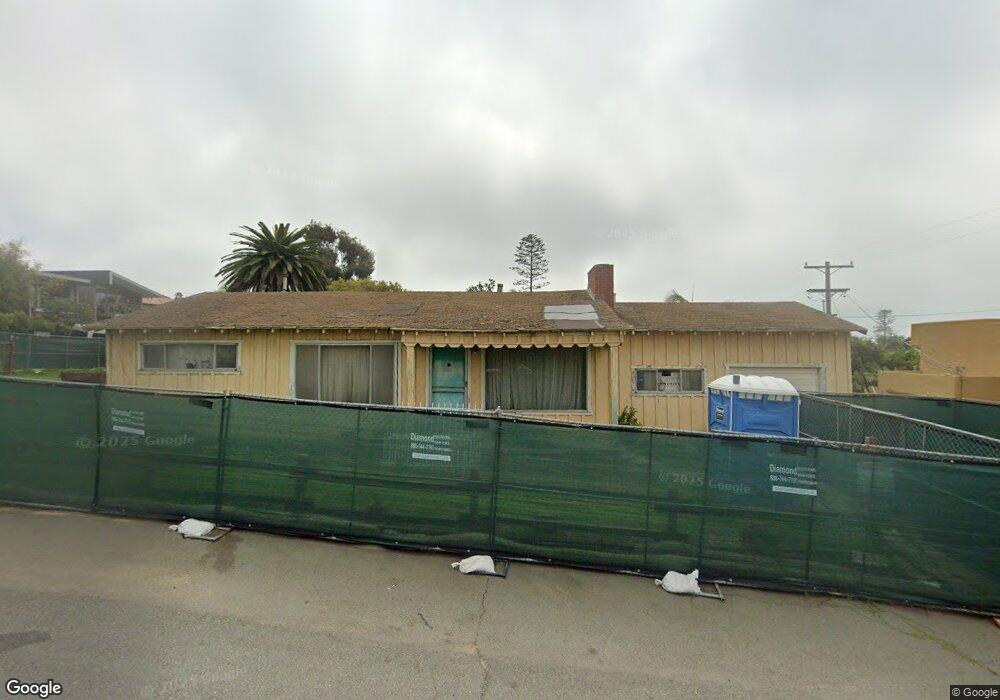
185 E D St Encinitas, CA 92024
Central Encinitas NeighborhoodEstimated Value: $1,747,978 - $2,265,000
3
Beds
1
Bath
1,120
Sq Ft
$1,757/Sq Ft
Est. Value
About This Home
This home is located at 185 E D St, Encinitas, CA 92024 and is currently estimated at $1,967,495, approximately $1,756 per square foot. 185 E D St is a home located in San Diego County with nearby schools including Paul Ecke-Central Elementary, Oak Crest Middle School, and La Costa Canyon High School.
Ownership History
Date
Name
Owned For
Owner Type
Purchase Details
Closed on
May 21, 1999
Sold by
S A G Trust 07-29-94 and Kwongsing George
Bought by
Yee George Kwongsing and Wong Yee Anna
Current Estimated Value
Home Financials for this Owner
Home Financials are based on the most recent Mortgage that was taken out on this home.
Original Mortgage
$170,250
Interest Rate
6.47%
Purchase Details
Closed on
Nov 9, 1995
Sold by
Lusitana Robert J and Austin James G
Bought by
Yee George and Yee Anna Wong
Create a Home Valuation Report for This Property
The Home Valuation Report is an in-depth analysis detailing your home's value as well as a comparison with similar homes in the area
Home Values in the Area
Average Home Value in this Area
Purchase History
| Date | Buyer | Sale Price | Title Company |
|---|---|---|---|
| Yee George Kwongsing | -- | Commonwealth Land Title Co | |
| Yee George | -- | Fidelity National Title |
Source: Public Records
Mortgage History
| Date | Status | Borrower | Loan Amount |
|---|---|---|---|
| Closed | Yee George Kwongsing | $170,250 |
Source: Public Records
Tax History
| Year | Tax Paid | Tax Assessment Tax Assessment Total Assessment is a certain percentage of the fair market value that is determined by local assessors to be the total taxable value of land and additions on the property. | Land | Improvement |
|---|---|---|---|---|
| 2025 | $886 | $73,876 | $25,156 | $48,720 |
| 2024 | $886 | $72,428 | $24,663 | $47,765 |
| 2023 | $859 | $71,009 | $24,180 | $46,829 |
| 2022 | $842 | $69,617 | $23,706 | $45,911 |
| 2021 | $831 | $68,253 | $23,242 | $45,011 |
| 2020 | $821 | $67,554 | $23,004 | $44,550 |
| 2019 | $805 | $66,230 | $22,553 | $43,677 |
| 2018 | $790 | $64,932 | $22,111 | $42,821 |
| 2017 | $191 | $63,660 | $21,678 | $41,982 |
| 2016 | $751 | $62,412 | $21,253 | $41,159 |
| 2015 | $742 | $61,475 | $20,934 | $40,541 |
| 2014 | $730 | $60,271 | $20,524 | $39,747 |
Source: Public Records
Map
Nearby Homes
- 554 & 556 Stratford Dr
- 233 Mangano Cir
- 823 Stratford Dr
- 103 Mangano Cir
- 687 S Coast Highway 101 Unit 223
- 405 Requeza St Unit H9
- 407 Requeza St Unit E9
- 90 N Coast Highway 101 Unit 310
- 215 2nd St Unit 101
- 538 4th St
- 548 Quail Pointe Ln
- 201 4th St Unit A & B
- 937 3rd St
- 806 4th St
- 135 4th St
- 231 5th St
- 922 Sealane Dr Unit B
- 215 N Vulcan Ave
- 537 Sweet Pea Place
- 370 Carmel Creeper Place Unit 8
- 524 Arden Dr
- 165 E D St
- 0000 Arden Dr
- 477 Arden Dr
- 530 Arden Dr Unit 32
- 228 Triton Cir
- 155 E D St
- 465 Arden Dr
- 527 San Dieguito Dr
- 240 Triton Cir
- 505 Arden Dr
- 519 Arden Dr
- 486 Arden Dr
- 216 Triton Cir
- 544 Arden Dr
- 529 Arden Dr
- 472 Arden Dr
- 252 Triton Cir
- 541 San Dieguito Dr Unit SI ID1048645P
- 541 San Dieguito Dr Unit ID1048645P
Your Personal Tour Guide
Ask me questions while you tour the home.