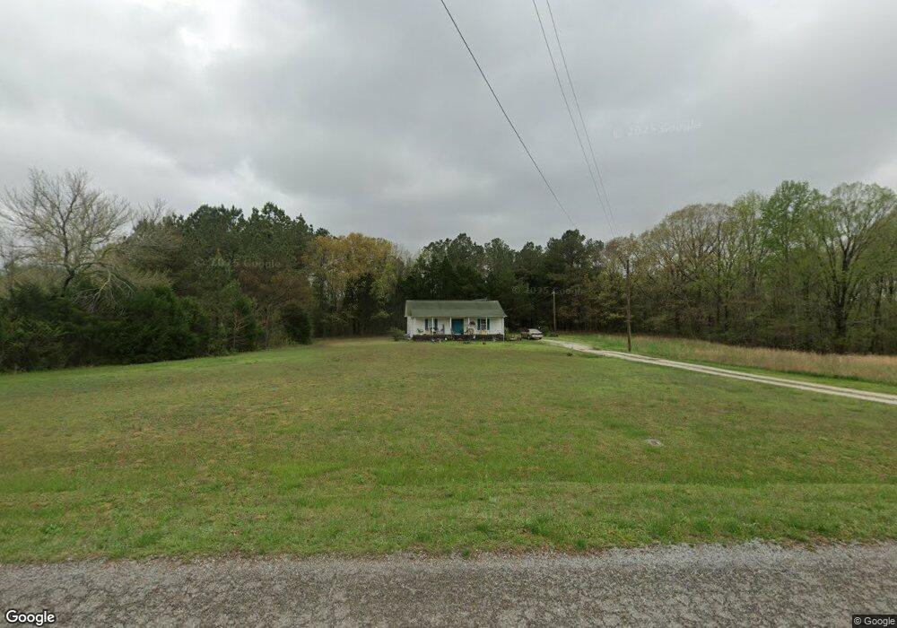
185 Loop Rd Big Sandy, TN 38221
Estimated Value: $138,295 - $198,000
--
Bed
1
Bath
1,040
Sq Ft
$159/Sq Ft
Est. Value
About This Home
This home is located at 185 Loop Rd, Big Sandy, TN 38221 and is currently estimated at $165,098, approximately $158 per square foot. 185 Loop Rd is a home located in Benton County with nearby schools including Big Sandy School.
Ownership History
Date
Name
Owned For
Owner Type
Purchase Details
Closed on
Apr 9, 2015
Sold by
Napoli Steven
Bought by
Jones Bonnie L
Current Estimated Value
Purchase Details
Closed on
Jun 30, 2006
Sold by
Cole R David
Bought by
Napoli Steven and Napoli
Purchase Details
Closed on
Jan 26, 2005
Sold by
Cole R David
Bought by
Cole R David and Cole Sheila J
Purchase Details
Closed on
Feb 17, 1999
Bought by
Cole R David R and Cole Leannda
Create a Home Valuation Report for This Property
The Home Valuation Report is an in-depth analysis detailing your home's value as well as a comparison with similar homes in the area
Home Values in the Area
Average Home Value in this Area
Purchase History
| Date | Buyer | Sale Price | Title Company |
|---|---|---|---|
| Jones Bonnie L | -- | -- | |
| Napoli Steven | $65,000 | -- | |
| Cole R David | -- | -- | |
| Cole R David | -- | -- | |
| Cole R David R | -- | -- |
Source: Public Records
Tax History Compared to Growth
Tax History
| Year | Tax Paid | Tax Assessment Tax Assessment Total Assessment is a certain percentage of the fair market value that is determined by local assessors to be the total taxable value of land and additions on the property. | Land | Improvement |
|---|---|---|---|---|
| 2024 | $548 | $20,075 | $2,075 | $18,000 |
| 2023 | $548 | $20,075 | $2,075 | $18,000 |
| 2022 | $548 | $20,075 | $2,075 | $18,000 |
| 2021 | $548 | $20,075 | $2,075 | $18,000 |
| 2020 | $548 | $20,075 | $2,075 | $18,000 |
| 2019 | $585 | $19,825 | $2,075 | $17,750 |
| 2018 | $585 | $19,825 | $2,075 | $17,750 |
| 2017 | $585 | $19,825 | $2,075 | $17,750 |
| 2016 | $585 | $19,825 | $2,075 | $17,750 |
| 2015 | $593 | $19,825 | $2,075 | $17,750 |
| 2014 | -- | $19,825 | $2,075 | $17,750 |
| 2013 | -- | $18,925 | $0 | $0 |
Source: Public Records
Map
Nearby Homes
- 1530 Prince Rd
- 540 Rolling Oak Dr
- 175 Rolling Oak Dr
- 9825 Highway 69a
- 3636 Reynoldsburg Rd
- 179 French Ln
- 674 Cantrell Rd
- 0 Mount Zion Rd
- 3855 Sulphur Creek Rd
- 1779 Mount Zion Rd
- 4820 Highway 641 N
- 5132 Sulphur Creek Rd
- 0 Hwy 641 N Unit 134811
- 0 Hwy 641 N Unit RTC2699308
- 0 Hwy 641 N Unit 131394
- 0 Hwy 641 N Unit 124817
- 5460 Sulphur Creek Rd
- 129 Tom White Rd
- 628 Tom White Rd
- 285 Tom White Rd
- 245 Loop Rd
- 8160 Highway 69a
- 8090 Tennessee 69a
- 8217 Highway 69a
- 368 Loop Rd
- 311 Loop Rd
- 8315 Highway 69a
- 7988 Highway 69a
- 448 Loop Rd
- 308 Loop Rd
- 495 Loop Rd
- 1240 Prince Rd
- 8430 Highway 69a
- 7925 Highway 69a
- 8460 Highway 69a
- 7840 Tennessee 69a
- 7840 Highway 69a
- 8500 Highway 69a
- 8500 Tennessee 69a
- 7875 Highway 69a