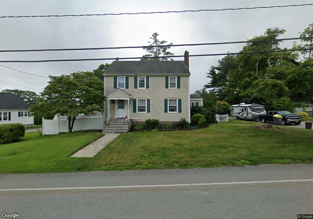
185 Read St Somerset, MA 02726
Brayton Point NeighborhoodEstimated Value: $482,000 - $511,578
3
Beds
2
Baths
1,488
Sq Ft
$336/Sq Ft
Est. Value
About This Home
This home is located at 185 Read St, Somerset, MA 02726 and is currently estimated at $500,395, approximately $336 per square foot. 185 Read St is a home located in Bristol County with nearby schools including Chace Street School, Somerset Middle School, and St. Michael's School.
Ownership History
Date
Name
Owned For
Owner Type
Purchase Details
Closed on
Feb 3, 2015
Sold by
Bates Paul D and Bates Ines
Bought by
Bates Ines
Current Estimated Value
Purchase Details
Closed on
Dec 7, 1988
Sold by
Kwasnik Joseph M
Bought by
Bates Paul D
Home Financials for this Owner
Home Financials are based on the most recent Mortgage that was taken out on this home.
Original Mortgage
$146,200
Interest Rate
10.17%
Mortgage Type
Purchase Money Mortgage
Create a Home Valuation Report for This Property
The Home Valuation Report is an in-depth analysis detailing your home's value as well as a comparison with similar homes in the area
Home Values in the Area
Average Home Value in this Area
Purchase History
| Date | Buyer | Sale Price | Title Company |
|---|---|---|---|
| Bates Ines | -- | -- | |
| Bates Ines | -- | -- | |
| Bates Paul D | $162,500 | -- |
Source: Public Records
Mortgage History
| Date | Status | Borrower | Loan Amount |
|---|---|---|---|
| Previous Owner | Bates Paul D | $100,000 | |
| Previous Owner | Bates Paul D | $176,500 | |
| Previous Owner | Bates Paul D | $143,700 | |
| Previous Owner | Bates Paul D | $146,200 |
Source: Public Records
Tax History Compared to Growth
Tax History
| Year | Tax Paid | Tax Assessment Tax Assessment Total Assessment is a certain percentage of the fair market value that is determined by local assessors to be the total taxable value of land and additions on the property. | Land | Improvement |
|---|---|---|---|---|
| 2025 | $5,957 | $447,900 | $170,100 | $277,800 |
| 2024 | $5,459 | $426,800 | $170,100 | $256,700 |
| 2023 | $4,730 | $373,000 | $141,600 | $231,400 |
| 2022 | $4,367 | $328,600 | $122,000 | $206,600 |
| 2021 | $4,398 | $299,600 | $110,200 | $189,400 |
| 2020 | $4,295 | $282,200 | $110,300 | $171,900 |
| 2019 | $4,878 | $267,300 | $110,300 | $157,000 |
| 2018 | $4,220 | $248,800 | $105,300 | $143,500 |
| 2017 | $4,120 | $236,800 | $100,000 | $136,800 |
| 2016 | $4,146 | $236,800 | $100,000 | $136,800 |
| 2015 | $3,885 | $223,900 | $95,100 | $128,800 |
| 2014 | $5,168 | $214,000 | $95,100 | $118,900 |
Source: Public Records
Map
Nearby Homes
- 66 Meadow Ln
- 80 Meadow Ln
- 34 Doherty Ave
- 82 Perry Ave
- 1496 Riverside Ave
- 8 Tower Hill Rd
- 24 Knapp St
- 337 Lepes Rd
- 126 Jaffrey St
- 21 Bradley Ave
- 95 Caroline Ave
- 55 Dias Terrace
- 82 Wellington St
- 96 Wellington St
- 105 Cornhill Rd
- 33 Rhinecliffe Rd
- 197 Alberta Ave
- 2396 Riverside Ave
- 1928 N Main St Unit 4
- 51 Linden Dr