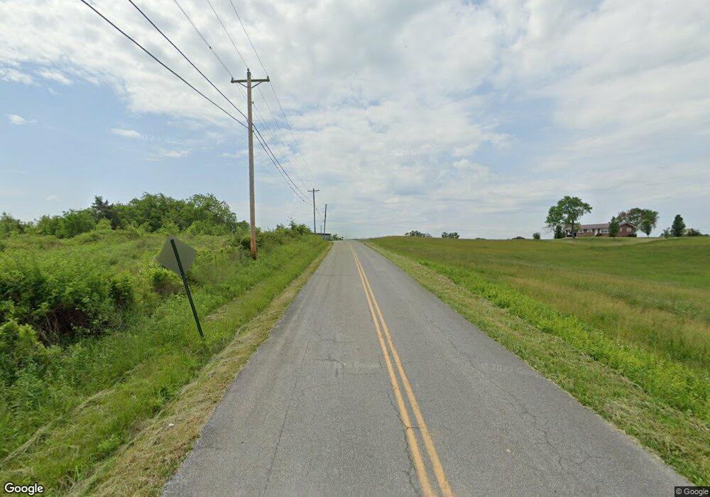
185 S Mohawk Rd Mohawk, TN 37810
Estimated Value: $650,000 - $865,389
Studio
1
Bath
914
Sq Ft
$829/Sq Ft
Est. Value
About This Home
This home is located at 185 S Mohawk Rd, Mohawk, TN 37810 and is currently estimated at $757,695, approximately $828 per square foot. 185 S Mohawk Rd is a home located in Greene County with nearby schools including McDonald Elementary School, West Greene Middle Schools, and West Greene High School.
Ownership History
Date
Name
Owned For
Owner Type
Purchase Details
Closed on
Jul 11, 2013
Sold by
Knipp William L
Bought by
Knipp William L Family Trust Janet M Knipp Tr
Current Estimated Value
Purchase Details
Closed on
Nov 22, 2005
Sold by
Knipp William L
Bought by
Knipp William L
Purchase Details
Closed on
Jan 5, 2005
Sold by
Gp Lawsons Corners
Bought by
Quality Properties Lp
Purchase Details
Closed on
Oct 2, 2002
Sold by
Ayers Doras H
Bought by
Knipp William L
Purchase Details
Closed on
Aug 27, 2002
Sold by
Ayers Doras H
Bought by
Corners Lawsons
Create a Home Valuation Report for This Property
The Home Valuation Report is an in-depth analysis detailing your home's value as well as a comparison with similar homes in the area
Purchase History
| Date | Buyer | Sale Price | Title Company |
|---|---|---|---|
| Knipp William L Family Trust Janet M Knipp Tr | -- | -- | |
| Knipp Janet M | -- | -- | |
| Knipp William L | -- | -- | |
| Quality Properties Lp | $287,500 | -- | |
| Knipp William L | $306,075 | -- | |
| Corners Lawsons | $225,000 | -- |
Source: Public Records
Tax History
| Year | Tax Paid | Tax Assessment Tax Assessment Total Assessment is a certain percentage of the fair market value that is determined by local assessors to be the total taxable value of land and additions on the property. | Land | Improvement |
|---|---|---|---|---|
| 2025 | -- | $27,450 | $27,450 | -- |
| 2024 | -- | $27,450 | $27,450 | -- |
| 2023 | $0 | $27,450 | $0 | $0 |
| 2022 | $677 | $33,600 | $28,375 | $5,225 |
| 2021 | $677 | $33,600 | $28,375 | $5,225 |
| 2020 | $715 | $33,600 | $28,375 | $5,225 |
| 2019 | $677 | $33,600 | $28,375 | $5,225 |
| 2018 | $715 | $35,475 | $28,375 | $7,100 |
| 2017 | $656 | $33,250 | $27,600 | $5,650 |
| 2016 | $623 | $33,250 | $27,600 | $5,650 |
| 2015 | $623 | $33,250 | $27,600 | $5,650 |
| 2014 | $623 | $33,250 | $27,600 | $5,650 |
Source: Public Records
Map
Nearby Homes
- 1700 Westwood Rd
- 1530 Westwood Rd
- 1550 Mount Hope #2 Rd
- 1550 Mount Hope #1 Rd
- 1550 Mount Hope Rd Unit 2
- 1550 Mount Hope Rd Unit 1
- 1550 Mount Hope Rd
- Tbd Copperhead Hollow Rd Unit LotWP001
- 100 Democrat Rd
- 780 Murray Bridge Rd
- 00 Glades Rd
- 3456 Warrensburg
- 3456 Warrensburg Rd
- 1530 Easterly Rd
- 4045 S Mohawk Rd
- 860 Yellow Springs Rd
- 3.35 Oakwood Rd
- N/A Oakwood Rd
- 2750 Mountain Rd
- 915 Porter Kite Rd
- 645 Tom Lawson Rd
- 765 Tom Lawson Rd
- 700 Tom Lawson Rd
- 870 Tom Lawson Rd
- 565 Tom Lawson Rd
- Lot 12 Matthews Loop Rd
- Lot 13 Matthews Loop Rd
- 95 Matthews Loop
- 990 Westwood Rd
- 645 Mount Hope Rd
- 290 Matthews Loop
- 1100 Westwood Rd
- 345 Matthews Loop
- 1145 Westwood Rd
- 585 Mount Hope Rd
- 365 Matthews Loop
- 485 Mount Hope Rd
- 242 Tom Lawson Rd
- 242 Tom Lawson Rd
- TBD Little Warrensburg Rd
