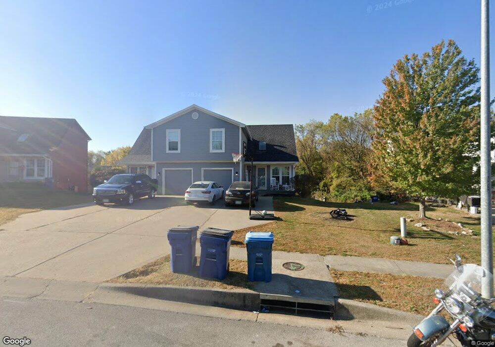
1851 Kingbird Ln Liberty, MO 64068
Estimated Value: $401,000 - $458,000
3
Beds
4
Baths
2,874
Sq Ft
$150/Sq Ft
Est. Value
About This Home
This home is located at 1851 Kingbird Ln, Liberty, MO 64068 and is currently estimated at $430,594, approximately $149 per square foot. 1851 Kingbird Ln is a home located in Clay County with nearby schools including Lillian Schumacher Elementary School, Liberty Middle School, and Liberty High School.
Ownership History
Date
Name
Owned For
Owner Type
Purchase Details
Closed on
Mar 7, 2023
Sold by
Blanch Chad and Blanch Bryanna
Bought by
5153 Kingbird Llc
Current Estimated Value
Purchase Details
Closed on
Jan 4, 2022
Sold by
Mingus Killorgen Properties Llc
Bought by
Blanch Chad and Blanch Bbryanna
Purchase Details
Closed on
Dec 11, 2015
Sold by
Gaunt Roger N and Gaunt Mary Lou
Bought by
Mingus Killorgen Properties Llc
Purchase Details
Closed on
Dec 7, 1999
Sold by
Robertson Construction Llc
Bought by
Gaunt Roger N and Gaunt Mary Lou
Home Financials for this Owner
Home Financials are based on the most recent Mortgage that was taken out on this home.
Original Mortgage
$154,600
Interest Rate
7.84%
Create a Home Valuation Report for This Property
The Home Valuation Report is an in-depth analysis detailing your home's value as well as a comparison with similar homes in the area
Home Values in the Area
Average Home Value in this Area
Purchase History
| Date | Buyer | Sale Price | Title Company |
|---|---|---|---|
| 5153 Kingbird Llc | -- | -- | |
| Blanch Chad | -- | None Available | |
| Mingus Killorgen Properties Llc | -- | None Available | |
| Gaunt Roger N | -- | Thomson Title Corporation |
Source: Public Records
Mortgage History
| Date | Status | Borrower | Loan Amount |
|---|---|---|---|
| Previous Owner | Gaunt Roger N | $154,600 |
Source: Public Records
Tax History Compared to Growth
Tax History
| Year | Tax Paid | Tax Assessment Tax Assessment Total Assessment is a certain percentage of the fair market value that is determined by local assessors to be the total taxable value of land and additions on the property. | Land | Improvement |
|---|---|---|---|---|
| 2025 | $4,095 | $61,160 | -- | -- |
| 2024 | $4,095 | $53,240 | -- | -- |
| 2023 | $4,164 | $53,240 | $0 | $0 |
| 2022 | $3,803 | $48,010 | $0 | $0 |
| 2021 | $3,773 | $48,013 | $6,650 | $41,363 |
| 2020 | $3,432 | $41,000 | $0 | $0 |
| 2019 | $3,431 | $41,000 | $0 | $0 |
| 2018 | $2,866 | $33,630 | $0 | $0 |
| 2017 | $2,840 | $33,630 | $4,560 | $29,070 |
| 2016 | $2,840 | $33,630 | $4,560 | $29,070 |
| 2015 | $2,840 | $33,630 | $4,560 | $29,070 |
| 2014 | $2,863 | $33,630 | $4,560 | $29,070 |
Source: Public Records
Map
Nearby Homes
- 1872 Kingbird Ln
- 1876 Kingbird Ln
- 3.86 acres Southview Dr
- 2504 Magnolia Ave
- 345 Cates Ct
- 1847 Mallard Dr
- 450 E Ruth Ewing Rd
- 1103 Pier
- 1905 Claywoods Pkwy
- 1004 Hackberry Ct
- 1435 Sumac Cir
- 1112 White Birch St
- 1116 Silverleaf Ln
- 1044 Silverleaf Ln
- 1024 Redwood Ln
- 1955 Birmingham Rd
- 429 Lilly Ln
- 1059 Fir Ln
- 900 White Oak Ln
- 1051 Fir Ln
- 1853 Kingbird Ln
- 1847 Kingbird Ln
- 1855 Kingbird Ln
- 1845 Kingbird Ln
- 1837 Chickadee Dr
- 1859 Kingbird Ln
- 1836 Chickadee Dr
- 1843 Kingbird Ln
- 1861 Kingbird Ln
- 1864 Kingbird Ln
- 1862 Kingbird Ln
- 1866 Kingbird Ln
- 1838 Chickadee Dr
- 1860 Kingbird Ln
- 1839 Kingbird Ln
- 1840 Chickadee Dr
- 1865 Kingbird Ct
- 1863 Kingbird Ct
- 1868 Kingbird Ln
- 1867 Kingbird Ct