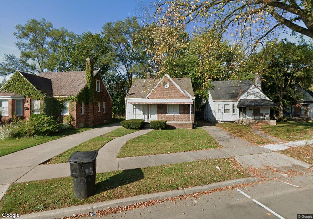
18527 Morang Dr Detroit, MI 48205
Maple Ridge NeighborhoodEstimated Value: $64,820 - $77,000
3
Beds
1
Bath
1,200
Sq Ft
$61/Sq Ft
Est. Value
About This Home
This home is located at 18527 Morang Dr, Detroit, MI 48205 and is currently estimated at $72,955, approximately $60 per square foot. 18527 Morang Dr is a home located in Wayne County with nearby schools including Edward 'Duke' Ellington Conservatory of Music and Art, Charles L. Spain Elementary-Middle School, and Denby High School.
Ownership History
Date
Name
Owned For
Owner Type
Purchase Details
Closed on
Jun 11, 2021
Sold by
Reed Melvin L and Reed Anne Marie
Bought by
Reed Anne Marie
Current Estimated Value
Purchase Details
Closed on
Sep 27, 2010
Sold by
Wells Fargo Bank Na
Bought by
Federal National Mortgage Association
Purchase Details
Closed on
Sep 22, 2010
Sold by
Fuga Mark and Fuga Deborah T
Bought by
Wells Fargo Bank Na and Americas Servicing Company
Create a Home Valuation Report for This Property
The Home Valuation Report is an in-depth analysis detailing your home's value as well as a comparison with similar homes in the area
Home Values in the Area
Average Home Value in this Area
Purchase History
| Date | Buyer | Sale Price | Title Company |
|---|---|---|---|
| Reed Anne Marie | -- | None Available | |
| Federal National Mortgage Association | -- | None Available | |
| Wells Fargo Bank Na | $58,849 | None Available |
Source: Public Records
Tax History Compared to Growth
Tax History
| Year | Tax Paid | Tax Assessment Tax Assessment Total Assessment is a certain percentage of the fair market value that is determined by local assessors to be the total taxable value of land and additions on the property. | Land | Improvement |
|---|---|---|---|---|
| 2025 | $918 | $28,000 | $0 | $0 |
| 2024 | $918 | $26,300 | $0 | $0 |
| 2023 | $890 | $21,300 | $0 | $0 |
| 2022 | $967 | $17,900 | $0 | $0 |
| 2021 | $944 | $12,400 | $0 | $0 |
| 2020 | $935 | $10,900 | $0 | $0 |
| 2019 | $922 | $9,800 | $0 | $0 |
| 2018 | $797 | $9,500 | $0 | $0 |
| 2017 | $176 | $9,700 | $0 | $0 |
| 2016 | $891 | $10,800 | $0 | $0 |
| 2015 | $1,080 | $10,800 | $0 | $0 |
| 2013 | $1,501 | $15,006 | $0 | $0 |
| 2010 | -- | $22,000 | $969 | $21,031 |
Source: Public Records
Map
Nearby Homes
- 15646 Saratoga St
- 15480 Saratoga St
- 18814 Morang Dr
- 15611 Mapleridge St
- 18820 Morang Dr
- 15596 Eastwood St
- 15762 Glenwood St
- 15315 Park Grove St
- 15860 Faircrest St
- 15666 Eastwood St
- 15470 Mapleridge St
- 15294 Saratoga St
- 15309 Mapleridge St
- 15430 Mapleridge St
- 15257 Faircrest St
- 18344 Kelly Rd
- 15227 Linnhurst St
- 18639 Kelly Rd
- 15860 Fordham St
- 12713 Payton St
- 18537 Morang Dr
- 18545 Morang Dr
- 18509 Morang Dr
- 15631 Glenwood St
- 15610 Linnhurst St
- 15617 Glenwood St
- 18601 Morang Dr
- 15611 Glenwood St
- 18600 Morang Dr
- 18616 Morang Dr
- 18626 Morang Dr
- 18550 Morang Dr
- 18540 Morang Ave
- 15603 Glenwood St
- 18609 Morang Dr Unit Bldg-Unit
- 18609 Morang Dr
- 15640 Glenwood St
- 18445 Morang Dr
- 18632 Morang Dr
- 15600 Linnhurst St