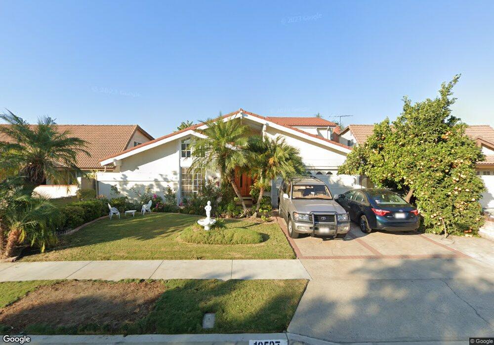
18527 Newbrook Cir Cerritos, CA 90703
Estimated Value: $1,209,372 - $1,366,000
4
Beds
3
Baths
2,171
Sq Ft
$592/Sq Ft
Est. Value
About This Home
This home is located at 18527 Newbrook Cir, Cerritos, CA 90703 and is currently estimated at $1,284,593, approximately $591 per square foot. 18527 Newbrook Cir is a home located in Los Angeles County with nearby schools including Cerritos Elementary School, Carmenita Middle School, and Cerritos High School.
Ownership History
Date
Name
Owned For
Owner Type
Purchase Details
Closed on
Mar 6, 1999
Sold by
Quinto Eva V
Bought by
Quinto Eva and The Eva V Quinto Revocable Living Trust
Current Estimated Value
Purchase Details
Closed on
Jun 16, 1998
Sold by
Leano Eva Q
Bought by
Quinto Eva
Home Financials for this Owner
Home Financials are based on the most recent Mortgage that was taken out on this home.
Original Mortgage
$75,000
Interest Rate
7.11%
Purchase Details
Closed on
Dec 18, 1995
Sold by
Leano Crispin I
Bought by
Leano Eva Q
Create a Home Valuation Report for This Property
The Home Valuation Report is an in-depth analysis detailing your home's value as well as a comparison with similar homes in the area
Home Values in the Area
Average Home Value in this Area
Purchase History
| Date | Buyer | Sale Price | Title Company |
|---|---|---|---|
| Quinto Eva | -- | -- | |
| Quinto Eva | -- | Southland Title | |
| Leano Eva Q | -- | -- |
Source: Public Records
Mortgage History
| Date | Status | Borrower | Loan Amount |
|---|---|---|---|
| Closed | Quinto Eva | $75,000 |
Source: Public Records
Tax History Compared to Growth
Tax History
| Year | Tax Paid | Tax Assessment Tax Assessment Total Assessment is a certain percentage of the fair market value that is determined by local assessors to be the total taxable value of land and additions on the property. | Land | Improvement |
|---|---|---|---|---|
| 2025 | $4,381 | $350,400 | $100,255 | $250,145 |
| 2024 | $4,381 | $343,531 | $98,290 | $245,241 |
| 2023 | $4,244 | $336,796 | $96,363 | $240,433 |
| 2022 | $4,177 | $330,193 | $94,474 | $235,719 |
| 2021 | $4,072 | $323,720 | $92,622 | $231,098 |
| 2019 | $3,978 | $314,121 | $89,876 | $224,245 |
| 2018 | $3,669 | $307,963 | $88,114 | $219,849 |
| 2016 | $3,504 | $296,007 | $84,694 | $211,313 |
| 2015 | $3,460 | $291,561 | $83,422 | $208,139 |
| 2014 | $3,396 | $285,850 | $81,788 | $204,062 |
Source: Public Records
Map
Nearby Homes
- 18517 Betty Way
- 7152 Caprice Cir
- 5412 Bransford Dr
- 19118 Martha Ave
- 13210 Sutton St
- 13044 Hedda Ln
- 18006 Point Conception Place
- 5568 Ozawa Cir
- 19008 Jeffrey Ave
- 5686 Panama Dr
- 5836 Trinidad Way
- 13370 Holly Oak Cir
- 13010 Artesia Blvd
- 5072 Alder Ln
- 7571 San Rafael Dr
- 12967 Moorshire Dr
- 5212 Lena Dr
- 12711 Castleford Ln
- 7862 Squaw Valley Way
- 19335 Derbyshire Ln
- 18521 Newbrook Cir
- 18531 Newbrook Cir
- 18526 Linda Cir
- 18517 Newbrook Cir
- 18537 Newbrook Cir
- 18520 Linda Cir
- 18532 Linda Cir
- 18514 Linda Cir
- 18538 Linda Cir
- 18526 Newbrook Cir
- 18511 Newbrook Cir
- 18520 Newbrook Cir
- 18530 Newbrook Cir
- 18543 Newbrook Cir
- 18508 Linda Cir
- 18516 Newbrook Cir
- 18536 Newbrook Cir
- 18542 Linda Cir
- 18549 Newbrook Cir
- 18505 Newbrook Cir