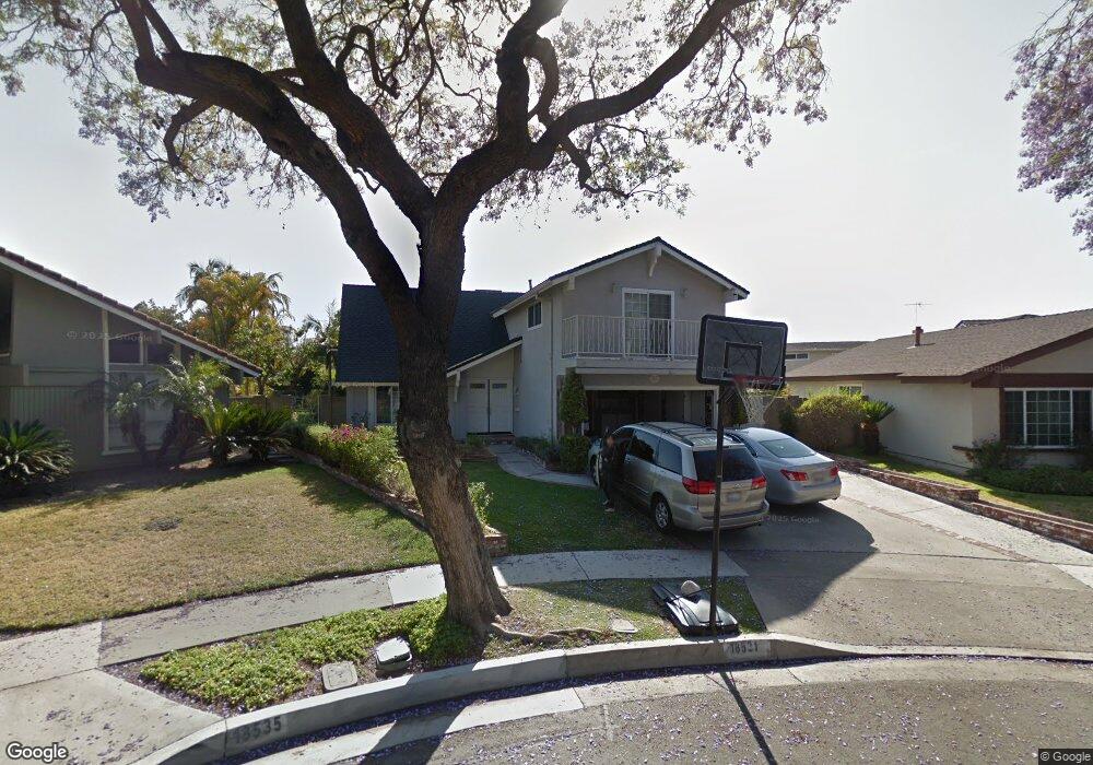
18531 Laurelbrook Cir Cerritos, CA 90703
Estimated Value: $1,262,311 - $1,381,000
3
Beds
3
Baths
2,394
Sq Ft
$541/Sq Ft
Est. Value
About This Home
This home is located at 18531 Laurelbrook Cir, Cerritos, CA 90703 and is currently estimated at $1,296,328, approximately $541 per square foot. 18531 Laurelbrook Cir is a home located in Los Angeles County with nearby schools including Cerritos Elementary School, Carmenita Middle School, and Cerritos High School.
Ownership History
Date
Name
Owned For
Owner Type
Purchase Details
Closed on
Apr 9, 2019
Sold by
Hamakawa Glen I and Hamakawa Irene S
Bought by
Hamakawa Family Trust
Current Estimated Value
Purchase Details
Closed on
Jul 28, 1999
Sold by
Kimball Michael J and Kimball Susan J
Bought by
Hamakawa Glen I and Hamakawa Irene S
Home Financials for this Owner
Home Financials are based on the most recent Mortgage that was taken out on this home.
Original Mortgage
$300,000
Interest Rate
8.09%
Create a Home Valuation Report for This Property
The Home Valuation Report is an in-depth analysis detailing your home's value as well as a comparison with similar homes in the area
Home Values in the Area
Average Home Value in this Area
Purchase History
| Date | Buyer | Sale Price | Title Company |
|---|---|---|---|
| Hamakawa Family Trust | -- | Accommodation | |
| Hamakawa Glen I | $375,000 | Commonwealth Land Title Co |
Source: Public Records
Mortgage History
| Date | Status | Borrower | Loan Amount |
|---|---|---|---|
| Previous Owner | Hamakawa Glen I | $300,000 |
Source: Public Records
Tax History
| Year | Tax Paid | Tax Assessment Tax Assessment Total Assessment is a certain percentage of the fair market value that is determined by local assessors to be the total taxable value of land and additions on the property. | Land | Improvement |
|---|---|---|---|---|
| 2025 | $6,925 | $576,339 | $290,475 | $285,864 |
| 2024 | $6,925 | $565,039 | $284,780 | $280,259 |
| 2023 | $6,700 | $553,961 | $279,197 | $274,764 |
| 2022 | $6,597 | $543,100 | $273,723 | $269,377 |
| 2021 | $6,436 | $532,452 | $268,356 | $264,096 |
| 2019 | $6,286 | $516,662 | $260,398 | $256,264 |
| 2018 | $5,831 | $506,533 | $255,293 | $251,240 |
| 2016 | $5,587 | $486,866 | $245,381 | $241,485 |
| 2015 | $5,516 | $479,554 | $241,696 | $237,858 |
| 2014 | $5,407 | $470,161 | $236,962 | $233,199 |
Source: Public Records
Map
Nearby Homes
- 13506 Darvalle St
- 18727 Holmes Ave
- 5161 Dumaine Dr
- 13325 Ashworth St
- 5271 Niguel Dr
- 17405 Jasmine Way
- 5865 Brazil Dr
- 5826 Bolivia Dr
- 5568 Ozawa Cir
- 13626 Aclare Ln
- 13044 Hedda Ln
- 5836 Trinidad Way
- 7582 Silverado Ln
- 18006 Point Conception Place
- 19008 Jeffrey Ave
- 7425 Bradley Dr
- 5091 Sharon Dr
- 17105 Holmes Cir
- 13026 San Salvador Place
- 5231 Bridgewood Dr
- 18535 Laurelbrook Cir
- 18525 Laurelbrook Cir
- 18530 Newbrook Cir
- 18536 Newbrook Cir
- 18526 Newbrook Cir
- 18542 Newbrook Cir
- 18534 Laurelbrook Cir
- 13639 Darvalle St
- 13643 Darvalle St
- 18519 Laurelbrook Cir
- 18520 Newbrook Cir
- 18548 Newbrook Cir
- 13647 Darvalle St
- 18530 Laurelbrook Cir
- 18515 Laurelbrook Cir
- 18516 Newbrook Cir
- 13710 Visroy Ave
- 13716 Visroy Ave
- 18531 Newbrook Cir
- 18537 Newbrook Cir
Your Personal Tour Guide
Ask me questions while you tour the home.