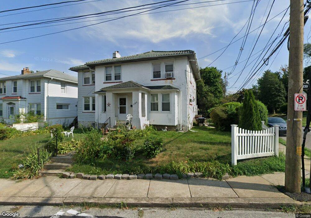
186 E Plumstead Ave Lansdowne, PA 19050
Estimated Value: $354,000 - $417,478
4
Beds
2
Baths
2,766
Sq Ft
$143/Sq Ft
Est. Value
About This Home
This home is located at 186 E Plumstead Ave, Lansdowne, PA 19050 and is currently estimated at $395,120, approximately $142 per square foot. 186 E Plumstead Ave is a home located in Delaware County with nearby schools including East Lansdowne Elementary School, Penn Wood Middle School, and Penn Wood High School - Cypress Street Campus.
Ownership History
Date
Name
Owned For
Owner Type
Purchase Details
Closed on
Oct 24, 2001
Sold by
Hill Joseph and Hill Shirley
Bought by
Alexander Lloyd C and Alexander Doris
Current Estimated Value
Home Financials for this Owner
Home Financials are based on the most recent Mortgage that was taken out on this home.
Original Mortgage
$89,900
Outstanding Balance
$35,113
Interest Rate
6.86%
Mortgage Type
VA
Estimated Equity
$360,007
Create a Home Valuation Report for This Property
The Home Valuation Report is an in-depth analysis detailing your home's value as well as a comparison with similar homes in the area
Home Values in the Area
Average Home Value in this Area
Purchase History
| Date | Buyer | Sale Price | Title Company |
|---|---|---|---|
| Alexander Lloyd C | $89,900 | -- |
Source: Public Records
Mortgage History
| Date | Status | Borrower | Loan Amount |
|---|---|---|---|
| Open | Alexander Lloyd C | $89,900 |
Source: Public Records
Tax History
| Year | Tax Paid | Tax Assessment Tax Assessment Total Assessment is a certain percentage of the fair market value that is determined by local assessors to be the total taxable value of land and additions on the property. | Land | Improvement |
|---|---|---|---|---|
| 2025 | $8,953 | $217,450 | $65,510 | $151,940 |
| 2024 | $8,953 | $217,450 | $65,510 | $151,940 |
| 2023 | $8,536 | $217,450 | $65,510 | $151,940 |
| 2022 | $8,368 | $217,450 | $65,510 | $151,940 |
| 2021 | $12,566 | $217,450 | $65,510 | $151,940 |
| 2020 | $7,214 | $110,000 | $33,380 | $76,620 |
| 2019 | $7,093 | $110,000 | $33,380 | $76,620 |
| 2018 | $6,971 | $110,000 | $0 | $0 |
| 2017 | $6,818 | $110,000 | $0 | $0 |
| 2016 | $604 | $110,000 | $0 | $0 |
| 2015 | $604 | $110,000 | $0 | $0 |
| 2014 | $604 | $110,000 | $0 | $0 |
Source: Public Records
Map
Nearby Homes
- 291 N Wycombe Ave
- 7303 Sherbrook Blvd
- 360 Huntley Rd
- 247 Coverly Rd
- 243 Coverly Rd
- 91 Lamport Rd
- 291 Jackson Ave
- 7265 Calvin Rd
- 7261 Calvin Rd
- 212 N Maple Ave
- 7273 Guilford Rd
- 319 Avon Rd
- 210 Wabash Ave
- 7283 Bradford Rd
- 305 Margate Rd
- 311 Margate Rd
- 178 N Union Ave
- 432 Grace Rd
- 244 Wembly Rd
- 329 Sanford Rd
- 190 E Plumstead Ave
- 313 N Maple Ave
- 313 N Maple Ave Unit 1ST FLOOR
- 194 E Plumstead Ave
- 181 E Plumstead Ave
- 179 E Plumstead Ave
- 302 N Maple Ave
- 177 E Plumstead Ave
- 199 E Plumstead Ave
- 175 E Plumstead Ave
- 198 E Plumstead Ave
- 185 E Plumstead Ave
- 201 E Plumstead Ave
- 305 N Maple Ave
- 173 E Plumstead Ave
- 308 N Wycombe Ave Unit 1
- 308 N Wycombe Ave
- 171 E Plumstead Ave
- 308 N Maple Ave
- 205 E Plumstead Ave
Your Personal Tour Guide
Ask me questions while you tour the home.