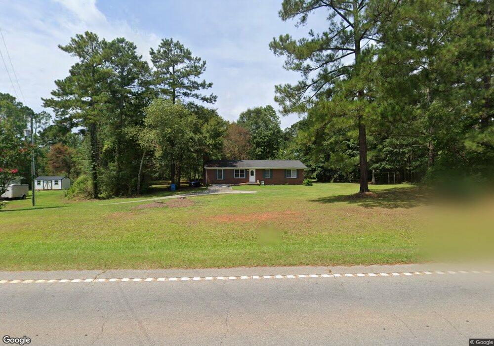
186 Highway 212 Covington, GA 30014
Estimated Value: $172,000 - $333,000
Studio
1
Bath
1,416
Sq Ft
$176/Sq Ft
Est. Value
About This Home
This home is located at 186 Highway 212, Covington, GA 30014 and is currently estimated at $249,345, approximately $176 per square foot. 186 Highway 212 is a home located in Newton County with nearby schools including Heard-Mixon Elementary School, Indian Creek Middle School, and Alcovy High School.
Ownership History
Date
Name
Owned For
Owner Type
Purchase Details
Closed on
Feb 22, 2024
Sold by
Prince Ron D
Bought by
212 Highway Llc
Current Estimated Value
Purchase Details
Closed on
Mar 17, 2023
Sold by
Prince Erlinda E
Bought by
Prince Ron D
Purchase Details
Closed on
Aug 3, 2006
Sold by
Secretary Of Hud
Bought by
Prince Ron D and Prince Erlinda E
Purchase Details
Closed on
Jun 16, 2004
Sold by
Gilliam Lonnie G and Gilliam Sherry L
Bought by
Sasser April
Home Financials for this Owner
Home Financials are based on the most recent Mortgage that was taken out on this home.
Original Mortgage
$109,315
Interest Rate
6.25%
Mortgage Type
VA
Purchase Details
Closed on
Jul 1, 1994
Sold by
Studdard Jc
Bought by
Gilliam Lonnie and Gilliam Sherry L
Home Financials for this Owner
Home Financials are based on the most recent Mortgage that was taken out on this home.
Original Mortgage
$54,750
Interest Rate
8.26%
Mortgage Type
Purchase Money Mortgage
Create a Home Valuation Report for This Property
The Home Valuation Report is an in-depth analysis detailing your home's value as well as a comparison with similar homes in the area
Home Values in the Area
Average Home Value in this Area
Purchase History
We collect this data history from publicly available records. To have your information removed, we recommend requesting removal directly through your county’s website.
| Date | Buyer | Sale Price | Title Company |
|---|---|---|---|
| 212 Highway Llc | -- | -- | |
| Prince Ron D | -- | -- | |
| Prince Ron D | -- | -- | |
| Sasser April | $110,200 | -- | |
| Gilliam Lonnie | $54,300 | -- |
Source: Public Records
Mortgage History
We collect this data history from publicly available records. To have your information removed, we recommend requesting removal directly through your county’s website.
| Date | Status | Borrower | Loan Amount |
|---|---|---|---|
| Previous Owner | Sasser April | $109,315 | |
| Previous Owner | Gilliam Lonnie | $54,750 |
Source: Public Records
Tax History
| Year | Tax Paid | Tax Assessment Tax Assessment Total Assessment is a certain percentage of the fair market value that is determined by local assessors to be the total taxable value of land and additions on the property. | Land | Improvement |
|---|---|---|---|---|
| 2025 | $2,392 | $96,120 | $14,800 | $81,320 |
| 2024 | $1,934 | $76,360 | $12,800 | $63,560 |
| 2023 | $1,725 | $63,560 | $9,000 | $54,560 |
| 2022 | $1,521 | $56,040 | $7,200 | $48,840 |
| 2021 | $1,426 | $47,040 | $7,200 | $39,840 |
| 2020 | $1,396 | $41,560 | $7,200 | $34,360 |
| 2019 | $1,288 | $37,760 | $5,600 | $32,160 |
| 2018 | $623 | $36,280 | $5,600 | $30,680 |
| 2017 | $911 | $26,520 | $3,310 | $23,210 |
| 2016 | $911 | $26,520 | $3,310 | $23,210 |
| 2015 | $911 | $26,520 | $3,200 | $23,320 |
| 2014 | $728 | $21,280 | $0 | $0 |
Source: Public Records
Map
Nearby Homes
- 120 Norman Rd
- 160 Norman Rd
- 15975 Georgia 36
- 70 Birch Rd
- 205 Yancey Rd
- 217 Yancey Rd
- 335 Yancey Rd
- Savoy Park
- 40 Eryn Terrace
- 0 Fincher Rd Unit 10734265
- 75 Eryn Terrace
- 215 Eryn Terrace
- 1155 Alcovy North Dr
- 250 Rainbow Dr
- 155 Loudoun Dr Unit LOT 35
- 300 Fincher Rd
- 245 Eryn Terrace
- 205 Eryn Terrace
- 175 Loudoun Dr
- 105 Eryn Terrace
- 0 Miller Rd Unit 7550149
- 0 Miller Rd Unit 8906718
- 200 Georgia 212
- 164 Highway 212
- 197 Highway 212
- 197 Georgia 212
- 15 Miller Rd
- 209 Highway 212
- 133 Ball Ground Rd
- 48 Miller Rd
- 143 Highway 212
- 225 Georgia 212
- 165 Ball Ground Rd
- 155 Ball Ground Rd
- 185 Ball Ground Rd
- 37 Miller Rd
- 243 Georgia 212
- 243 Highway 212
- 62 Miller Rd
- 81 Highway 212
Your Personal Tour Guide
Ask me questions while you tour the home.