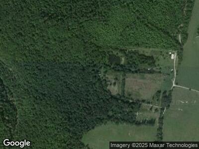
1860 Vaughn Rd Clarkrange, TN 38553
Estimated Value: $76,000 - $212,000
--
Bed
1
Bath
1,161
Sq Ft
$113/Sq Ft
Est. Value
About This Home
This home is located at 1860 Vaughn Rd, Clarkrange, TN 38553 and is currently estimated at $131,615, approximately $113 per square foot. 1860 Vaughn Rd is a home located in Fentress County.
Ownership History
Date
Name
Owned For
Owner Type
Purchase Details
Closed on
May 1, 2018
Sold by
Stierwalt Karl
Bought by
Welch Barbara
Current Estimated Value
Purchase Details
Closed on
Dec 2, 2016
Sold by
Chavez Deborah
Bought by
Welch Barbara Jean Sons
Purchase Details
Closed on
Dec 9, 2015
Sold by
Stierwalt Rebekah
Bought by
Stierwalt Karl
Purchase Details
Closed on
Nov 9, 2015
Sold by
Welch Barbara Jean Sons
Bought by
Welch Barbara Jean Sons
Purchase Details
Closed on
Sep 30, 2014
Sold by
Welch Barbara Jean Sons
Bought by
Stagner Johnny and Stagner Shelby
Purchase Details
Closed on
Aug 9, 1991
Bought by
Sons Jerry A & Artie B
Create a Home Valuation Report for This Property
The Home Valuation Report is an in-depth analysis detailing your home's value as well as a comparison with similar homes in the area
Home Values in the Area
Average Home Value in this Area
Purchase History
| Date | Buyer | Sale Price | Title Company |
|---|---|---|---|
| Welch Barbara | $37,000 | None Available | |
| Welch Barbara Jean Sons | -- | -- | |
| Stierwalt Karl | -- | -- | |
| Welch Barbara Jean Sons | -- | -- | |
| Stagner Johnny | -- | -- | |
| Chavez Deborah | -- | -- | |
| Stierwalt Karl | -- | -- | |
| Sons Jerry A & Artie B | $52,000 | -- |
Source: Public Records
Tax History Compared to Growth
Tax History
| Year | Tax Paid | Tax Assessment Tax Assessment Total Assessment is a certain percentage of the fair market value that is determined by local assessors to be the total taxable value of land and additions on the property. | Land | Improvement |
|---|---|---|---|---|
| 2024 | $225 | $16,675 | $4,250 | $12,425 |
| 2023 | $225 | $16,675 | $4,250 | $12,425 |
| 2022 | $166 | $8,700 | $3,350 | $5,350 |
| 2021 | $166 | $8,700 | $3,350 | $5,350 |
| 2020 | $166 | $8,700 | $3,350 | $5,350 |
| 2019 | $166 | $8,700 | $3,350 | $5,350 |
| 2018 | $166 | $8,700 | $3,350 | $5,350 |
| 2017 | $146 | $5,600 | $1,025 | $4,575 |
| 2016 | $199 | $10,025 | $5,450 | $4,575 |
| 2015 | $160 | $8,089 | $0 | $0 |
| 2014 | $215 | $10,841 | $0 | $0 |
Source: Public Records
Map
Nearby Homes
- 1865 Campground Rd
- 892 Norris Rd
- 0 Coal Ln
- 20.78 ac B Armstrong Ln
- 500 B Armstrong Ln
- 126 Andrea Ln
- 1130 Old Martha Washington Rd
- 789 Clear Creek Pkwy
- 129 Kendra Rd
- 1039 Old Martha Washington Rd
- 813 Clear Creek Pkwy
- 166 Craig Rd
- 195 Laurel Cliff Rd
- Lot 151 Steel Tram Ridge
- 1.5 AC S York Hwy
- 150 Volunteer Rd
