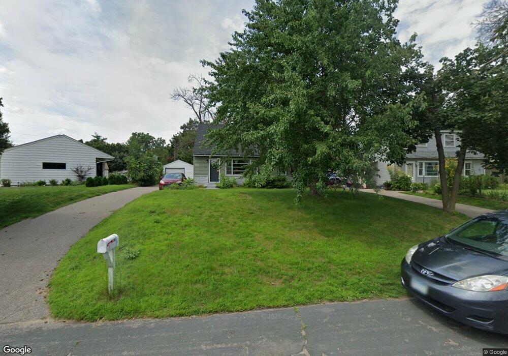
1861 Hazelwood St Saint Paul, MN 55109
Gladstone NeighborhoodEstimated Value: $269,418 - $283,000
4
Beds
1
Bath
1,404
Sq Ft
$198/Sq Ft
Est. Value
About This Home
This home is located at 1861 Hazelwood St, Saint Paul, MN 55109 and is currently estimated at $278,605, approximately $198 per square foot. 1861 Hazelwood St is a home located in Ramsey County with nearby schools including Weaver Elementary School, John Glenn Middle School, and Mounds Park Academy.
Ownership History
Date
Name
Owned For
Owner Type
Purchase Details
Closed on
Oct 31, 2019
Sold by
Floor Karin and Floor Alan
Bought by
Esser Robert P
Current Estimated Value
Home Financials for this Owner
Home Financials are based on the most recent Mortgage that was taken out on this home.
Original Mortgage
$186,558
Interest Rate
3.7%
Mortgage Type
FHA
Purchase Details
Closed on
Nov 15, 2002
Sold by
Estate Of Julia C Drohman
Bought by
Lienke Martin and Lienke Nicole
Purchase Details
Closed on
Aug 25, 2000
Sold by
Anderson James R and Anderson Jean M
Bought by
Livingston Karen
Create a Home Valuation Report for This Property
The Home Valuation Report is an in-depth analysis detailing your home's value as well as a comparison with similar homes in the area
Home Values in the Area
Average Home Value in this Area
Purchase History
| Date | Buyer | Sale Price | Title Company |
|---|---|---|---|
| Esser Robert P | $190,000 | Stewart Title Company | |
| Lienke Martin | $170,000 | -- | |
| Livingston Karen | $137,300 | -- |
Source: Public Records
Mortgage History
| Date | Status | Borrower | Loan Amount |
|---|---|---|---|
| Previous Owner | Esser Robert P | $186,558 |
Source: Public Records
Tax History Compared to Growth
Tax History
| Year | Tax Paid | Tax Assessment Tax Assessment Total Assessment is a certain percentage of the fair market value that is determined by local assessors to be the total taxable value of land and additions on the property. | Land | Improvement |
|---|---|---|---|---|
| 2025 | $3,106 | $259,400 | $47,300 | $212,100 |
| 2023 | $3,106 | $232,200 | $47,300 | $184,900 |
| 2022 | $2,666 | $238,100 | $47,300 | $190,800 |
| 2021 | $2,440 | $194,700 | $47,300 | $147,400 |
| 2020 | $2,562 | $184,000 | $47,300 | $136,700 |
| 2019 | $2,390 | $180,400 | $47,300 | $133,100 |
| 2018 | $2,340 | $153,400 | $47,300 | $106,100 |
| 2017 | $2,074 | $145,900 | $47,300 | $98,600 |
| 2016 | $1,854 | $0 | $0 | $0 |
| 2015 | $1,622 | $128,000 | $43,400 | $84,600 |
| 2014 | $1,322 | $0 | $0 | $0 |
Source: Public Records
Map
Nearby Homes
- 1854 Barclay St
- 1940 Barclay St
- 1869 Birmingham St
- 1849 Kennard St
- 1984 Prosperity Rd
- 1870 Clarence St
- 1435 Price Ave
- 1856 Flandrau St
- 1672 Manton St
- 1751 Clarence St
- 1937 Flandrau St
- 1627 Christie Place
- 1740 English St
- 1743 White Bear Ave N
- 1637 Iowa Ave E
- 1639 Clarence St
- 1607 Hoyt Ave E
- 1730 Atlantic St
- 1467 County Road B E
- 1509 Sandhurst Ave E
- 1865 Hazelwood St
- 1539 Ripley Ave
- 1531 Ripley Ave
- 1873 Hazelwood St
- 1860 Dieter St
- 1864 Dieter St
- 1877 Hazelwood St
- 1872 Dieter St
- 1523 Ripley Ave
- 1883 Hazelwood St
- 1882 Dieter St
- 1887 Hazelwood St
- 1513 Ripley Ave
- 1861 Dieter St
- 1886 Dieter St
- 1855 Dieter St
- 1865 Dieter St
- 1873 Dieter St
- 1851 Dieter St
- 1891 Hazelwood St